


"Old Map Of Rennes – Cassini"
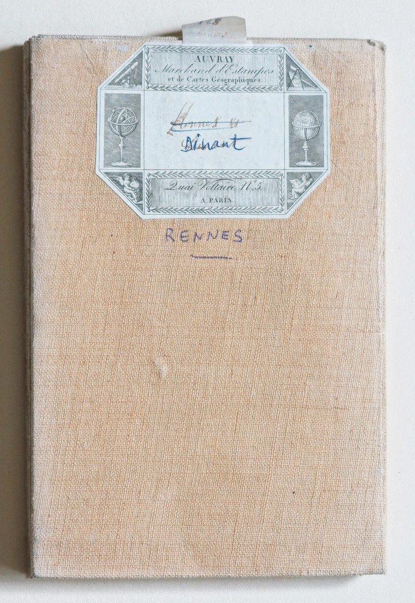
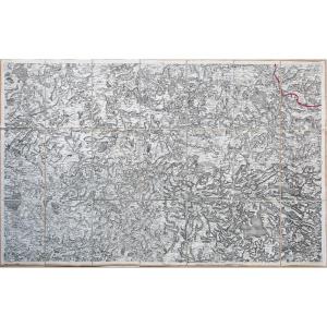
Epreuve originale de Cassini éditée chez Auvray vers 1790.Entoilées d’époque et montées en 21 sections.
Très bon état.
Format feuille : 94 x 59,5 cm.
Format repliée : 20,5 x 13,5 cm.
Vous pouvez consulter l’ensemble des cartes, livres et gravures disponibles sur votre région en cliquant sur le lien de notre site internet spécialisé en archives anciennes géographiques :
https://cartes-livres-anciens.com/categorie-produit/cartes-geographiques-anciennes-original-antique-maps/france/bretagne/
Règlement sécurisé par carte bancaire sur notre site internet en cliquant sur le lien ci-dessous :
https://cartes-livres-anciens.com/produit/cartes-geographiques-anciennes-original-antique-maps/france/bretagne/carte-ancienne-de-rennes-cassini/
Toutes nos cartes et gravures sont accompagnées d’un certificat d’authenticité.
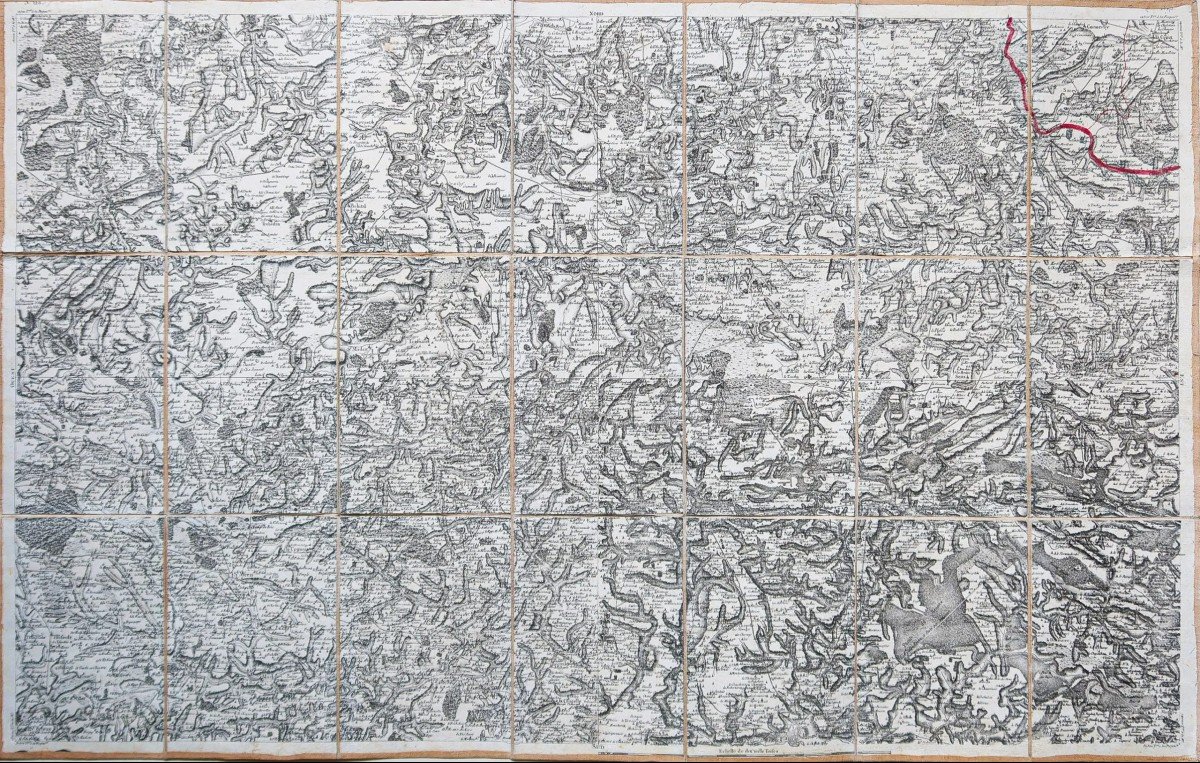
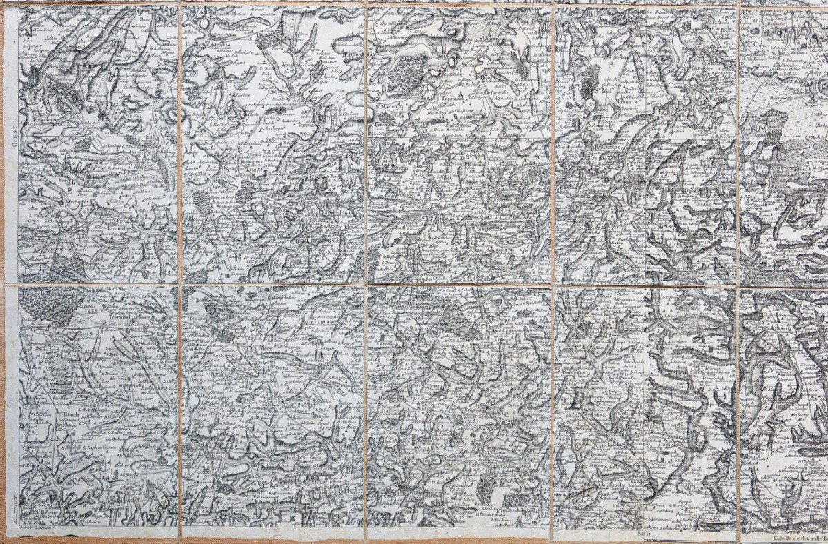
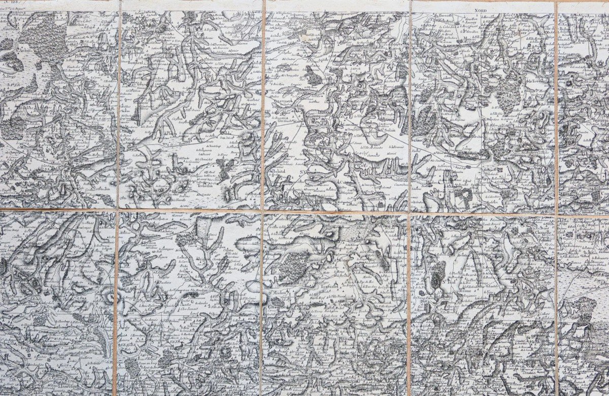
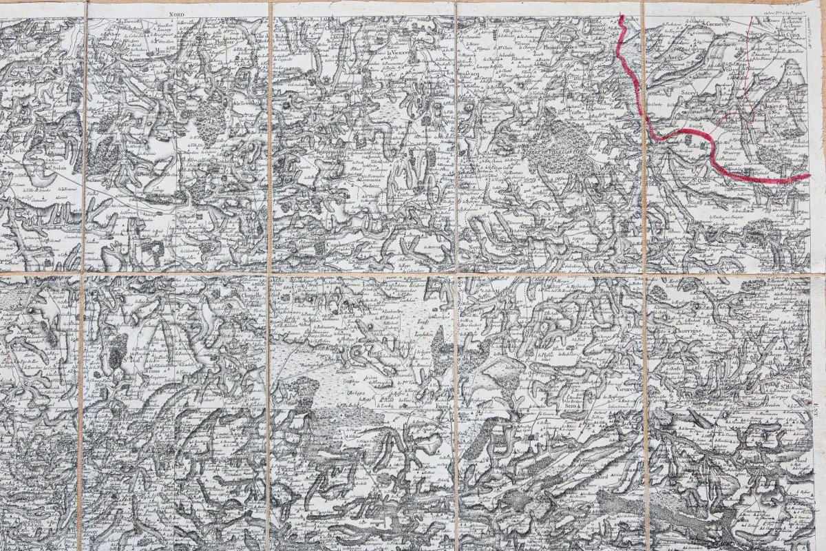
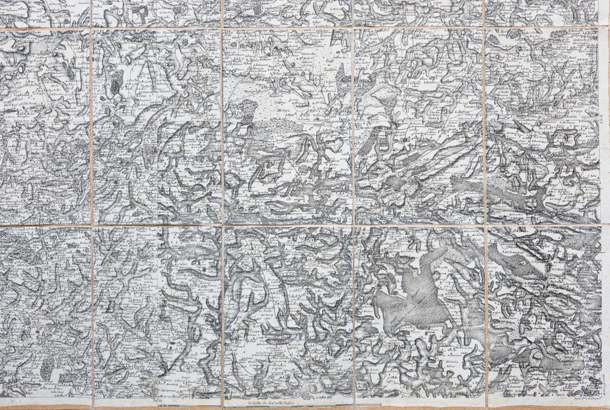
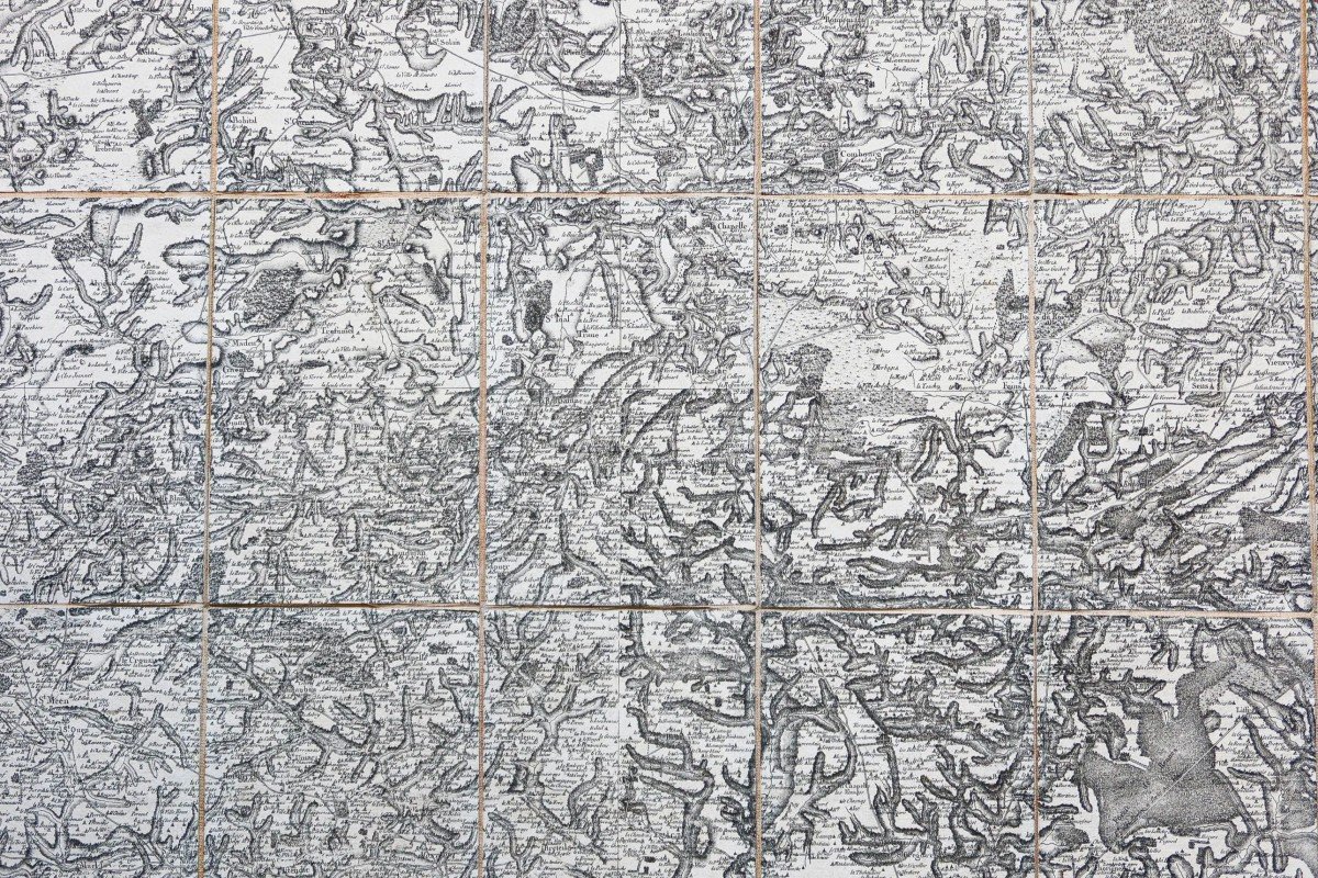
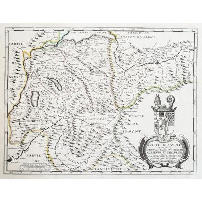
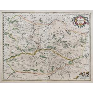
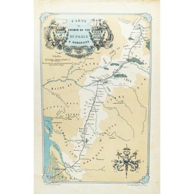
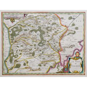
La carte de Cassini, qu’il serait plus juste de nommer la carte des Cassini, puisqu’elle tient son nom d’une famille de quatre géographes italiens installés dans le royaume à la fin du XVIIe siècle, est la première grande entreprise cartographique couvrant l’ensemble du territoire français. Elle se compose de 180 feuilles dont les levés, entamés en 1756, ont été achevés en 1789. Elles ont été gravées sur des plaques de cuivre puis tirées à l’Observatoire de Paris de 1757 à 1790. Destinées à être commercialisées auprès d’un riche public, certaines éditions ont, en outre, été aquarellées.
La carte de Cassini doit son extraordinaire précision à la méthode de la triangulation, sollicitée pour son élaboration. Cette méthode consiste à mesurer la distance entre deux points B et C puis, à partir d’un point de référence A, à mesurer les angles des droites BA et CA. Il suffit ensuite au géographe d’appliquer les formules de trigonométrie afin de connaître les distances BA et CA. Cette méthode est employée par le Hollandais Snellius en 1615, puis par l’abbé Picard en 1670 et, enfin, de 1683 à 1718, pour la mesure d’une grande méridienne allant de Dunkerque à Perpignan. Les coins de chaque feuille de la carte de Cassini portent les distances en toises à la méridienne de Paris et à sa perpendiculaire (qui joint Saint-Malo et Strasbourg). Outre cette triangulation principale, chaque planche compte près de 300 points de repère (édifices, hauteurs), utiles pour établir une triangulation secondaire.
De fait, les mentions portées sur la carte sont nombreuses et variées. On y trouve ainsi des informations relatives au relief (les forêts, les marais, les cours d’eau, les étangs), aux voies de communication (les routes, les canaux, les ponts), à l’organisation administrative et religieuse (les limites de province, de diocèse, les paroisses) ou encore aux édifices civils et religieux (églises, abbayes, prieurés, moulins, châteaux).
La carte de Cassini est encore utilisée aujourd’hui par de nombreux chercheurs, amateurs ou professionnels, attachés à l’étude des toponymes, à l’archéologie, à la géographie historique ou encore à l’histoire de l’environnement.
Original proof by Cassini published by Auvray around 1790. Period-backed and mounted in 21 sections. Very good state. Sheet size: 94 x 59.5 cm. Folded size: 20.5 x 13.5 cm. You can consult all the maps, books and engravings available in your region by clicking on the link of our website specializing in ancient geographical archives: https://cartes-livres-anciens.com/categorie-produit/cartes-geographiques -anciens-original-antique-maps/france/bretagne/ Secure payment by credit card on our website by clicking on the link below: https://cartes-livres-anciens.com/produit/cartes-geographiques-anciennes -original-antique-maps/france/bretagne/carte-ancienne-de-rennes-cassini/ All our maps and engravings are accompanied by a certificate of authenticity. The Cassini map, which it would be more accurate to call the Cassini map, since it takes its name from a family of four Italian geographers who settled in the kingdom at the end of the 17th century, is the first major cartographic undertaking covering the whole of France. It is made up of 180 sheets whose surveys, begun in 1756, were completed in 1789. They were engraved on copper plates and then printed at the Paris Observatory from 1757 to 1790. Intended to be marketed to a rich public, some editions have also been watercoloured. Cassini's map owes its extraordinary precision to the method of triangulation, used for its development. This method consists in measuring the distance between two points B and C then, from a reference point A, in measuring the angles of the straight lines BA and CA. It is then sufficient for the geographer to apply the trigonometry formulas in order to know the distances BA and CA. This method was used by the Dutchman Snellius in 1615, then by the Abbé Picard in 1670 and, finally, from 1683 to 1718, for the measurement of a long meridian going from Dunkirk to Perpignan. The corners of each sheet of Cassini's map bear the distances in toises to the meridian of Paris and to its perpendicular (which joins Saint-Malo and Strasbourg). In addition to this main triangulation, each board has nearly 300 landmarks (buildings, heights), useful for establishing a secondary triangulation. In fact, the mentions on the map are numerous and varied. One thus finds there information relative to the relief (the forests, the marshes, the rivers, the ponds), to the ways of communication (the roads, the channels, the bridges), to the administrative and religious organization (the province, diocese, parish boundaries) or to civil and religious buildings (churches, abbeys, priories, mills, castles). Cassini's map is still used today by many researchers, amateurs or professionals, attached to the study of toponyms, archeology, historical geography or environmental history.


 Le Magazine de PROANTIC
 TRÉSORS Magazine
 Rivista Artiquariato