


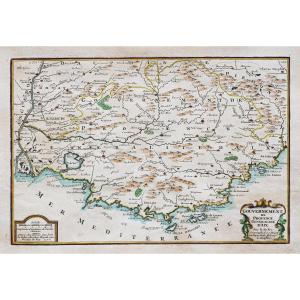
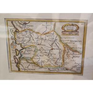
"Ancient Map Of Roman Empire History"
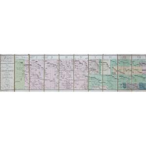
Carte originale éditée en 1808. Chez Arthus Bertrand.Entoilée d’époque repliée en 8 sections.
Beaux coloris aquarelle.
Quelques plis angulaires sur les panneaux.
Bon état.
Format Carte : 81 x 30 cm.
Format replié : 30 x 10 cm.
Carte chronologique biographique et généalogique pour servir à l’histoire de l’empire romain depuis Auguste jusqu’à Charlemagne.
Vous pouvez consulter l’ensemble des cartes, livres et gravures disponibles sur votre région en cliquant sur le lien de notre site internet spécialisé en archives anciennes géographiques :
https://cartes-livres-anciens.com/categorie-produit/cartes-geographiques-anciennes-original-antique-maps/europe/italie/
Règlement sécurisé par carte bancaire sur notre site internet en cliquant sur le lien ci-dessous :
https://cartes-livres-anciens.com/produit/cartes-geographiques-anciennes-original-antique-maps/europe/italie/carte-ancienne-de-lhistoire-de-lempire-romain/
Toutes nos cartes et gravures sont accompagnées d’un certificat d’authenticité.
Original map published in 1808. Chez Arthus Bertrand. Vintage canvas folded in 8 sections. Beautiful watercolor colors. A few angular creases on the panels. Good condition. Map size: 81 x 30 cm. Folded size: 30 x 10 cm. Biographical and genealogical chronological map for the history of the Roman Empire from Augustus to Charlemagne. You can consult all the maps, books and engravings available in your region by clicking on the link of our website specializing in ancient geographical archives: https://cartes-livres-anciens.com/categorie-produit/cartes-geographiques -anciens-original-antique-maps/europe/italy/ Secure payment by credit card on our website by clicking on the link below: https://cartes-livres-anciens.com/produit/cartes-geographiques-anciennes -original-antique-maps/europe/italy/carte-ancien-de-lhistoire-de-lempire-romain/ All our maps and engravings are accompanied by a certificate of authenticity.


 Le Magazine de PROANTIC
 TRÉSORS Magazine
 Rivista Artiquariato