
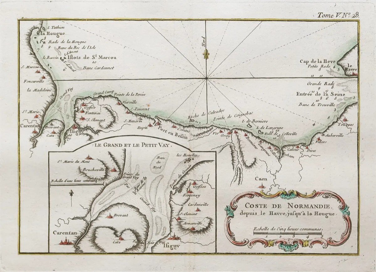

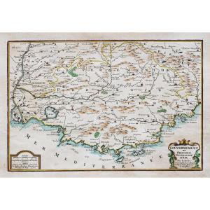
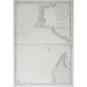
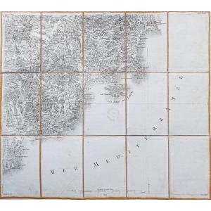
"Nautical Chart Of The Coasts Of Normandy"
Côte de Normandie depuis le Havre jusqu’à la Hougue.Epreuve originale réalisée en 1764. Bellin cartographe.
Coloris aquarelle.
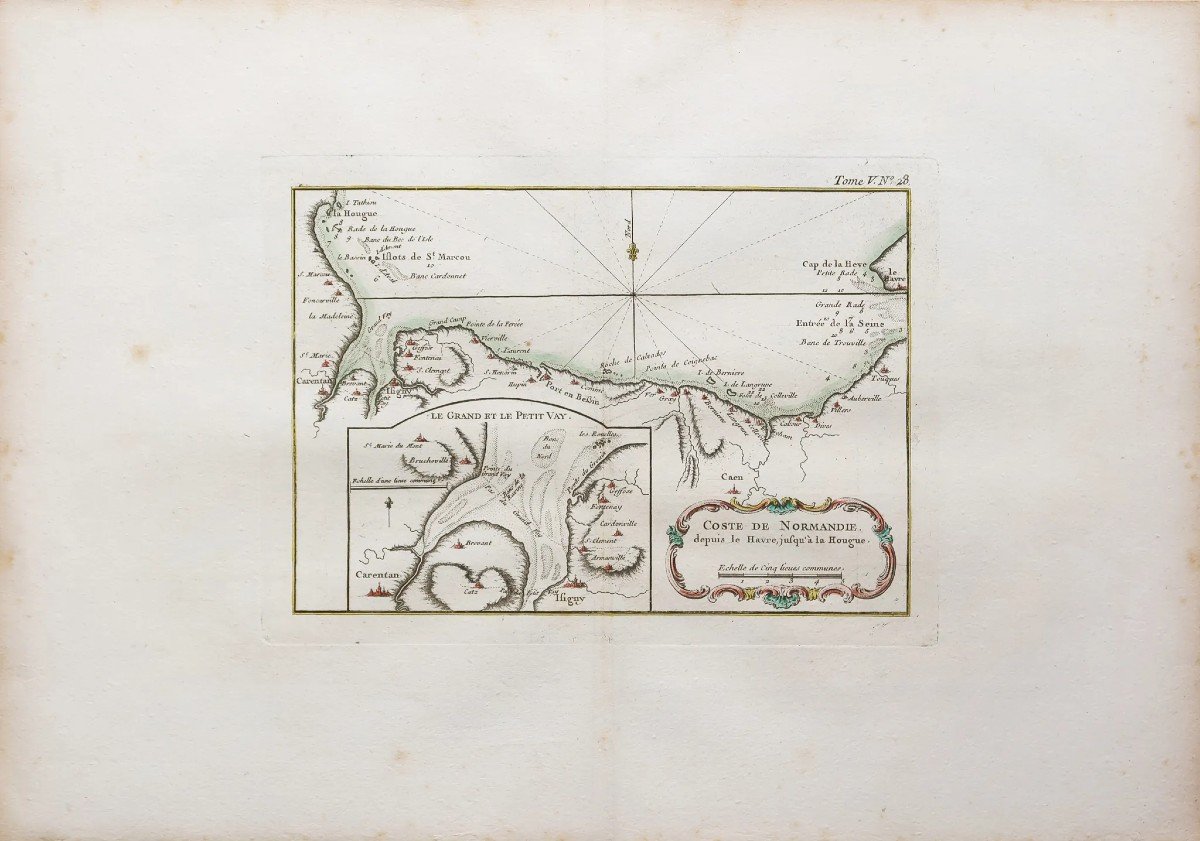
Fines rousseurs dans les marges.
Bon état.
Format feuille : 47,5 x 33 cm.
Format gravure : 26,5 x 19 cm.
Original antique map of 1764.
Carte particulièrement précise avec relevés des fonds marins, cartouche de titre aquarellé. Repère indiquant le nord. Cartouche explicatif détaillant le Grand et le Petit Vay. Peu courant.
Vous pouvez consulter l’ensemble des cartes, livres et gravures disponibles sur votre région en cliquant sur le lien de notre site internet spécialisé en archives anciennes géographiques :
https://cartes-livres-anciens.com/categorie-produit/cartes-geographiques-anciennes-original-antique-maps/france/normandie/
Règlement sécurisé par carte bancaire sur notre site internet en cliquant sur le lien ci-dessous :
https://cartes-livres-anciens.com/produit/cartes-geographiques-anciennes-original-antique-maps/france/normandie/carte-marine-ancienne-de-la-normandie/
Toutes nos cartes et gravures sont accompagnées d’un certificat d’authenticité.
Jacques-Nicolas Bellin, né à Paris en 1703, mort à Versailles le 21 mars 1772, est un cartographe hydrographe français. En 1721, Bellin est nommé hydrographe du ministère de la Marine suite à la création de l’office hydrographique français et du Dépôt des cartes et plans de la Marine. Membre de l’Académie de Marine et la Royal Society of London. Au cours d’une carrière de 50 ans, il est l’auteur d’un grand nombre de cartes et d’atlas. Ses cartes du Canada et des territoires français de l’Amérique du Nord (Nouvelle-France, Acadie, Louisiane) sont d’une valeur considérable.
Coast of Normandy from Le Havre to La Hougue. Original proof produced in 1764. Bellin cartographer. Watercolor colors. Fine foxing in the margins. Good condition. Sheet size: 47.5 x 33 cm. Engraving format: 26.5 x 19 cm. Original antique map of 1764. Particularly accurate map with seabed readings, title block in watercolor. Mark indicating the north. Explanatory cartouche detailing the Grand and the Petit Vay. Uncommon. You can consult all the maps, books and engravings available in your region by clicking on the link of our website specializing in ancient geographical archives: https://cartes-livres-anciens.com/categorie-produit/cartes-geographiques -anciens-original-antique-maps/france/normandie/ Secure payment by credit card on our website by clicking on the link below: https://cartes-livres-anciens.com/produit/cartes-geographiques-anciennes -original-antique-maps/france/normandie/carte-marine-ancienne-de-la-normandie/ All our maps and engravings are accompanied by a certificate of authenticity. Jacques-Nicolas Bellin, born in Paris in 1703, died in Versailles on March 21, 1772, was a French hydrographer cartographer. In 1721, Bellin was appointed hydrographer of the Ministry of the Navy following the creation of the French hydrographic office and the Depot of maps and plans of the Navy. Member of the Naval Academy and the Royal Society of London. During a 50-year career, he authored a large number of maps and atlases. His maps of Canada and the French territories of North America (New France, Acadia, Louisiana) are of considerable value.


 Le Magazine de PROANTIC
 TRÉSORS Magazine
 Rivista Artiquariato