Tassin Watercolor Map Of Poitou, La Rochelle, Noirmoutier, Ré, Oléron...1634 flag


1060018-main-63b8058b5db4c.jpg 1060018-63b805718b3c5.jpg 1060018-63b805a6e68b8.jpg 1060018-63b805bec2eb2.jpg

Object description :

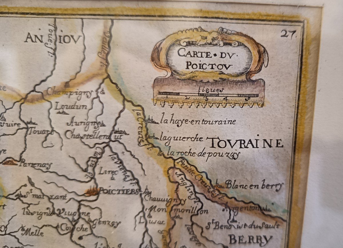
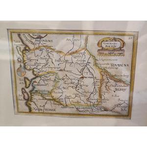
"Tassin Watercolor Map Of Poitou, La Rochelle, Noirmoutier, Ré, Oléron...1634"
Watercolor map of Poitouj by Tassin dating from 1634 with the agglomerations, the islands of Noirmoutier, Yeu, Ré and Oléron, cartridge decorations, a wind rose. Very beautiful original colors Golden frame 27cm x 21 cm
Price: 320 €
Period: 17th century
Style: Other Style
Condition: Good condition

Material: Paper

Reference: 1060018
Contact Dealer
line

"KRON Frédéric Antiquités" See more objects from this dealer

line

"Old Maps, Other Style"

More objects on Proantic.com
Subscribe to newsletter
line
facebook
pinterest
instagram
KRON Frédéric Antiquités
Mobilier 18ème 19ème, Marine
Tassin Watercolor Map Of Poitou, La Rochelle, Noirmoutier, Ré, Oléron...1634
1060018-main-63b8058b5db4c.jpg
06 13 50 19 76


*We will send you a confirmation email from info@proantic.com Please check your messages, including the spam folder.

Thank you! Your submission has been received!

Oops! Something went wrong while submitting the form