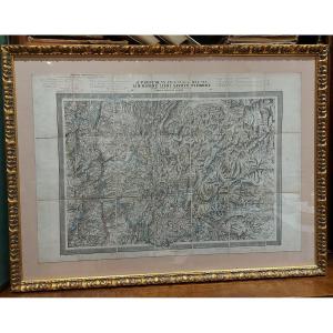
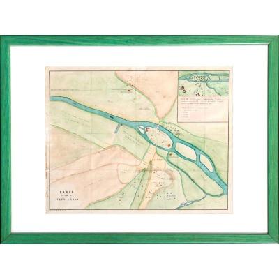
Departmental Map flag

Departmental Map
Departmental Map-photo-2
Departmental Map-photo-3

1064098-main-63c1767eb2fa9.jpg 1064098-63c1769ac1acc.jpg 1064098-63c176fa0f094.jpg

Object description :

"Departmental Map"
Departmental map of 1850 "French departments united" Ain-Rhône-Isère-Savoye-Piémont Map on canvas paper in a beautiful quality frame
Price: 350 €
Artist: H.langlois
Period: 19th century
Style: Louis Philippe, Charles 10th
Condition: Excellent condition

Width: 107cm
Height: 80cm

Reference: 1064098
line

"La Belle Poule Antiquités" See more objects from this dealer

line

"Old Maps, Louis Philippe, Charles 10th"

More objects on Proantic.com
Subscribe to newsletter
line
facebook
pinterest
instagram

La Belle Poule Antiquités
XVIIÈME et XVIIIÈME
Departmental Map
1064098-main-63c1767eb2fa9.jpg

0644063677


*We will send you a confirmation email from info@proantic.com Please check your messages, including the spam folder.

Thank you! Your submission has been received!

Oops! Something went wrong while submitting the form