Beaulieu (sébastien De) - Map Of The Government Of Nancy. Around 1670; 180/233mm flag


1195442-main-6509a93bad25f.jpg 1195442-6509a955e9827.jpg 1195442-6509a9564547a.jpg 1195442-6509a9568f84d.jpg

Object description :

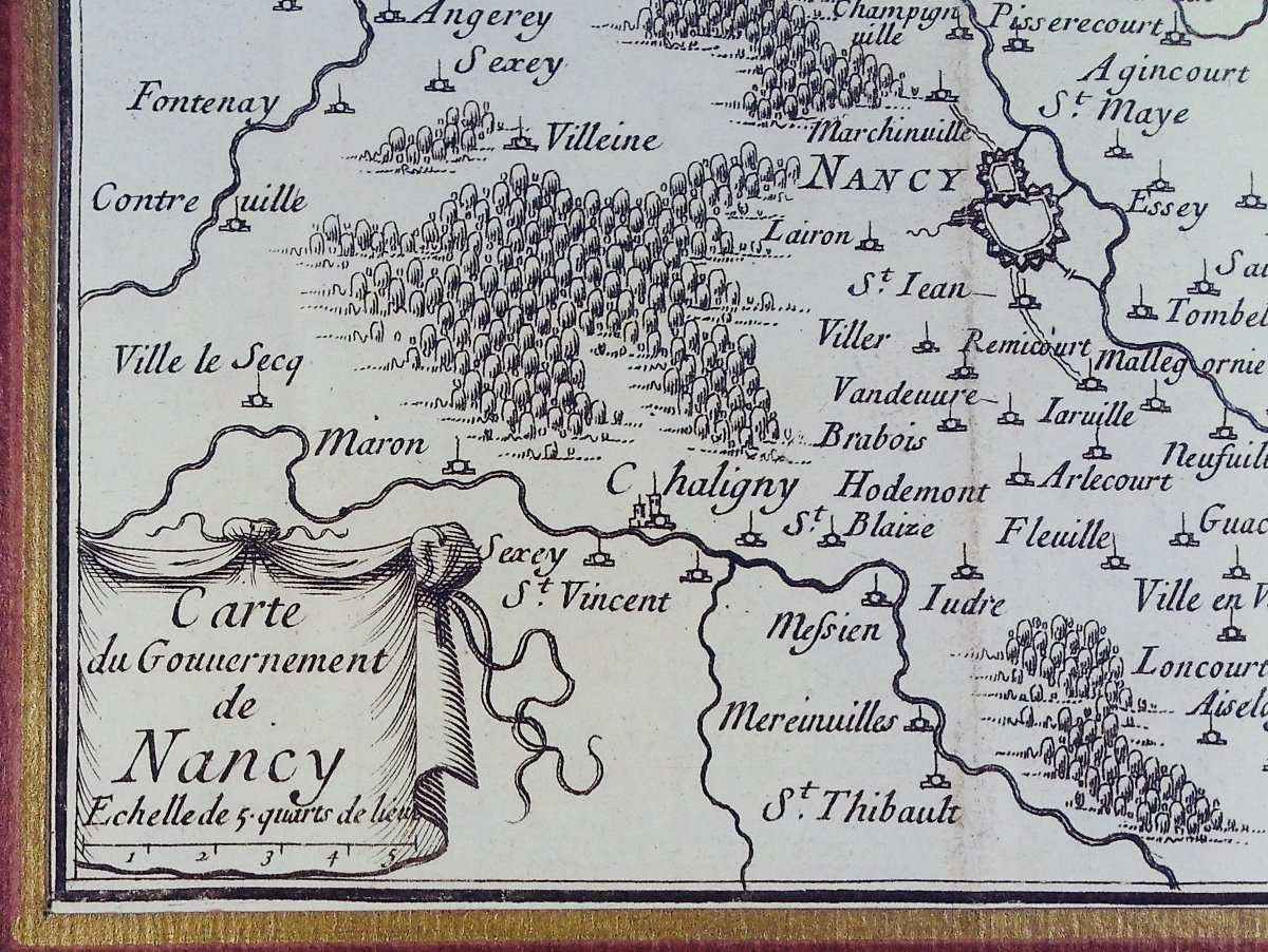
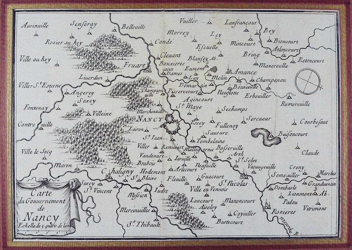
"Beaulieu (sébastien De) - Map Of The Government Of Nancy. Around 1670; 180/233mm"
BEAULIEU (Sébastien de) - Map of the government of Nancy. sl, At the author's house, around 1670; 180/233 mm, one page, in a marie-louise. Engraving on beautiful laid paper. We see the Nancy region and the 15 kilometers surrounding the Nancy fortifications.
Price: 55 €
credit
Artist: Beaulieu (sébastien De) - Carte De La Région De Nancy. Vers 1670 ; 180/233 Mm. Dans Une Marie-louise.
Period: 17th century
Style: Renaissance, Louis 13th
Condition: Excellent condition

Material: Paper
Length: une gravure de format 180/233 mm et d'un poids d'environ 80 grammes

Reference: 1195442
Contact Dealer
line

"Librairie ALPHABETS" See more objects from this dealer

line

"Old Maps, Renaissance, Louis 13th"

More objects on Proantic.com
Subscribe to newsletter
line
facebook
pinterest
instagram
Librairie ALPHABETS
Old books and rare books
Beaulieu (sébastien De) - Map Of The Government Of Nancy. Around 1670; 180/233mm
1195442-main-6509a93bad25f.jpg
0383327737
0687325592


*We will send you a confirmation email from info@proantic.com Please check your messages, including the spam folder.

Thank you! Your submission has been received!

Oops! Something went wrong while submitting the form