Map Of Paris From 1788 flag


1200613-main-65159e8b86412.jpg 1200613-65159ebc55ad6.jpg 1200613-65159ebc6dc79.jpg 1200613-65159ebc8f9e8.jpg

Object description :

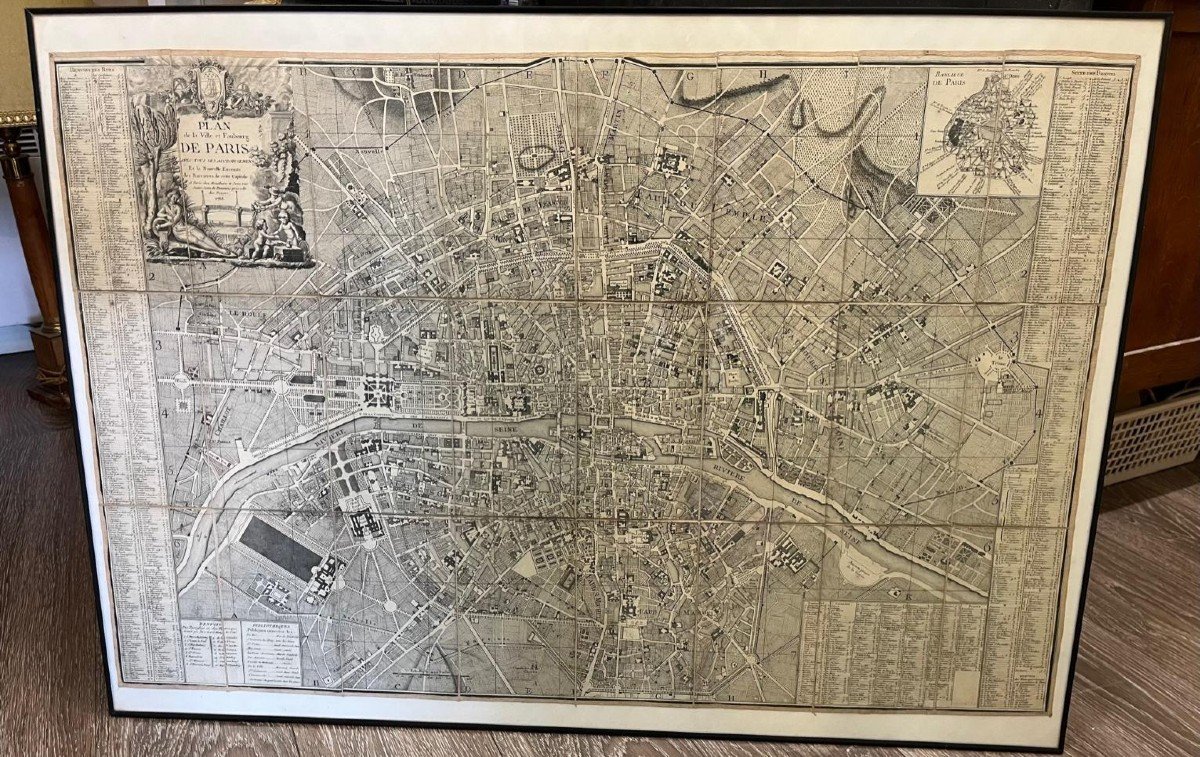
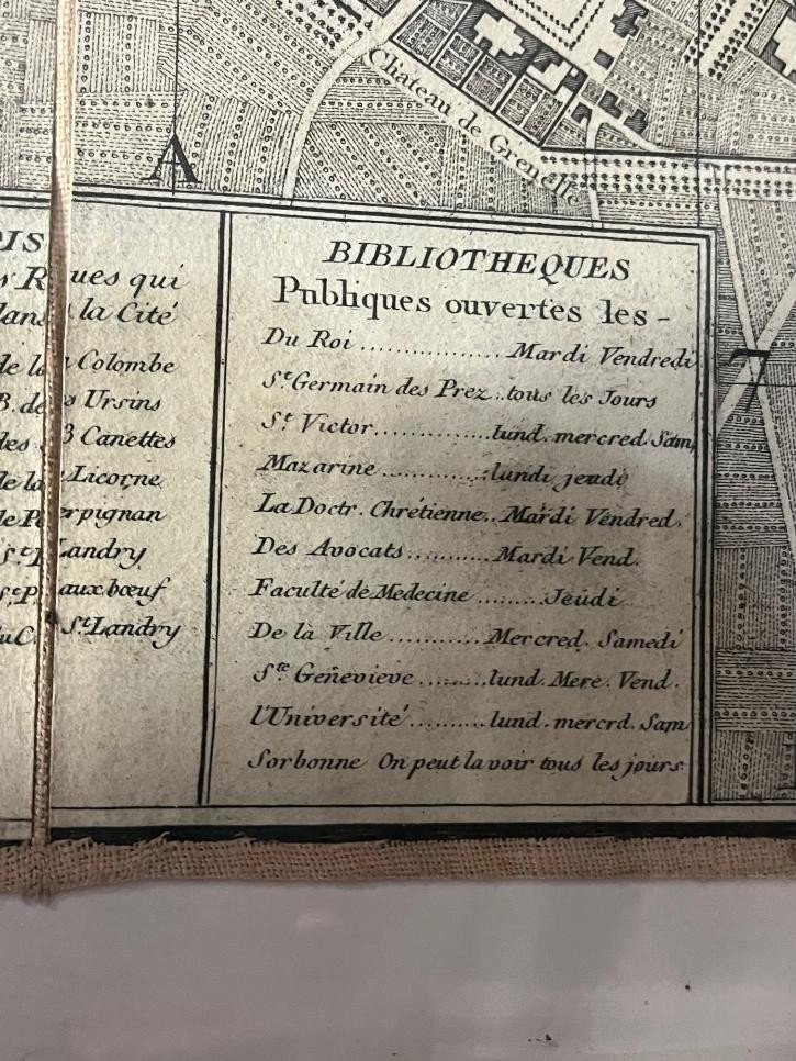
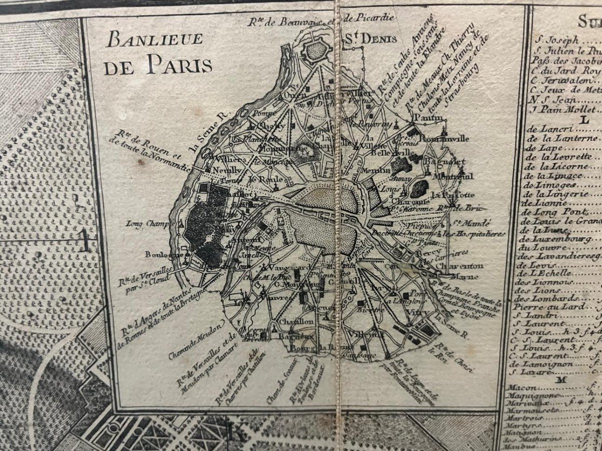
"Map Of Paris From 1788"
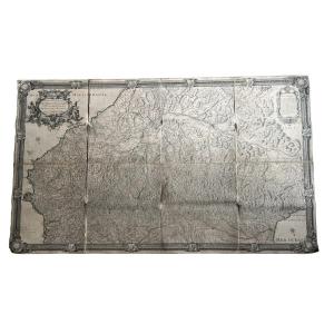
plan of the city and suburb of Paris 1788 with all its additions and the new enclosure map mounted on canvas in 24 sections allegory of MONCEAU with street references. In Paris at Mondhare and Jean rue Saint Jean De Beauvais near that of Noyers 1788
Price: 650 €
Period: 18th century
Style: Louis 16th, Directory
Condition: Perfect condition

Material: Paper
Length: 96cm
Height: 62cm

Reference: 1200613
Contact Dealer
line

"ors et bijoux" See more objects from this dealer

line

"Old Maps, Louis 16th, Directory"

More objects on Proantic.com
Subscribe to newsletter
line
facebook
pinterest
instagram
ors et bijoux
jewelry and antiques
Map Of Paris From 1788
1200613-main-65159e8b86412.jpg
0149762403
0682612878


*We will send you a confirmation email from info@proantic.com Please check your messages, including the spam folder.

Thank you! Your submission has been received!

Oops! Something went wrong while submitting the form