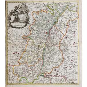
Limites colorées de l’époque.
2 renforts au dos de la carte dans l’angle inférieur gauche et pli central droit.
Bon état.
Format feuille : 58,5 x 51 cm.
Format gravure : 57,5 x 50 cm.
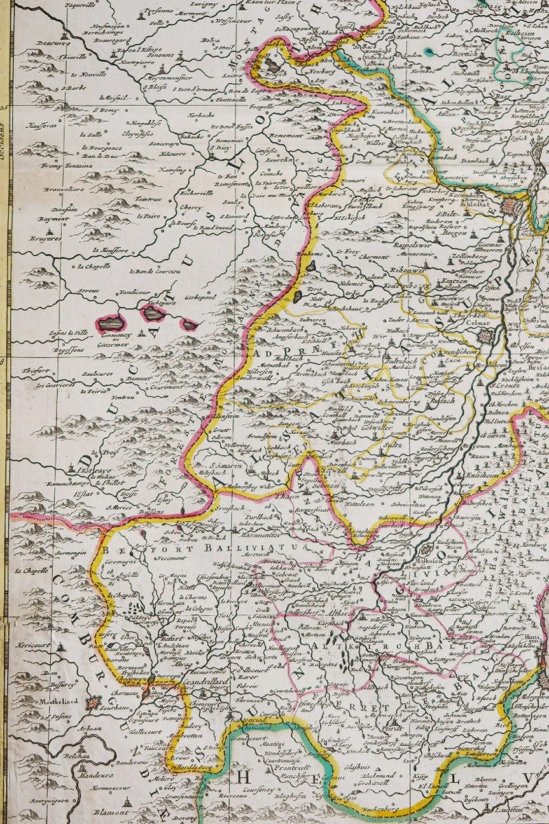
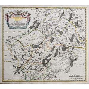
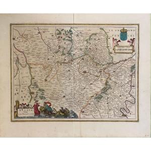
Original antique map around 1720.
Large carte du pays d’Alsace. Les lacs et villes sont réhaussés anciennement à l’aquarelle, cartouche de titre surplombant l’échelle des lieux entouré d’une guirlande de fruits.
Vous pouvez consulter l’ensemble des cartes, livres et gravures disponibles sur votre région en cliquant sur le lien de notre site internet spécialisé en archives anciennes géographiques :
https://cartes-livres-anciens.com/categorie-produit/cartes-geographiques-anciennes-original-antique-maps/france/alsace-lorraine/
Règlement sécurisé par carte bancaire sur notre site internet en cliquant sur le lien ci-dessous :
https://cartes-livres-anciens.com/produit/cartes-geographiques-anciennes-original-antique-maps/france/alsace-lorraine/carte-geographique-ancienne-de-lalsace-3/
Toutes nos cartes et gravures sont accompagnées d’un certificat d’authenticité.
Pieter Schenk est né en Allemagne mais s’est installé à Amsterdam où il est devenu l’élève de Gerard Valck, le graveur. En 1687, il épousa la soeur de Valck. Par la suite, les familles Schenk et Valck exercèrent une longue activité, notamment auprès des vendeurs d’imprimés, des éditeurs de livres, de cartes, de dessins topographiques et architecturaux et de fabricants de globe. Bien que la famille Schenk ait produit des cartes originales, la plupart de leurs atlas consistaient en des impressions à partir de planches révisées et retravaillées à l’origine de Jansson, des Visschers, des Sansons et d’autres.
Original proof made around 1720. P. Schenk author. Colorful boundaries of the time. 2 reinforcements on the back of the card in the lower left corner and central right fold. Good condition. Sheet size: 58.5 x 51 cm. Engraving format: 57.5 x 50 cm. Original antique map around 1720. Large map of the country of Alsace. The lakes and towns are formerly enhanced in watercolor, a title block overlooking the scale of the place surrounded by a garland of fruit. You can consult all the maps, books and engravings available in your region by clicking on the link to our website specializing in ancient geographical archives: https://cartes-livres-anciens.com/categorie-produit/cartes-gegraphiques -Ancienes-original-antique-maps/france/alsace-lorraine/ Secure payment by credit card on our website by clicking on the link below: https://cartes-livres-anciens.com/produit/cartes-gegraphiques -Ancienes-original-antique-maps/france/alsace-lorraine/carte-gegraphique-Anciene-de-lalsace-3/ All our maps and engravings are accompanied by a certificate of authenticity. Pieter Schenk was born in Germany but settled in Amsterdam where he became a student of Gerard Valck, the engraver. In 1687 he married Valck's sister. Subsequently, the Schenk and Valck families exercised a long activity, notably with sellers of printed matter, publishers of books, maps, topographical and architectural drawings and globe manufacturers. Although the Schenk family produced original maps, most of their atlases consisted of prints from originally revised and reworked plates by Jansson, the Visschers, the Sansons, and others.












 Le Magazine de PROANTIC
 TRÉSORS Magazine
 Rivista Artiquariato