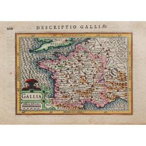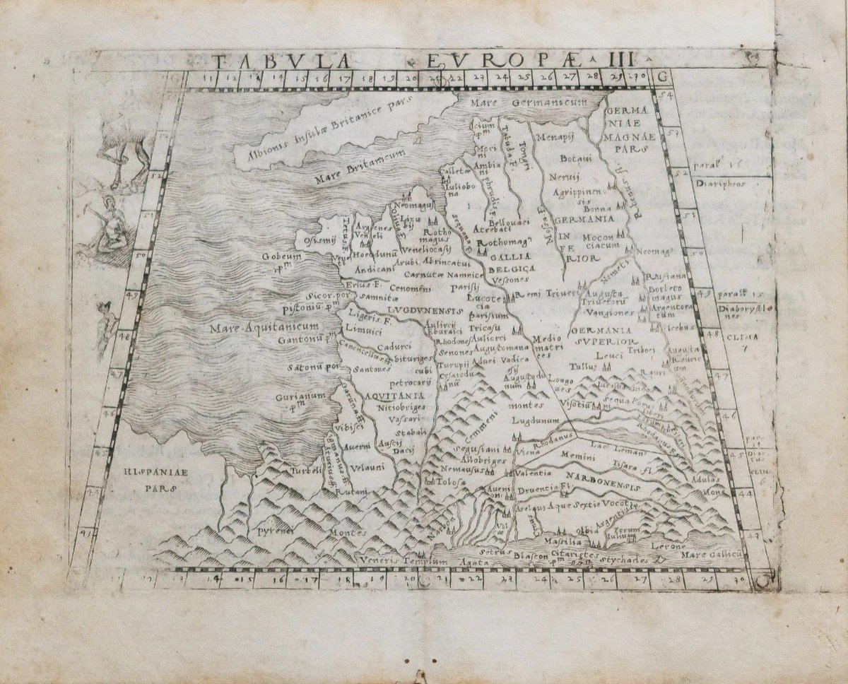

Old Geographical Map Of France
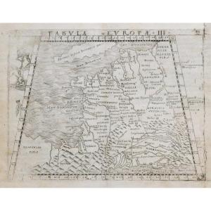
preuve originale réalisée en 1548. Gastaldi cartographe.
Belle impression de la première édition avec figure et cervidé.
Texte explicatif en latin/ italien au verso.
2 petits trous de ver anciens dans la marge inférieure loin de la carte.
Bon état.
Format : 21 x 17 cm.
Original antique map of 1548.
Vous pouvez consulter l’ensemble des cartes, livres et gravures disponibles sur votre région en cliquant sur le lien de notre site internet spécialisé en archives anciennes géographiques :
https://cartes-livres-anciens.com/categorie-produit/cartes-geographiques-anciennes-original-antique-maps/france/france-generale/
Règlement sécurisé par carte bancaire sur notre site internet en cliquant sur le lien ci-dessous :
https://cartes-livres-anciens.com/produit/cartes-geographiques-anciennes-original-antique-maps/france/france-generale/carte-geographique-ancienne-de-la-france/
Toutes nos cartes et gravures sont accompagnées d’un certificat d’authenticité.
RUSCELLI 1500 – 1566 – GASTALDI
Issues des grandes écoles italiennes de géographie, les cartes de Ruscelli et Gastaldi ont été magnifiquement gravées sur du cuivre, marquant un tournant dans l’histoire de la cartographie. À partir de ce moment, la majorité des œuvres cartographiques ont utilisé ce support. Comme il s’agissait d’un matériau plus dur que le bois, il permettait au graveur de donner plus de détails.
Original proof made in 1548. Gastaldi cartographer. Beautiful impression of the first edition with figure and deer. Explanatory text in Latin on the back. 2 small old wormholes in the bottom margin away from the map. Good condition. Size: 21 x 17 cm. Original antique map of 1548. You can consult all the maps, books and engravings available in your region by clicking on the link to our website specializing in ancient geographical archives: https://cartes-livres-anciens.com/categorie -product/cartes-gegraphiques-Ancienes-original-antique-maps/france/france-generale/ Secure payment by credit card on our website by clicking on the link below: https://cartes-livres-anciens.com /product/old-geographic-maps-original-antique-maps/france/france-generale/old-geographic-map-of-france/ All our maps and engravings are accompanied by a certificate of authenticity. RUSCELLI 1500 – 1566 – GASTALDI Coming from the great Italian schools of geography, the maps of Ruscelli and Gastaldi were magnificently engraved on copper, marking a turning point in the history of cartography. From this point on, the majority of cartographic works used this medium. As it was a harder material than wood, it allowed the engraver to give more detail.
300 €
Period: 16th century
Style: Other Style
Condition: Good condition
Material: Paper
Reference (ID): 1220744
Availability: In stock
Print