Limites colorées de l’époque.
Rousseurs dans la marge latérale gauche, loin de la carte.
Bon état.
Format feuille : 55 x 36 cm.
Format gravure : 49 x 32 cm.
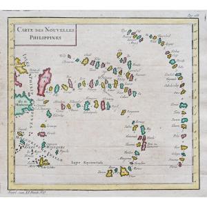
Original antique map of 1812.
Seconde édition réalisée par Laurie et Whittle de la carte d’Anville en 1765.
Large table numérotée de 1 à 53 situant les principaux lieux.
Vous pouvez consulter l’ensemble des cartes et gravures disponibles sur votre région en cliquant sur le lien de notre site internet spécialisé en archives anciennes géographiques :
https://cartes-livres-anciens.com/categorie-produit/cartes-geographiques-anciennes-original-antique-maps/afrique/egypte/
Règlement sécurisé par carte bancaire sur notre site internet en cliquant sur le lien :
https://cartes-livres-anciens.com/produit/cartes-geographiques-anciennes-original-antique-maps/afrique/egypte/carte-geographique-ancienne-de-legypte-antique/
Toutes nos cartes et gravures sont accompagnées d’un certificat d’authenticité.
Jean-Baptiste Bourguignon d’Anville (1697-1782) est l’un des plus grands géographes français du 18ème siècle. Il a mené des recherches rigoureuses afin de créer ses cartes, ce qui a considérablement développé les compétences techniques de la cartographie au cours de sa vie. Son style restera plus sobre que celui de plusieurs de ses prédécesseurs. Il a été largement adopté par ses contemporains et successeurs.
Fils de tailleur, d’Anville a fait preuve d’expérience cartographique dès son plus jeune âge ; sa première carte, de la Grèce antique, a été publiée alors qu’il n’avait que quinze ans. À vingt-deux ans, il est nommé l’un des géographes ordinaires de roi du roi. Il a comme tuteur le jeune Louis XV.
D’Anville n’accepte pas de copier comme beaucoup de cartographes les caractéristiques d’autres cartes, préférant à la place, revenir aux textes sur lesquels ces cartes étaient basées pour faire ses propres représentations.
Cela l’a conduit à adopter des espaces vides pour les zones inconnues et à rejeter les noms qui n’étaient pas soutenus par d’autres sources. Ses sources s’appuieront sur sa grande bibliothèque de cartes personnelles et son réseau de sources contemporaines auprès des jésuites en Chine et des savants au Brésil.
Son approche historique de la cartographie aboutira sur des cartes particulièrement détaillées, modernes et académiques.
Original proof made in 1812. Anville cartographer. Colorful boundaries of the time. Foxing in the left lateral margin, away from the map. Good condition. Sheet size: 55 x 36 cm. Engraving format: 49 x 32 cm. Original antique map of 1812. Second edition produced by Laurie and Whittle of the Anville map in 1765. Large table numbered from 1 to 53 locating the main places. You can consult all the maps and engravings available in your region by clicking on the link to our website specializing in ancient geographical archives: https://cartes-livres-anciens.com/categorie-produit/cartes-gegraphiques-Ancienes -original-antique-maps/afrique/egypte/ Secure payment by credit card on our website by clicking on the link: https://cartes-livres-anciens.com/produit/cartes-gegraphiques-Ancienes-original-antique- maps/africa/egypt/ancient-geographic-map-of-antique-egypt/ All our maps and engravings are accompanied by a certificate of authenticity. Jean-Baptiste Bourguignon d'Anville (1697-1782) is one of the greatest French geographers of the 18th century. He conducted rigorous research in order to create his maps, which greatly developed the technical skills of cartography during his life. His style will remain more sober than that of several of his predecessors. It was widely adopted by his contemporaries and successors. The son of a tailor, d'Anville demonstrated cartographic experience from an early age; his first map, of ancient Greece, was published when he was only fifteen. At twenty-two, he was appointed one of the king's ordinary geographers. His tutor was the young Louis XV. D'Anville does not agree to copy the characteristics of other maps like many cartographers, preferring instead to return to the texts on which these maps were based to make his own representations. This led him to adopt blank spaces for unknown areas and to reject names that were not supported by other sources. His sources will draw on his large library of personal maps and his network of contemporary sources from Jesuits in China and scholars in Brazil. His historical approach to cartography resulted in particularly detailed, modern and academic maps.








 Le Magazine de PROANTIC
 TRÉSORS Magazine
 Rivista Artiquariato