this object was sold
line

18th Century Watercolor Map Of The Islands Of New Caledonia And The New Hebrides, Good

Sold
18th Century Watercolor Map Of The Islands Of New Caledonia And The New Hebrides, Good
pictures.

Object description :

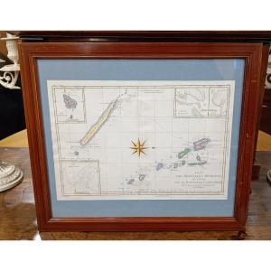
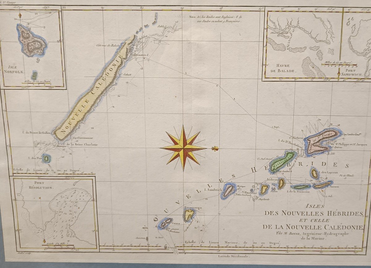
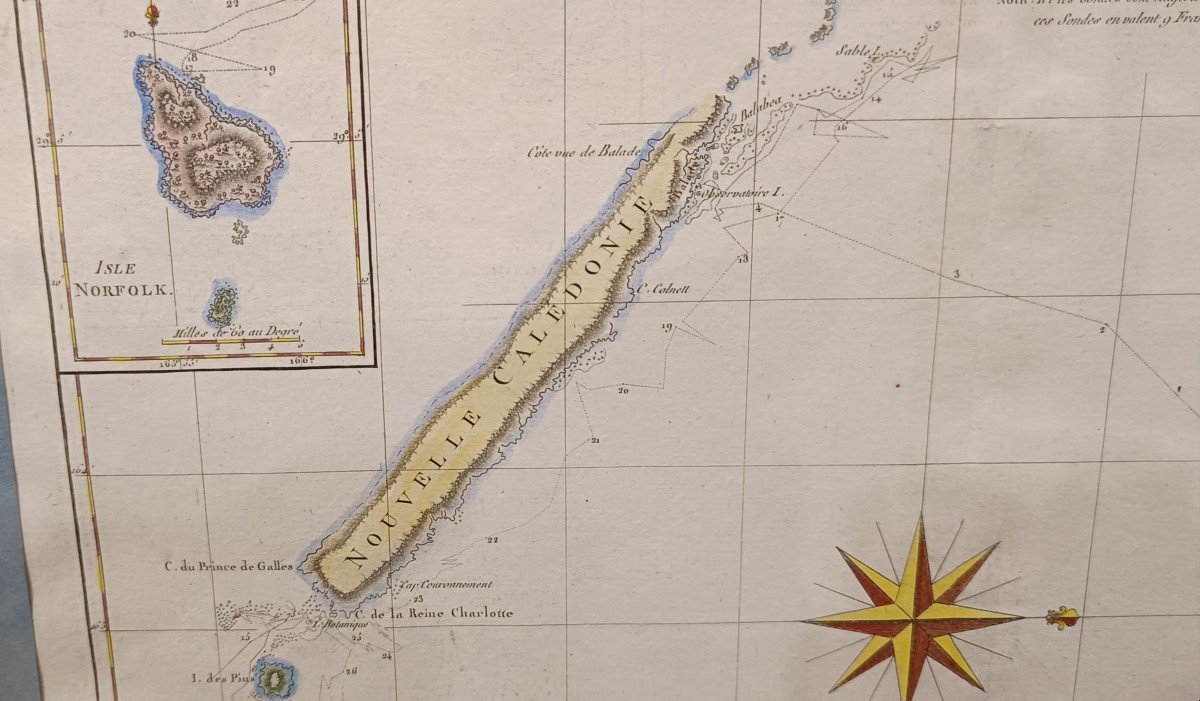
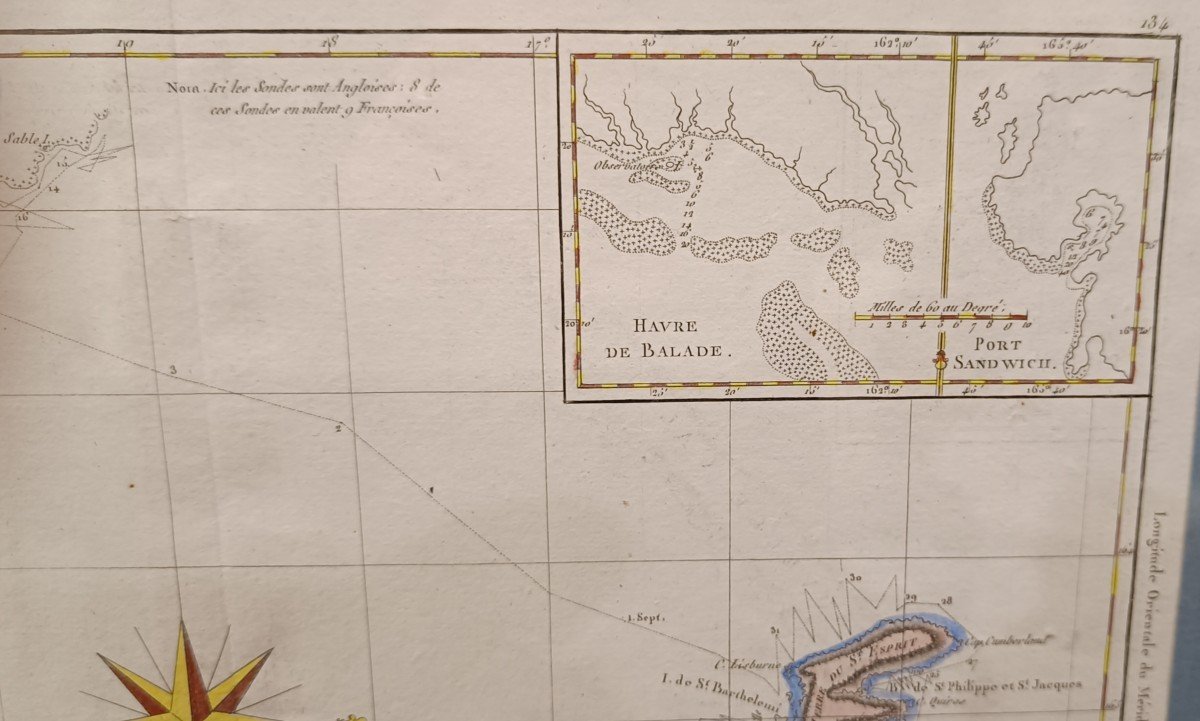
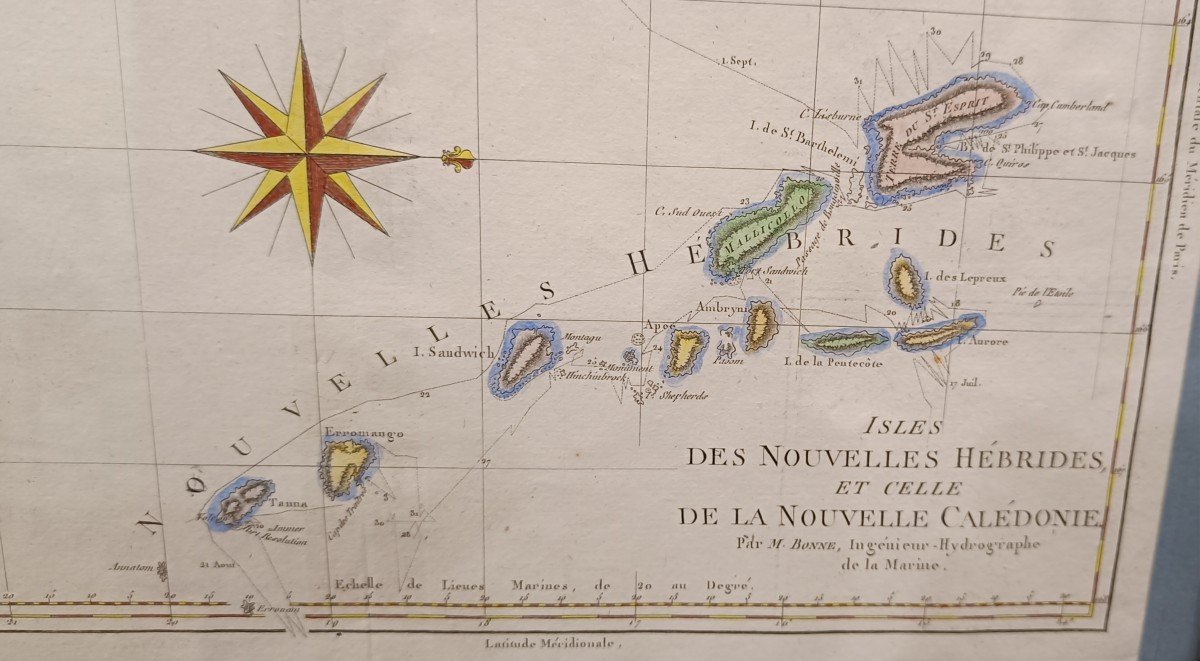
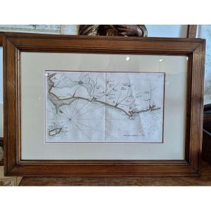
"18th Century Watercolor Map Of The Islands Of New Caledonia And The New Hebrides, Good"
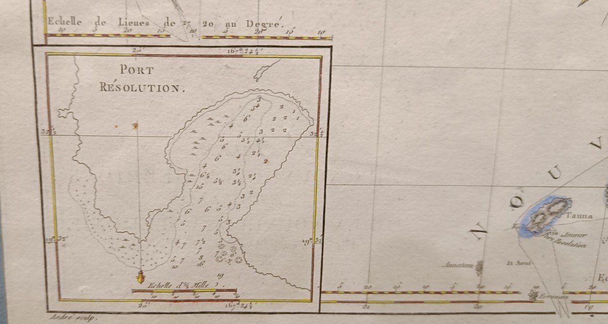
Watercolor map from 1780 by Bonne, representing the islands of New Caledonia and the new Hebrides. Cartouches of Norfolk Island, Port Resolution, Strolling Harbor and Sandwich Port Beautiful original color Pitchpin framing 45.5 cm x 39.5 cm

View more from this dealer

View more - Old Maps

Subscribe to newsletter
line
facebook
pinterest
instagram

KRON Frédéric Antiquités
Mobilier 18ème 19ème, Marine

18th Century Watercolor Map Of The Islands Of New Caledonia And The New Hebrides, Good
1251353-main-6582bc3d1a003.jpg

06 13 50 19 76


*We will send you a confirmation email from info@proantic.com Please check your messages, including the spam folder.

Thank you! Your submission has been received!

Oops! Something went wrong while submitting the form