


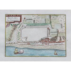

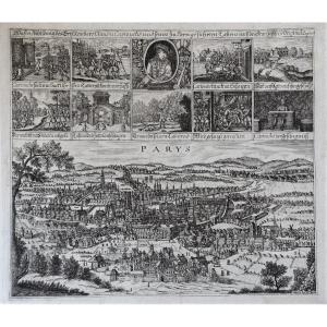
"Ancient Engraving From Bourg – Gironde"
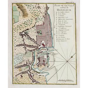
Epreuve originale réalisée en 1638. Tassin géographe.Coloris aquarelle.
2 petits trous de ver dans la marge supérieure loin du sujet.
Bon état.
Format feuille : 23 x 17 cm.
Format gravure : 15 x 10,5 cm.
Original antique map of 1638
Vous pouvez consulter l’ensemble des cartes, livres et gravures disponibles sur votre région en cliquant sur le lien de notre site internet spécialisé en archives anciennes géographiques :
https://cartes-livres-anciens.com/categorie-produit/cartes-geographiques-anciennes-original-antique-maps/france/aquitaine-guyenne-gascogne-perigord/
Règlement sécurisé par carte bancaire sur notre site internet en cliquant sur le lien ci-dessous :
https://cartes-livres-anciens.com/produit/cartes-geographiques-anciennes-original-antique-maps/france/aquitaine-guyenne-gascogne-perigord/gravure-ancienne-de-bourg-gironde/
Toutes nos cartes et gravures sont accompagnées d’un certificat d’authenticité.
Christophe Nicolas Tassin ou Christophe Le Tassin, cartographe français, connu pour ses cartes de la France, de l’Espagne, de l’Allemagne et de la Suisse. La plupart de son travail a été publié à Paris de 1633 à 1635. Parmi ses collègues on peut citer Melchior Tavernier (1594-1665), Sébastien Cramoisy (1584-1669) et Michael van Lochum (1601-1647).
Original proof made in 1638. Tassin geographer. Watercolor colors. 2 small wormholes in the upper margin away from the subject. Good condition. Sheet size: 23 x 17 cm. Engraving format: 15 x 10.5 cm. Original antique map of 1638 You can consult all the maps, books and engravings available in your region by clicking on the link to our website specializing in ancient geographical archives: https://cartes-livres-anciens.com/categorie- product/cartes-gegraphiques-Ancienes-original-antique-maps/france/aquitaine-guyenne-gascogne-perigord/ Secure payment by credit card on our website by clicking on the link below: https://cartes-livres- old.com/product/cartes-gegraphiques-Ancienes-original-antique-maps/france/aquitaine-guyenne-gascogne-perigord/gravure-Anciene-de-bourg-gironde/ All our maps and engravings are accompanied by a certificate of 'authenticity. Christophe Nicolas Tassin or Christophe Le Tassin, French cartographer, known for his maps of France, Spain, Germany and Switzerland. Most of his work was published in Paris from 1633 to 1635. Among his colleagues we can cite Melchior Tavernier (1594-1665), Sébastien Cramoisy (1584-1669) and Michael van Lochum (1601-1647).


 Le Magazine de PROANTIC
 TRÉSORS Magazine
 Rivista Artiquariato