


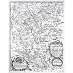


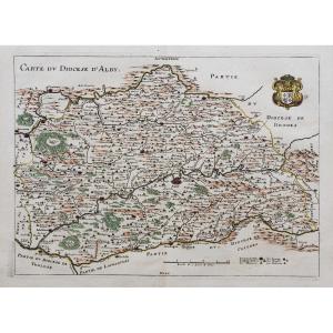
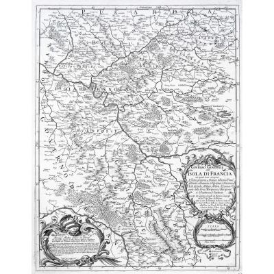
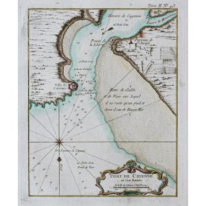
"Old Geographical Map Of Ile De France"
Epreuve originale réalisée en 1692. Rossi Domenico et Giacomo Cantelli auteurs.Très belle épreuve sur papier fort.
Très bon état.
Format feuille : 62,5 x 47 cm.
Format gravure : 59 x 45,5 cm.
Original antique map of 1692.
Dans la pure tradition des cartographes italiens de la fin du 17ème siècle, une carte d’un graphisme très pure, parfaitement gravée. 2 larges cartouches de présentation ornent cette carte.
Vous pouvez consulter l’ensemble des cartes, livres et gravures disponibles sur votre région en cliquant sur le lien de notre site internet spécialisé en archives anciennes géographiques :
https://cartes-livres-anciens.com/categorie-produit/cartes-geographiques-anciennes-original-antique-maps/france/ile-de-france-78-versailles/
Règlement sécurisé par carte bancaire sur notre site internet en cliquant sur le lien ci-dessous :
https://cartes-livres-anciens.com/produit/cartes-geographiques-anciennes-original-antique-maps/france/ile-de-france-78-versailles/carte-geographique-ancienne-de-lile-de-france-6/
Toutes nos cartes et gravures sont accompagnées d’un certificat d’authenticité.
Cantelli Giacomo fut un important cartographe et graveur italien qui travaillera pour Francesco II, Duc de Modène au 17ème siècle. Il est bien connu pour avoir été le pionnier du style italien de carte géographique artistique qui sera finalement adopté et développé par Vincenzo Coronelli cartographe de Louis XIV.
Original proof made in 1692. Rossi Domenico and Giacomo Cantelli authors. Very nice proof on strong paper. Very good state. Sheet size: 62.5 x 47 cm. Engraving format: 59 x 45.5 cm. Original antique map of 1692. In the pure tradition of Italian cartographers from the end of the 17th century, a map with very pure graphics, perfectly engraved. 2 large presentation cartridges adorn this card. You can consult all the maps, books and engravings available in your region by clicking on the link to our website specializing in ancient geographical archives: https://cartes-livres-anciens.com/categorie-produit/cartes-gegraphiques -Ancienes-original-antique-maps/france/ile-de-france-78-versailles/ Secure payment by credit card on our website by clicking on the link below: https://cartes-livres-anciens.com /product/old-geographic-maps-original-antique-maps/france/ile-de-france-78-versailles/old-geographic-map-of-lile-de-france-6/ All our maps and engravings are accompanied a certificate of authenticity. Cantelli Giacomo was an important Italian cartographer and engraver who worked for Francesco II, Duke of Modena in the 17th century. He is well known for pioneering the Italian style of artistic geographic map which would eventually be adopted and developed by Vincenzo Coronelli, cartographer to Louis XIV.


 Le Magazine de PROANTIC
 TRÉSORS Magazine
 Rivista Artiquariato