Map Of Africa Divided Into Its Main States And Isle De France By Caille 1753 flag


Object description :

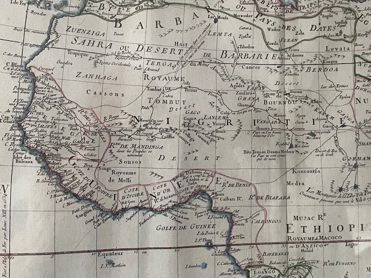
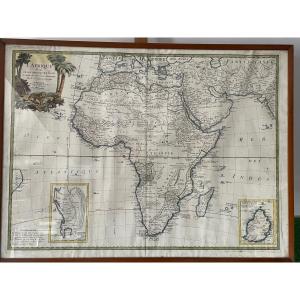
"Map Of Africa Divided Into Its Main States And Isle De France By Caille 1753"
VERY BEAUTIFUL MAP OF AFRICA FROM THE 18TH PERIOD, 1753, AT THE BOTTOM RIGHT THE SPECIAL MAP OF ISLE DE FRANCE DRAWED UP BY THE ABBÉ DE LA CAILLE IN 1753, VERY FRESH, THE PHOTOS WITH THE GLASS ARE SLIGHTLY TROUBLE FRAMED AFTER WAR DIMENSIONS 71 CM X 53 CM
Price: 300 €
credit
Period: 18th century
Style: Louis 16th, Directory
Condition: Excellent condition

Material: Paper
Length: 71 cm
Width: 53 cm

Reference: 1345879
Contact Dealer
line

"AU HUSSARD" See more objects from this dealer

line

"Old Maps, Louis 16th, Directory"

More objects on Proantic.com
Subscribe to newsletter
line
facebook
pinterest
instagram
AU HUSSARD
Military and civilian antiques
Map Of Africa Divided Into Its Main States And Isle De France By Caille 1753
1345879-main-6656e79b09c06.jpg
0618780703


*We will send you a confirmation email from info@proantic.com Please check your messages, including the spam folder.

Thank you! Your submission has been received!

Oops! Something went wrong while submitting the form