Large 18th Century Map Of Texas - Coast Of Louisiana And The Coast Of New Leon - T. Jefferys flag

Large 18th Century Map Of Texas - Coast Of Louisiana And The Coast Of New Leon - T. Jefferys
Large 18th Century Map Of Texas - Coast Of Louisiana And The Coast Of New Leon - T. Jefferys-photo-2
Large 18th Century Map Of Texas - Coast Of Louisiana And The Coast Of New Leon - T. Jefferys-photo-3

1405448-main-66f131a89f57c.jpg 1405448-66f131bac8b01.jpg 1405448-66f131baea806.jpg

Object description :

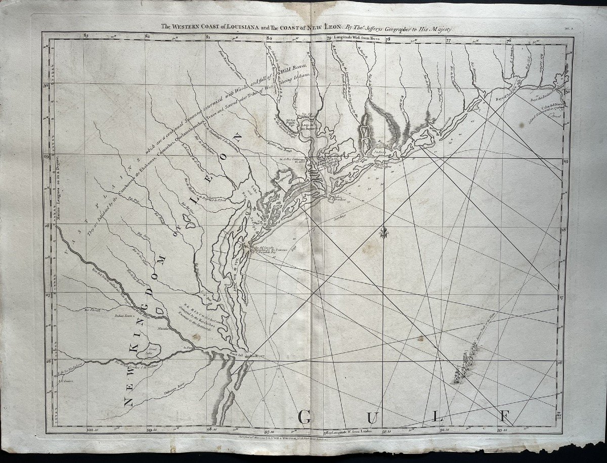
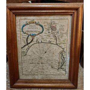
"Large 18th Century Map Of Texas - Coast Of Louisiana And The Coast Of New Leon - T. Jefferys"
Rare and Large 18th Century Map "The Western Coast of Louisiana and The Coast of New Leon" This is the 1794 edition by Laurie & Witthe of Thomas Jeffrys' map. Period proof Good general condition, some foxing Dimensions: 54 x 73.5 cm Dimensions at the plate: 50.5 x 65.5 cm
Price: 2 000 €
credit
Artist: Thomas Jeffrys
Period: 18th century
Style: Other Style
Condition: Good condition

Material: Paper
Width: 54 cm
Height: 73,5 cm

Reference: 1405448
line

"Camille Baroux" See more objects from this dealer

line

"Old Maps, Other Style"

More objects on Proantic.com
Subscribe to newsletter
line
facebook
pinterest
instagram

Camille Baroux
Paintings, old drawings and objects of curiosity
Large 18th Century Map Of Texas - Coast Of Louisiana And The Coast Of New Leon - T. Jefferys
1405448-main-66f131a89f57c.jpg

0698994213


*We will send you a confirmation email from info@proantic.com Please check your messages, including the spam folder.

Thank you! Your submission has been received!

Oops! Something went wrong while submitting the form