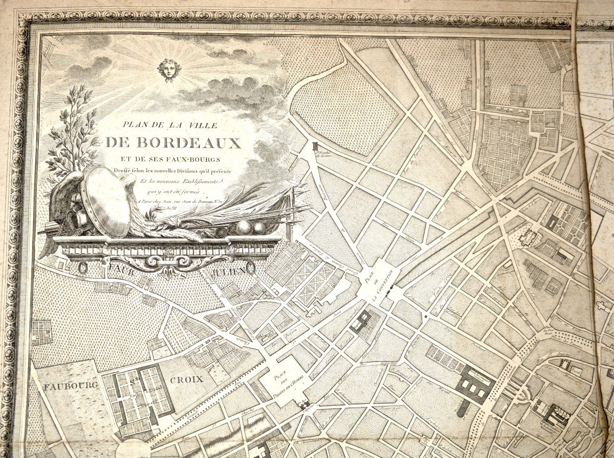


Map Of The City Of Bordeaux And Its Faux-bourgs, Jean De Bauvais, Year XII (1803-1804)
Artist: Jean De Bauvais
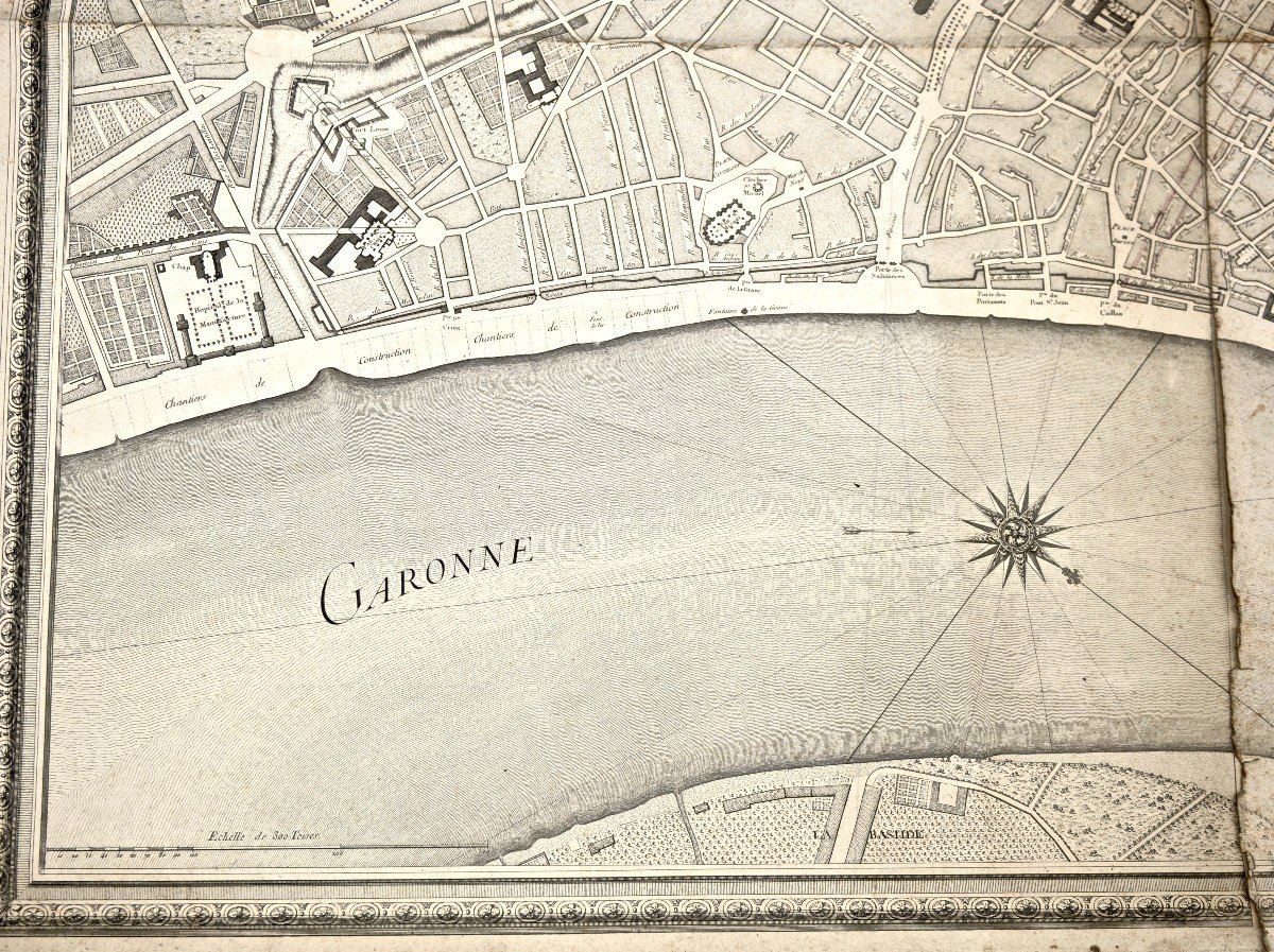
BORDEAUX – Map of the City of Bordeaux and its Suburbs Year XII, around 1803-1804 / sn Paris: at Jean. rue Jean de Bauvais Print on paper, black and white or color support: paper dimensions: 78 × 107 cm In the upper left corner, in a decorative cartouche, “Plan of the City of Bordeaux and its Suburbs Drawn according to the new Divisions that it presents And the new Establishments that have been formed there. In Paris at Jean, rue Jean de Beauvais N°32 Year XII”. In the upper right corner of the composition, rectangular cartouche “List of streets and squares that have received new names since the Revolution”. At the bottom left, “Scale of 300 Toises”. The location of the Chateau Trompette has been cut out and replaced by a hand-drawn plan
350 €
Period: 19th century
Style: Consulat, Empire
Condition: Condition of use
Material: Paper
Reference (ID): 1428122
Availability: In stock
Print