this object was sold
line

Map: Reunion Island By Levasseur Around 1850 Well Framed In 1968

Sold
Map: Reunion Island By Levasseur Around 1850 Well Framed In 1968
Sold
Map: Reunion Island By Levasseur Around 1850 Well Framed In 1968-photo-2
Sold
Map: Reunion Island By Levasseur Around 1850 Well Framed In 1968-photo-3
Sold
Map: Reunion Island By Levasseur Around 1850 Well Framed In 1968-photo-4
Sold
Map: Reunion Island By Levasseur Around 1850 Well Framed In 1968-photo-1
Sold
Map: Reunion Island By Levasseur Around 1850 Well Framed In 1968-photo-2
Sold
Map: Reunion Island By Levasseur Around 1850 Well Framed In 1968-photo-3
Sold
Map: Reunion Island By Levasseur Around 1850 Well Framed In 1968-photo-4
Sold
Map: Reunion Island By Levasseur Around 1850 Well Framed In 1968-photo-5
pictures.

Object description :

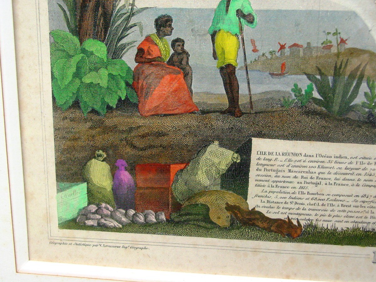
"Map: Reunion Island By Levasseur Around 1850 Well Framed In 1968"
I offer you this beautiful card, dating from the middle of the 19th century, enhanced with watercolor and gouache, at the time. Pretty colors, a good mat, a lacquered baguette, all dated 1968 on the back. from a Norman manor, facing the sea and the exotic.

View more from this dealer

View more - Old Maps

Subscribe to newsletter
line
facebook
pinterest
instagram

Philippe Beaudoin Antiquités
Antiquaire Généraliste

Map: Reunion Island By Levasseur Around 1850 Well Framed In 1968
1429326-main-672604b9a6313.jpg

06 85 41 50 93


*We will send you a confirmation email from info@proantic.com Please check your messages, including the spam folder.

Thank you! Your submission has been received!

Oops! Something went wrong while submitting the form