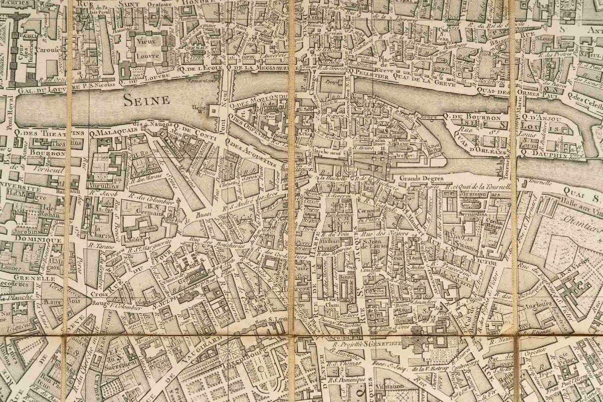
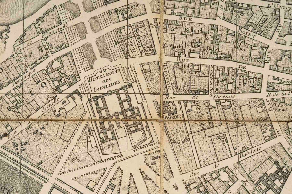
In the upper part of this cartographic representation covering the major part of the city, in an insert, is carried for the most daring travelers with a wandering mood a plan of the nearby "Suburbs of Paris".
Folded, the Plan nestles in a rectangular case in cardboard and morocco in a tan ochre decorated on its edge with a gilded frame with small iron motifs of wolf teeth, foliage scrolls decorated with pine cones. On its title piece in blue sheepskin is soberly carried the indicative mention: "NOUVEAU PLAN DE PARIS".
-------------------
As instructive as entertaining, this New Plan of Paris engraved by Esnault and Rapilly in a decade during which this editorial genre flourished destined for a notable commercial success constitutes as much by the date of its publication, its composition and its mode of presentation "in pocket" a most appreciable milestone in the secular tradition of urban cartographic documents intended for the greatest number. In a few glances, the notable or busy traveler, the dilettante stroller on a pleasure trip grasped the form and beauty of the Parisian Capital in the Age of Enlightenment, the most popular, visited and praised. They could, through the exhaustiveness of its indexing, its boxes, easily grasp the road network and its modifications, the remarkable places and buildings as well as the recent or planned embellishments under the aegis of the monarchy.
Forming a palimpest of pre-revolutionary and pre-Hausmannian Paris, this New Plan of the City and Suburbs of Paris will arouse the interest of the bibliophile who loves cartographic documents, will seduce any lover of the Parisian Capital looking for unusual routes of this prestigious urban site. It also invites another imagination: going against Time, the Centuries, we would hail as in the past: Roll Carriage! ."..:
---------------------------
.ESNAULT § RAPILLY, Publishers, Booksellers and Print Dealers (1770-1798) in Paris:
Both mentioned in 1768 as modest "Etaleurs sur les Quais" (Stallholders on the Quays) of the Parisian City, Sieurs Jacques Esnault (1739-1812) and Michel Rapilly (1740-1797) respectively natives of small agricultural hamlets located in Orne (Magny-le-Désert) and Manche (Pirou, near Coutances) joined forces around 1770. Established at that date as printers, publishers and Print Dealers at No. 195 Rue Saint-Jacques, "near the Fontaine Saint-Séverin" under the name "A la Ville de Coutances", they co-published the following year a "Collection of Prints relating to the ornamentation of apartments in the 16th and 17th centuries" (1771) which would be thematically echoed by "Views of the most beautiful public and private buildings in the City of Paris" (1787).
In 1773, with the intention of responding to the new customs of the clientele of their time, they launched into a then flourishing editorial genre: the Pocket Plan of the City of Paris whose carefully recorded urban topography and maneuverability corresponded to the needs and customs of travelers of a century inclined to movement and discovery. Thus, between 1773 and 1792, they would be the authors of the "New Road Plan of the City and the Suburbs of Paris" whose regular editions recorded over the years the progressive transformation of the road network, the significant urban developments and embellishments, the sudden mutation of the limits of the Parisian Capital. From this point of view, their "New Road Map of the City and Suburbs of Paris/With its Principal Buildings and New Barriers" (1792) drawn up in collaboration with the engineer-geographer Pichon is one of their most remarkable documents of urban cartography linked to post-revolutionary Paris. More unusual is their publication of maps including crucial moments of the American Revolutionary War (1782).
On a lighter subject, their publication in 1778 of the "Gallery of French Fashions and Costumes of the City of Paris", a collection of prints devoted to the clothing fashions of the French aristocracy, met with great editorial success among the European Courts infatuated with the so-called "A la Française" attire of which Queen Marie-Antoinette was the muse.
After the death in 1797 of his partner followed by a sale on May 12, 1798 of their common business, Jacques Esnault worked alone until 1812 as a "Bookseller, Publisher and Print Dealer" at No. 7 rue de Montmartre.
Materials: Copper-engraved plan, linen backing; strong cardboard and morocco leather
Dimensions: Plan: 54.5 cm x 78 cm Case: 19 X 11.5 cm.
Paris, 18th century urban cartography document from the Louis XVI period dated 1786.
Related literature: Boutier, Jean, The plans of Paris from the origins (1493) to the end of the 18th century: study, carto-bibliography and catalog, Paris: BNF, 2002, 330 C;- Pinon, Pierre, The Plans of Paris: History of a Capital, Paris: 2004;-Vallée, Léon, Catalog of the Plans of Paris and the maps of the Ile-de-France, Paris: Ed. Champion, 1908.
Good general condition considering the age of the document - Minor foxing, Lining in good condition - Period cardboard case showing wear at the corners and its Title label.













 Le Magazine de PROANTIC
 TRÉSORS Magazine
 Rivista Artiquariato