


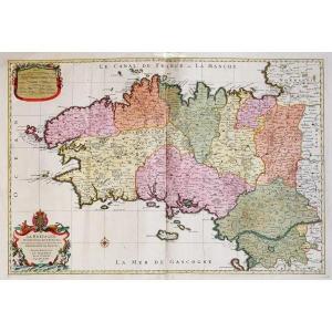
"Old Geographic Map Of Normandy"
Epreuve originale réalisée vers 1700. Valck éditeur.Coloris anciens.
Très bon état.
Format feuille : 67 x 57 cm.
Format gravure : 60 x 50 cm.
Original antique map around 1700.
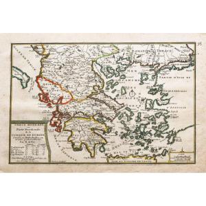
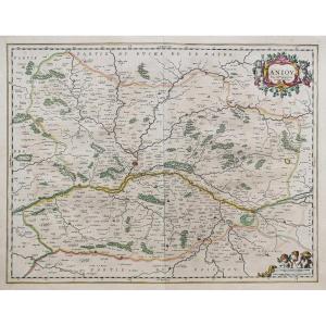
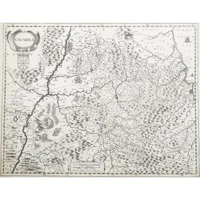
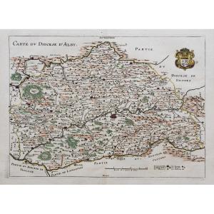
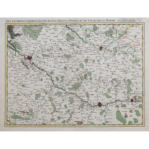
Carte décorative de la Normandie avec légende situant les principales villes de la région.
Echelle des lieux.
Vous pouvez consulter l’ensemble des cartes et gravures disponibles sur votre région en cliquant sur le lien de notre site internet spécialisé en archives anciennes géographiques :
https://cartes-livres-anciens.com/categorie-produit/cartes-geographiques-anciennes-original-antique-maps/france/normandie/
Règlement sécurisé par carte bancaire sur notre site internet en cliquant sur le lien :
https://cartes-livres-anciens.com/produit/cartes-geographiques-anciennes-original-antique-maps/france/normandie/carte-geographique-ancienne-de-la-normandie-2/
Toutes nos cartes et gravures sont accompagnées d’un certificat d’authenticité.
Gerard Valck, ou Gerrit Leendertsz Valck (1652-1726) et son fils Leonard étaient les seuls éditeurs importants de globes aux Pays-Bas au 18e siècle, bénéficiant d’un monopole presque total dans la première moitié des années 1700. Initialement graveur et marchand d’art, Valck fonda sa société à Amsterdam en 1687 près de celle occupée par le cartographe et fabricant de globes Jodocus Hondius. En 1701, il demande une charte pour la fabrication de globes et le « Planetolabium », conçu par Lotharius Zumbach de Coesfelt (1661-1727), professeur d’astronomie à l’Université de Leiden.
Les Valcks ont produit plusieurs éditions de Globe terrestre et céleste.
Vers 1711, lorsqu’il devint membre de la guilde des libraires, Leonard Valck (1675-1746) s’associa et son nom commença à apparaître aux côtés de celui de son père sur les cartouches des globes et des cartes anciennes. Leonard prit naturellement le contrôle de l’entreprise à la mort de son père en 1726 et, après sa propre mort en 1746, la société fut dirigée par Maria Valck, cousine et épouse de Gérard.
Original proof made around 1700. Valck publisher. Old colors. Very good condition. Sheet size: 67 x 57 cm. Engraving size: 60 x 50 cm. Original antique map around 1700. Decorative map of Normandy with legend locating the main cities of the region. Scale of places. You can view all the maps and engravings available in your region by clicking on the link to our website specializing in old geographical archives: https://cartes-livres-anciens.com/categorie-produit/cartes-geographiques-anciennes-original-antique-maps/france/normandie/ Secure payment by credit card on our website by clicking on the link: https://cartes-livres-anciens.com/produit/cartes-geographiques-anciennes-original-antique-maps/france/normandie/carte-geographique-ancienne-de-la-normandie-2/ All our maps and engravings are accompanied by a certificate of authenticity. Gerard Valck, or Gerrit Leendertsz Valck (1652-1726) and his son Leonard were the only significant globe publishers in the Netherlands in the 18th century, enjoying a near-total monopoly in the first half of the 1700s. Initially an engraver and art dealer, Valck founded his company in Amsterdam in 1687 near that occupied by the cartographer and globe maker Jodocus Hondius. In 1701 he applied for a charter for the manufacture of globes and the "Planetolabium", designed by Lotharius Zumbach de Coesfelt (1661-1727), professor of astronomy at Leiden University. The Valcks produced several editions of Globe terrestre et céleste. Around 1711, when he became a member of the booksellers' guild, Leonard Valck (1675-1746) went into partnership and his name began to appear alongside his father's on the cartouches of globes and old maps. Leonard naturally took control of the business on his father's death in 1726 and, after his own death in 1746, the company was run by Maria Valck, Gerard's cousin and wife.


 Le Magazine de PROANTIC
 TRÉSORS Magazine
 Rivista Artiquariato