


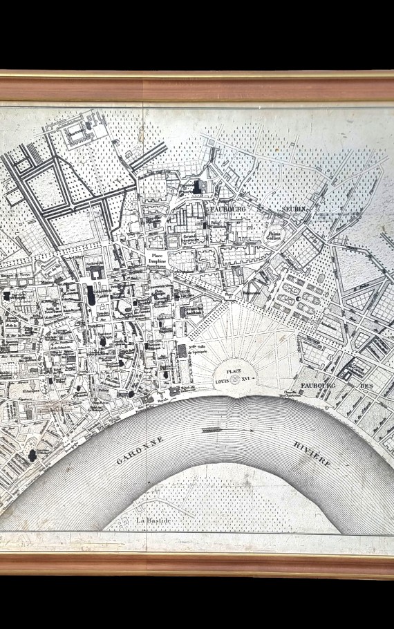


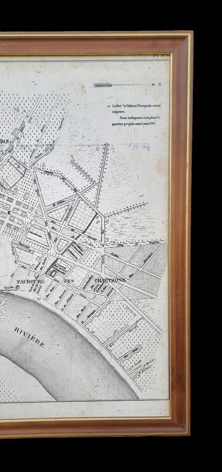

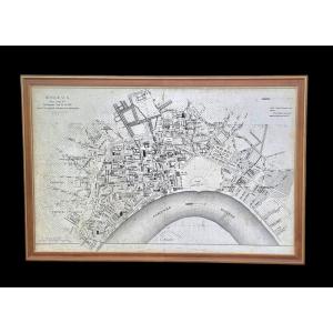


"Old Map Of The City Of Bordeaux In 1775"
Old and very interesting map of the city of Bordeaux and its suburbs in 1775, under King Louis XVI after the major works of the intendants. Very detailed map, locating the main streets, avenues, squares, places and monuments of the city. Place Louis XVI, today Place des Quiconces Place Royal, today Place de la Bourse and many other changes to note over the 250 years since these major works. Very large map, 1 m36 by 2 m 15. Very well highlighted by a very pretty frame in patinated oak enhanced with 2 gold fillets. (frame after the map). Map in very good condition and frame in perfect condition (restored). 


 Le Magazine de PROANTIC
 TRÉSORS Magazine
 Rivista Artiquariato