Map Of Italy From 1805 flag

Map Of Italy From 1805
Map Of Italy From 1805-photo-2
Map Of Italy From 1805-photo-3
Map Of Italy From 1805-photo-4

1515643-main-67e2c4d72ff82.jpg 1515643-67e2c4f7f1cfc.jpg 1515643-67e2c5183f6a5.jpg 1515643-67e2c528099dc.jpg

Object description :

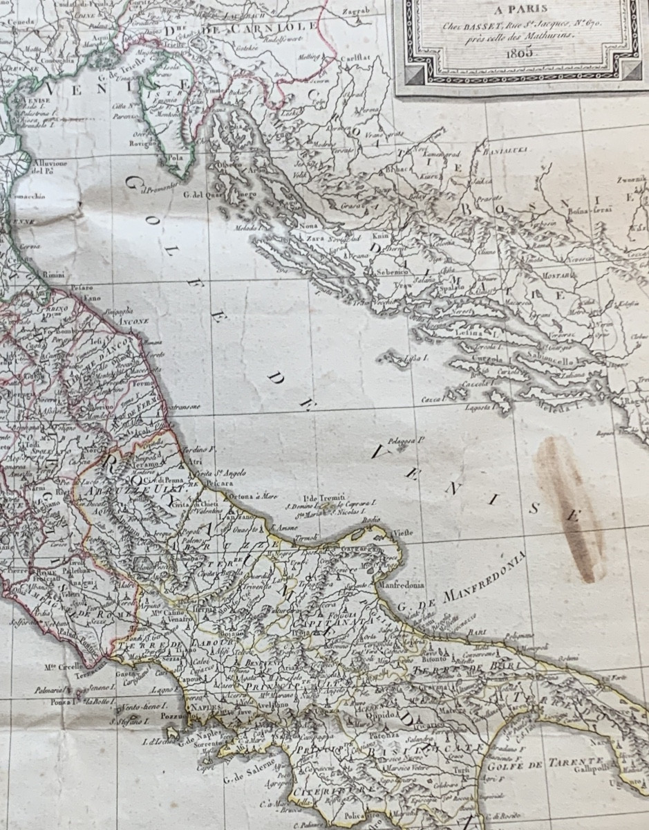
"Map Of Italy From 1805"
Map of Italy drawn up by the cartographer Eustache Hérisson (1759-1816), pupil and student of Rigobert Bonne (1727-1795), map published by Basset in 1805. Good condition, traces of folding, see photos
Price: 170 €
credit
Period: 19th century
Style: Consulat, Empire
Condition: Condition of use

Material: Paper
Width: 57
Height: 86

Reference: 1515643
Availability: In stock
line

"L'ouestampille" See more objects from this dealer

line

"Old Maps, Consulat, Empire"

More objects on Proantic.com
Subscribe to newsletter
line
facebook
pinterest
instagram

L'ouestampille
Généraliste XVIII et XIX
Map Of Italy From 1805
1515643-main-67e2c4d72ff82.jpg

06 03 01 26 03


*We will send you a confirmation email from info@proantic.com Please check your messages, including the spam folder.

Thank you! Your submission has been received!

Oops! Something went wrong while submitting the form