Very good state.
Sheet size: 74 x 54.5 cm.
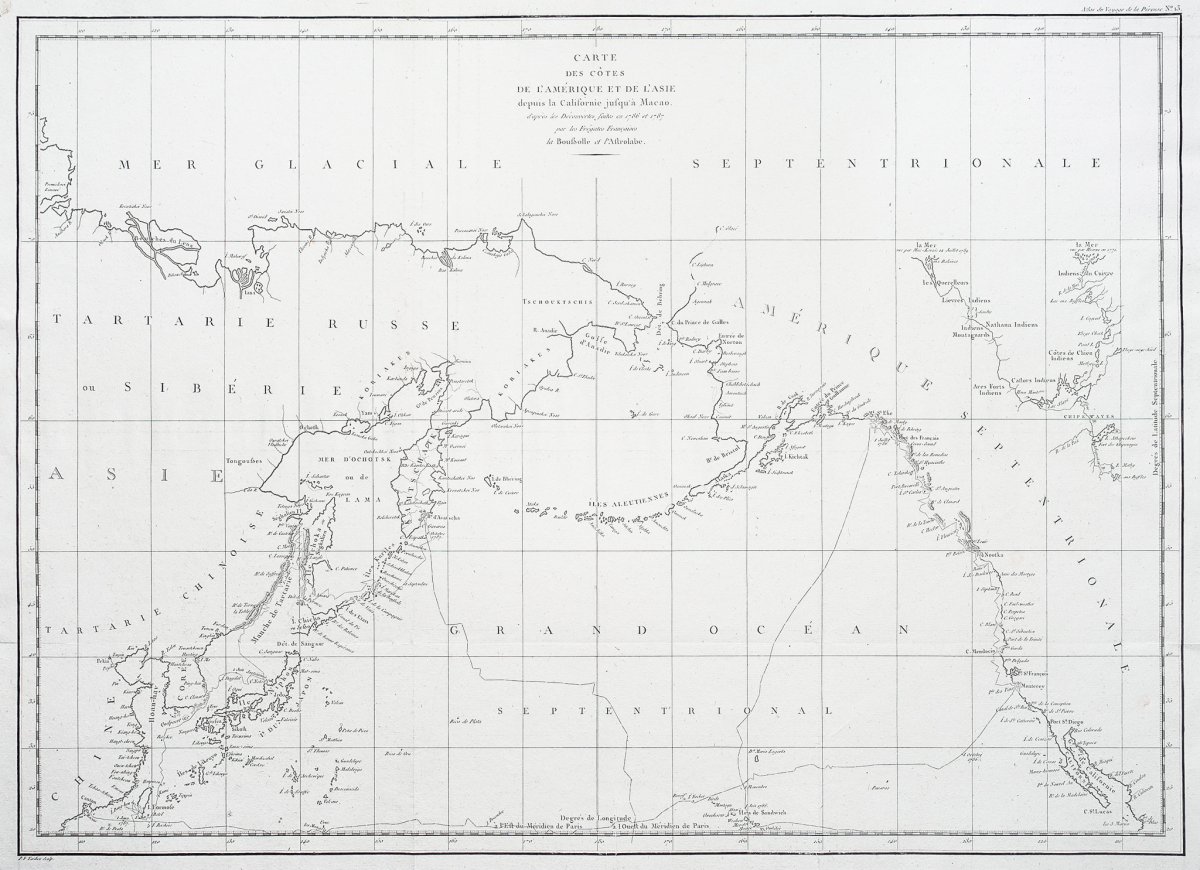
Original antique map of 1798.
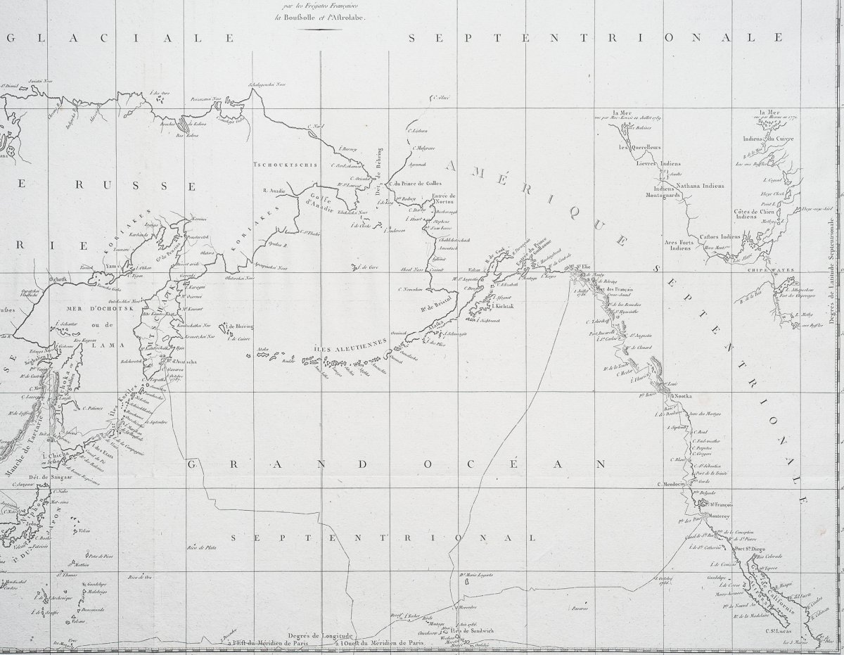
The west coast of North America is shown to the south as Baja California and to the north as above 70 degrees latitude. Shows part of China, all of Japan and Kamtschatka, and an attractive depiction of the Behring Strait and the Alaskan Archipelago. You can consult all the maps, books and engravings available in your region by clicking on the link of our website specializing in ancient geographic archives: https://www.cartes-livres-anciens.com
Secure payment by credit card on our website: https://cartes-livres-anciens.
com/produit/cartes-geographique-anciennes-original-antique-maps/monde-cartes-marines/cartes-marines/la-perouse-carte-geographique-ancienne- des-cotes-de-lamerique-de-lasie /
Voyage de La Perouse around the world, published in accordance with the decree of April 22, 1791, and drafted by MLA Milet-Mureau. Paris, From the Imprimerie de la République, year V (1797). First edition In August 1785, by order of King Louis XVI, Jean-Francois de La Perouse (1741-1788) and his companions embarked aboard the La Boussole and L'Astrolabe ships to lead a great expedition around the world. Their mission was to complete the numerous topographical surveys undertaken a few years earlier by James Cook, in particular those of the Pacific coast of the North American continent. The expedition first headed for Brazil and Cape Horn, then ventured into the Pacific Ocean, which it explored up and down. But in 1788 the ships were wrecked on the reefs of Vanikoro, south of the archipelago of the Santa Cruz Islands, and the crew disappeared under mysterious circumstances. On April 22, 1791, a decree of the National Assembly ordered the publication of the reports, maps and drawings that La Pérouse had taken care to send during his journey: we know, in fact, that the major part of these documents had was entrusted to the interpreter Barthelemy de Lesseps in September 1787, during a stopover in Kamtchatka and that the latter brought them back to Paris a year later, at the end of an incredible terrestrial epic through Siberia and Europe .
Grande carte originale gravée à Paris en 1797-1798.
Très bon état.
Format feuille : 74 x 54,5 cm.
Original antique map of 1798.
La côte ouest de l’Amérique du Nord est représentée au sud comme la Basse Californie et au nord au-dessus de 70 degrés de latitude. Montre une partie de la Chine, tout le Japon et le Kamtschatka, et une représentation attrayante du détroit de Behring et de l’archipel de l’Alaska.
Vous pouvez consulter l’ensemble des cartes, livres et gravures disponibles sur votre région en cliquant sur le lien de notre site internet spécialisé en archives anciennes géographiques : https://www.cartes-livres-anciens.com
Règlement sécurisé par carte bancaire sur notre site internet : https://cartes-livres-anciens.com/produit/cartes-geographiques-anciennes-original-antique-maps/monde-cartes-marines/cartes-marines/la-perouse-carte-geographique-ancienne-des-cotes-de-lamerique-de-lasie/
Voyage de La Perouse autour du monde, publie conformément au décret du 22 avril 1791, et rédigé par M. L. A. Milet-Mureau. Paris, De l’Imprimerie de la République, an V (1797).
Edition originale
En août 1785, sur ordre du roi Louis XVI, Jean-Francois de La Perouse (1741-1788) et ses compagnons embarquèrent a bord des vaisseaux La Boussole et L’Astrolabe pour conduire une grande expédition autour du monde. Leur mission était de compléter les nombreux relevés topographiques entrepris quelques années auparavant par James Cook, en particulier ceux du littoral pacifique du continent nord-américain. L’expédition se dirigea dans un premier temps vers le Brésil et le cap Horn, puis s’aventura dans l’océan Pacifique qu’elle explora de long en large. Mais en 1788, les navires firent naufrage sur les récifs de Vanikoro, au sud de l’archipel des iles Santa Cruz, et l’équipage disparut dans des circonstances mystérieuses. Le 22 avril 1791, un décret de l’Assemblée nationale ordonna la publication des relations, cartes et dessins que La Pérouse avait pris soin d’envoyer au cours de son périple: on sait, en effet, que la majeure partie de ces documents avait été confié a l’interprète Barthelemy de Lesseps en septembre 1787, lors d’une escale au Kamtchatka et que celui-ci les rapporta a Paris un an plus tard, au terme d’une incroyable épopée terrestre a travers la Sibérie et l’Europe.















 Le Magazine de PROANTIC
 TRÉSORS Magazine
 Rivista Artiquariato