
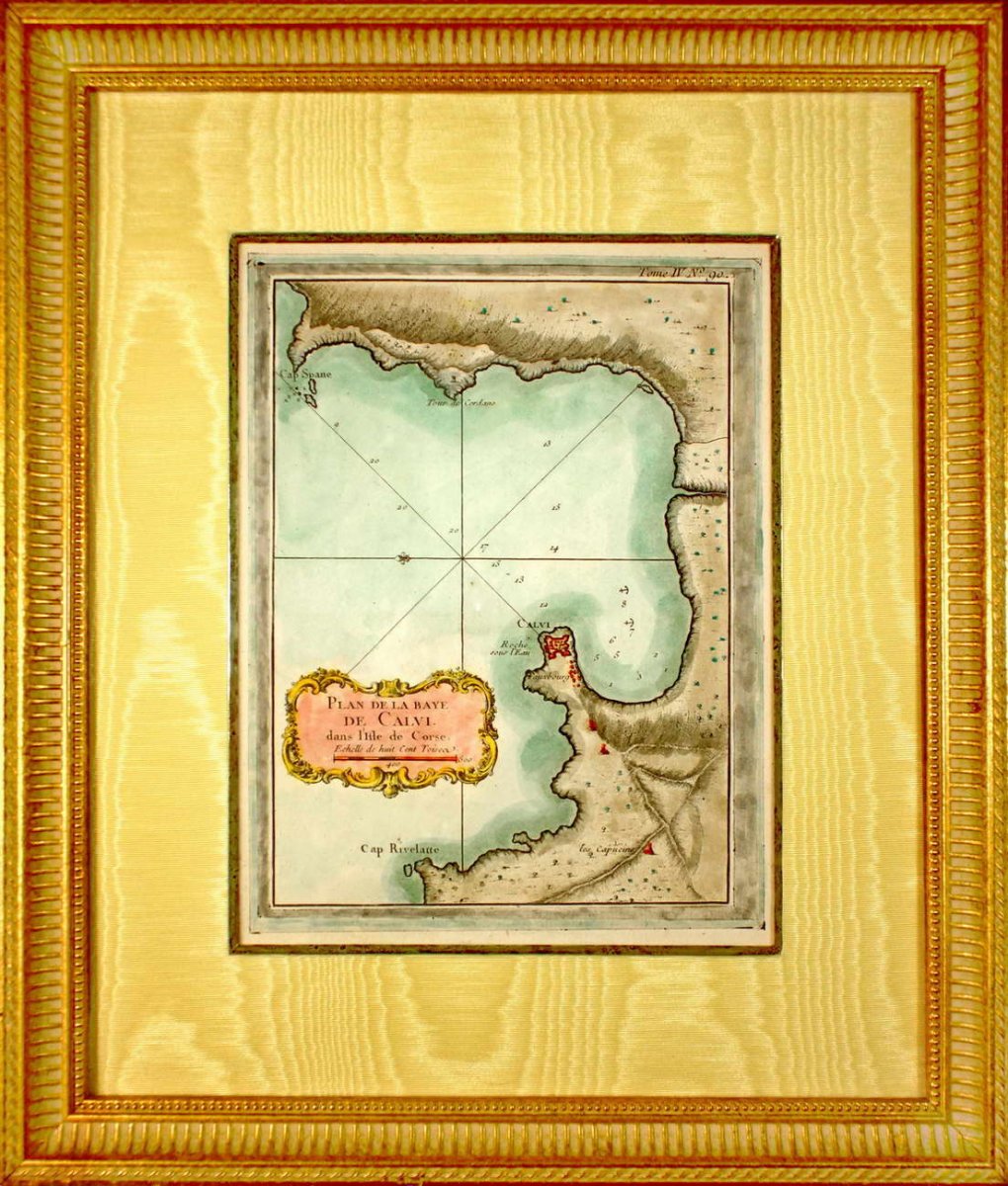


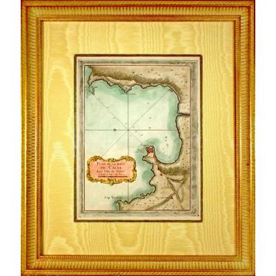
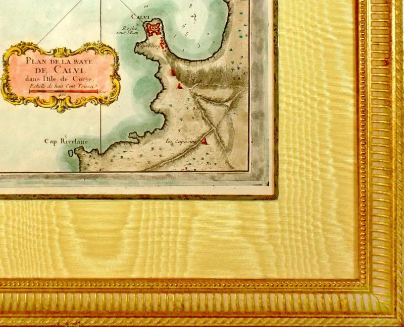
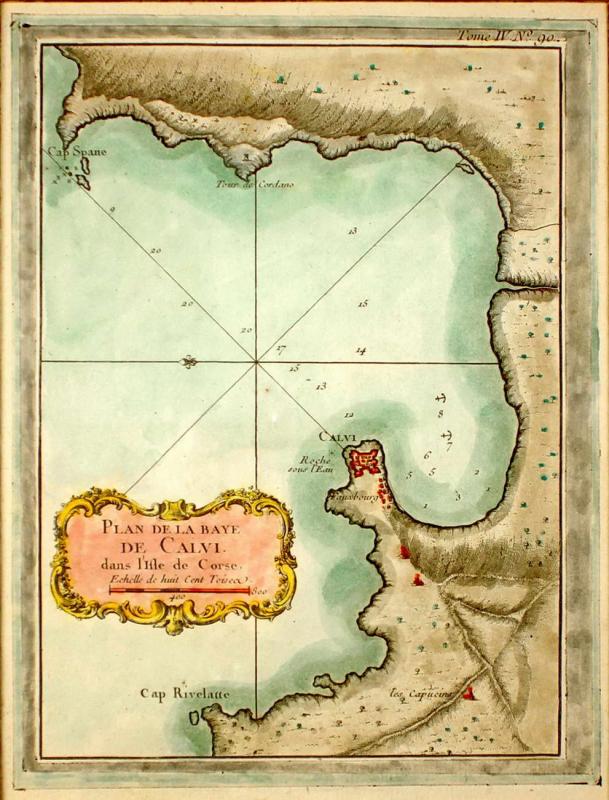
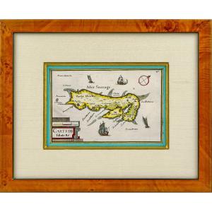
"Corsica - Rare Marine Chart Engraving - Plan Of The Baye De Calvi In The Isle Of Corsica - Ep. XVIII"
PLAN OF THE BAYE DE CALVI in the Isle of Corsica RARE nautical chart Original steel engraving with a chisel and laid paper with watermark. Engraved by BELLIN Jacques Nicolas, (French -1703-1772). Cartographer and hydrographer. In 1721, he was appointed hydrographer of the Ministry of the Navy. He is the author of a large number of maps and atlases. Hand watercolored. Dimension (s): High. 40.5 cm - Width. 34.5 cm Width. of the Baguette: 3 cm Condition: INTACT Engraving period: 18th century (1764) Framing: CURRENT - Gold bevel - Marie-Louise in straw yellow moire - Wooden baguette, aged water gilding. 


 Le Magazine de PROANTIC
 TRÉSORS Magazine
 Rivista Artiquariato