Old Geographical And Marine Map Of The Côtes De Bretagne Anse De Goulven l'Isle d'Ouessant 18th flag


Object description :

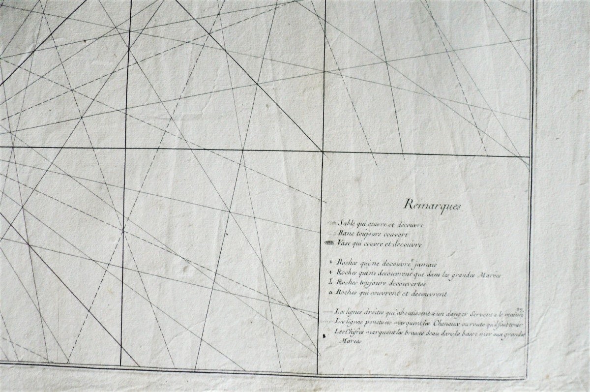
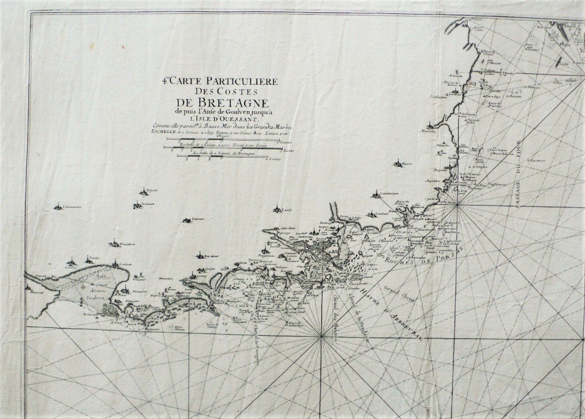
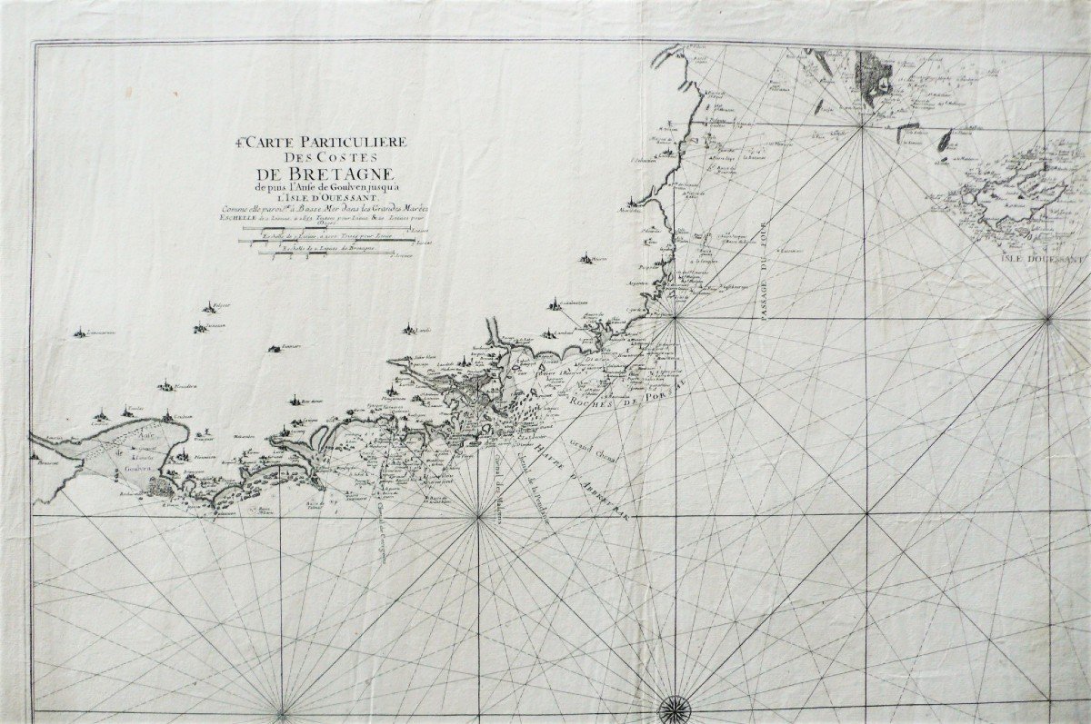
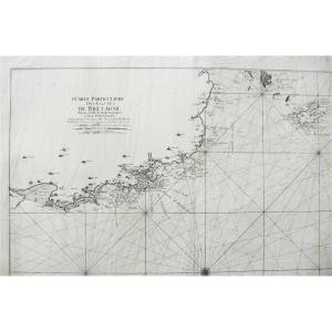
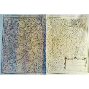
"Old Geographical And Marine Map Of The Côtes De Bretagne Anse De Goulven l'Isle d'Ouessant 18th"
18th century maritime map.
Particular map of the Côtes de Bretagne from the Goulven cove to the Isle of Ouessant, probably by Le Rouge.
Dimensions: 58 x 80.3 cm 22.83 x 31.61 inches in the line
66.5 x 99 cm​​​ 26.18 x 38.97 inches sheet
The work has been restored by a licensed professional conservator. All our prints and drawings for sale are in good condition. If necessary, they have been repaired by a licensed professional conservator.
Price: 850 €
credit
Period: 18th century
Style: Louis 15th - Transition
Condition: Good condition

Material: Paper
Width: 99 cm
Height: 66,5 cm

Reference: 854886
Contact Dealer
line

"FineArtsFrance" See more objects from this dealer

line

"Old Maps, Louis 15th - Transition"

More objects on Proantic.com
Subscribe to newsletter
line
facebook
pinterest
instagram
FineArtsFrance
19th & 20th c. paintings, engravings, Fine Art dealer & expert Cnes & Cedea
Old Geographical And Marine Map Of The Côtes De Bretagne Anse De Goulven l'Isle d'Ouessant 18th
854886-main-619100b798fdb.jpg
+33 143 25 34 83
+33 686324613 +33 607067552


*We will send you a confirmation email from info@proantic.com Please check your messages, including the spam folder.

Thank you! Your submission has been received!

Oops! Something went wrong while submitting the form