


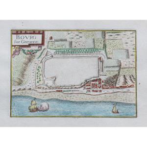
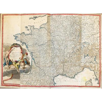
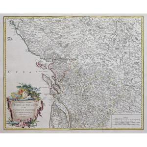
"Ancient Geographic Map Of Gascony"
Original map engraved in 1620. Abraham Ortelius cartographer.hand colors.
Text on the back on Poitou in Latin.
Freckle in the margin not reaching the map.
Very good state.
Sheet size: 15 x 11.5 cm.
Engraving format: 11 x 8 cm. Original map of 1620.
You can consult all the maps, books and engravings available in your region by clicking on the link of our website specializing in ancient geographic archives:
https://cartes-livres-anciens.com/categorie- product / old-geographic-maps-original-antique-maps / france / aquitaine-guyenne-gascogne-perigord /
Secure payment by credit card on our website by clicking on the link below:
https://https: // maps-books- Anciens.com/produit/cartes-geographique-anciennes-original-antique-maps/france/aquitaine-guyenne-gascogne-perigord/carte-geographique-ancienne-guasconiae-orignal-antique-map/
All our maps and engravings are accompanied by 'a certificate of authenticity.
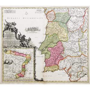
Abraham Ortel, better known as Ortelius, was born in Antwerp and, after studying Greek, Latin and mathematics, settled there with his sister, as a bookseller and "map painter". Traveling extensively, especially to major book fairs, his business flourished and he established contacts with scholars in many countries. A turning point in his career was reached in 1564 with the publication of a world map in eight sheets of which only one copy was known: other individual maps would follow, then, at the suggestion of a friend, he assembled a collection of maps which he had engraved in a uniform size, thus forming a set of maps which was first published in 1570 as the Theatrum Orbis Terrarum (Atlases of the whole world). Although Lafreri and other Italian cartographers had published "modern" map collections in book form in previous years, the Theatrum was the first systematic collection of uniformly sized maps and can therefore be called the first atlas, although this term was not used twenty years later by Mercator. The Theatrum, with most of its elegantly engraved maps by Frans Hogenberg, was an immediate success and appeared in numerous editions in different languages, including addenda published from time to time incorporating the latest contemporary knowledge and discoveries. The last edition of maps appeared in 1612. Unlike many of his contemporaries, Ortelius noted his sources of information. In the first edition, eighty-seven cartographers were thanked. In addition to modern maps from his main atlas, Ortelius himself compiled a series of historical maps known as Parergon Theatri, which appeared from 1579, sometimes as a separate publication and sometimes incorporated into the Theatrum.


 Le Magazine
 Rivista Artiquariato
 TRÉSORS magazine