Map Of The Gulf Of Guinea By Blaeu, Circa 1650. flag

Map Of The Gulf Of Guinea By Blaeu, Circa 1650.
Map Of The Gulf Of Guinea By Blaeu, Circa 1650.-photo-2
Map Of The Gulf Of Guinea By Blaeu, Circa 1650.-photo-3
Map Of The Gulf Of Guinea By Blaeu, Circa 1650.-photo-4

891617-main-61f2cbab06018.jpg 891617-61f2cbcc2dfa4.jpg 891617-61f2cbe5f178d.jpg 891617-61f2cc0577efb.jpg

Object description :

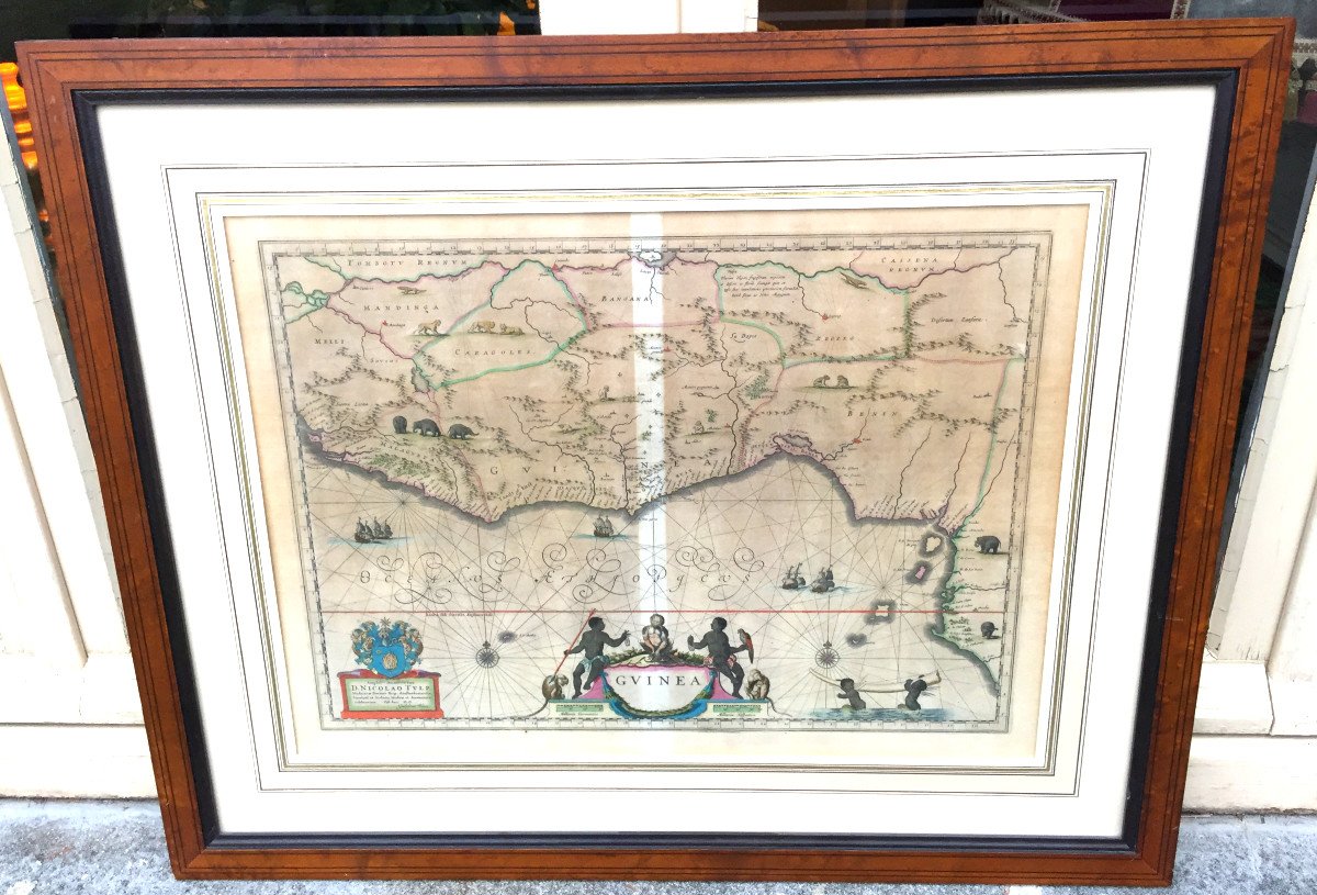
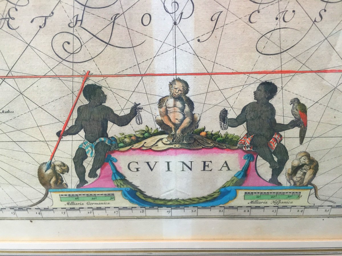
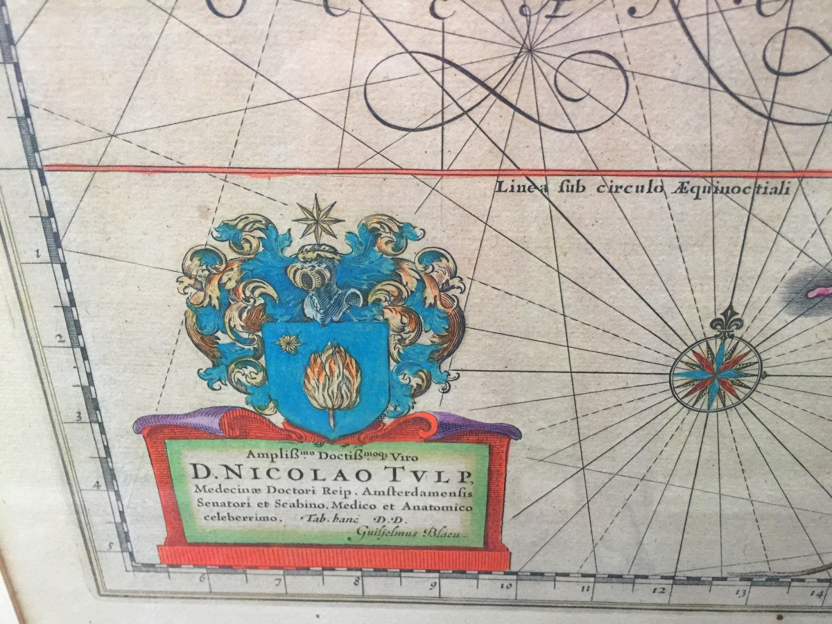
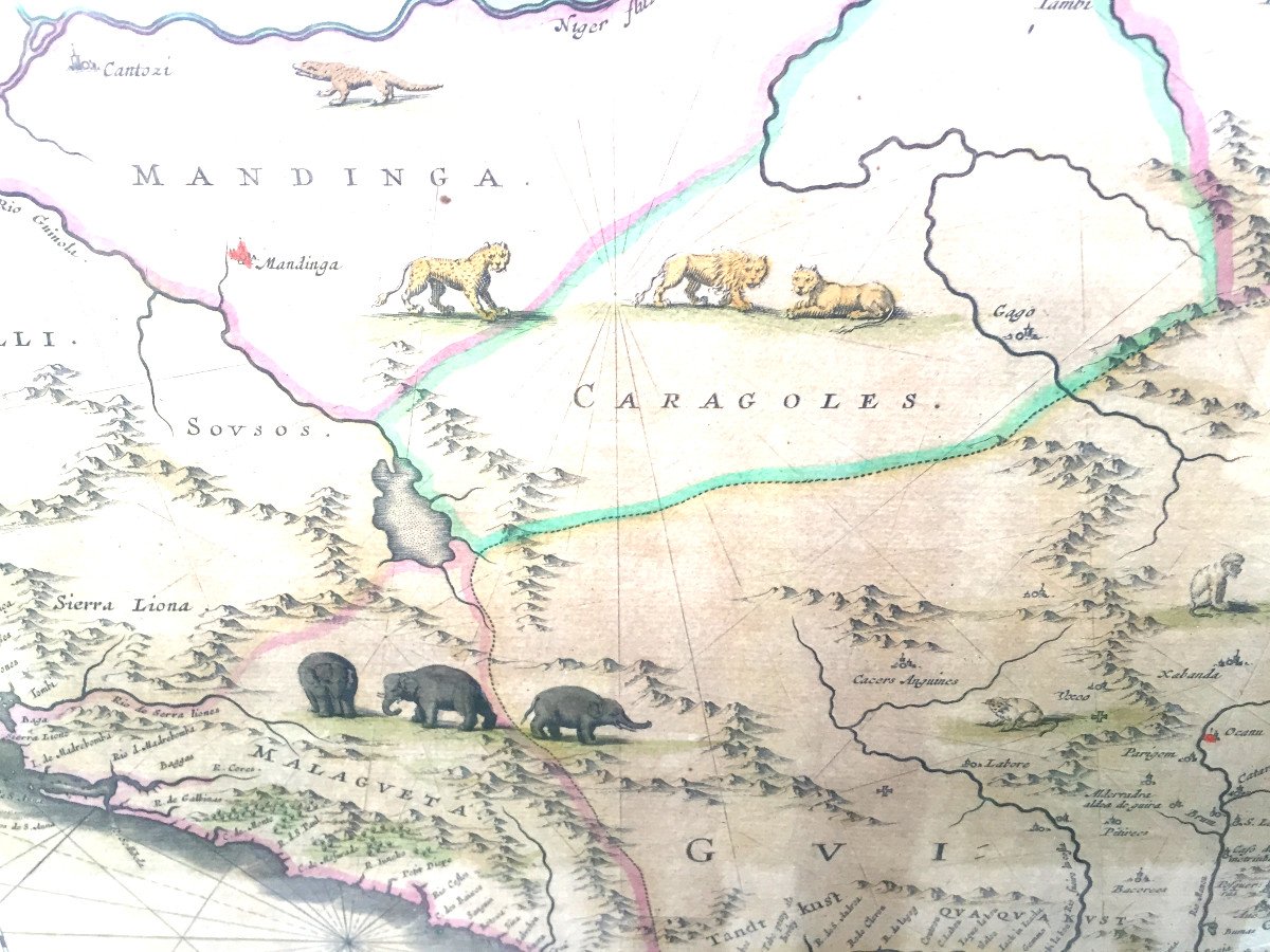
"Map Of The Gulf Of Guinea By Blaeu, Circa 1650."
Original colorized map, mid-17th century. Modern quality framework. Frame size: 79/65 cm
Price: 350 €
Period: 17th century
Style: Other Style
Condition: Perfect condition

Material: Paper

Reference: 891617
line

"Antiquités Gallien" See more objects from this dealer

line

"Old Maps, Other Style"

More objects on Proantic.com
Subscribe to newsletter
line
facebook
pinterest
instagram

Antiquités Gallien
Antiquaire généraliste
Map Of The Gulf Of Guinea By Blaeu, Circa 1650.
891617-main-61f2cbab06018.jpg

02.47.97.15.25

06 72 10 83 75


*We will send you a confirmation email from info@proantic.com Please check your messages, including the spam folder.

Thank you! Your submission has been received!

Oops! Something went wrong while submitting the form