


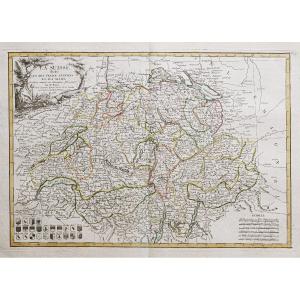
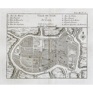
"Ancient Map Of The Coasts Of Persia – Iran – Guzarat – Malabar"
Carte originale gravée en 1740.Très bon état.
Coloris aquarelle.
Format feuille : 27 x 21,5 cm.
Format gravure : 26,5 x 20,5 cm.
Original antique map of 1740.
Carte illustrée d’un large cartouche décoratif et d’une rose des vents. Explication dans le second cartouche des lieux avec observations astronomiques.
Vous pouvez consulter l’ensemble des cartes et gravures disponibles sur votre région en cliquant sur le lien de notre site internet spécialisé en archives anciennes géographiques:
https://cartes-livres-anciens.com/categorie-produit/cartes-geographiques-anciennes-original-antique-maps/moyen-orient/iran/
Règlement sécurisé par carte bancaire sur notre site internet en cliquant sur le lien:
https://cartes-livres-anciens.com/produit/cartes-geographiques-anciennes-original-antique-maps/moyen-orient/arabie/antique-map-carte-des-cotes-de-perse-iran-guzarat-malabar/
Toutes nos cartes et gravures sont accompagnées d’un certificat d’authenticité.
Original map engraved in 1740. Very good condition. Watercolor colors. Sheet size: 27 x 21.5 cm. Engraving format: 26.5 x 20.5 cm. Original antique map of 1740. Map illustrated with a large decorative cartouche and a compass rose. Explanation in the second cartouche of the places with astronomical observations. You can consult all the maps and engravings available in your region by clicking on the link of our website specializing in ancient geographical archives: https://cartes-livres-anciens.com/categorie-produit/cartes-geographiques-anciennes -original-antique-maps/moyen-orient/iran/ Secure payment by credit card on our website by clicking on the link: https://cartes-livres-anciens.com/produit/cartes-geographiques-anciennes-original- antique-maps/middle-east/arabia/antique-map-carte-des-cotes-de-perse-iran-guzarat-malabar/ All our maps and engravings are accompanied by a certificate of authenticity.


 Le Magazine de PROANTIC
 TRÉSORS Magazine
 Rivista Artiquariato