
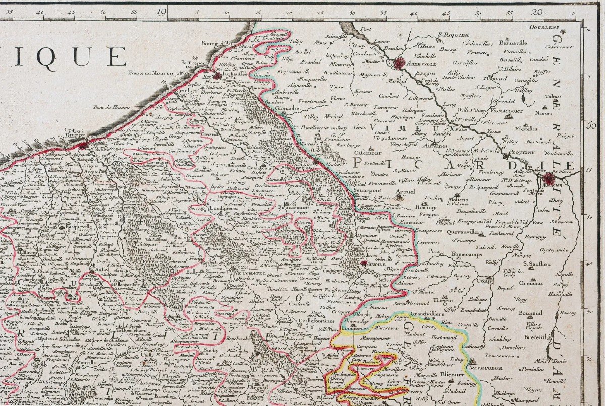
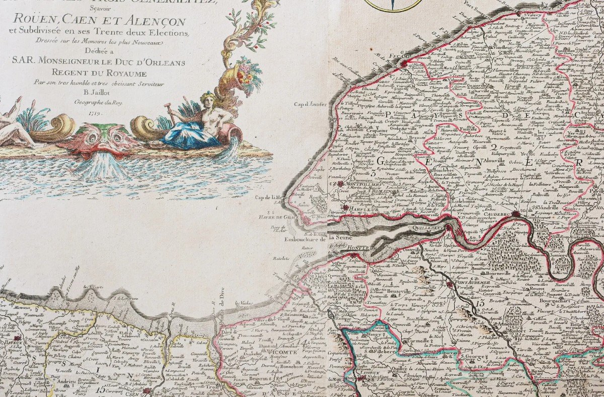


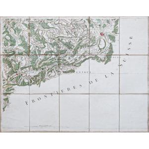
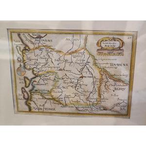
"Old Map Of Normandy"
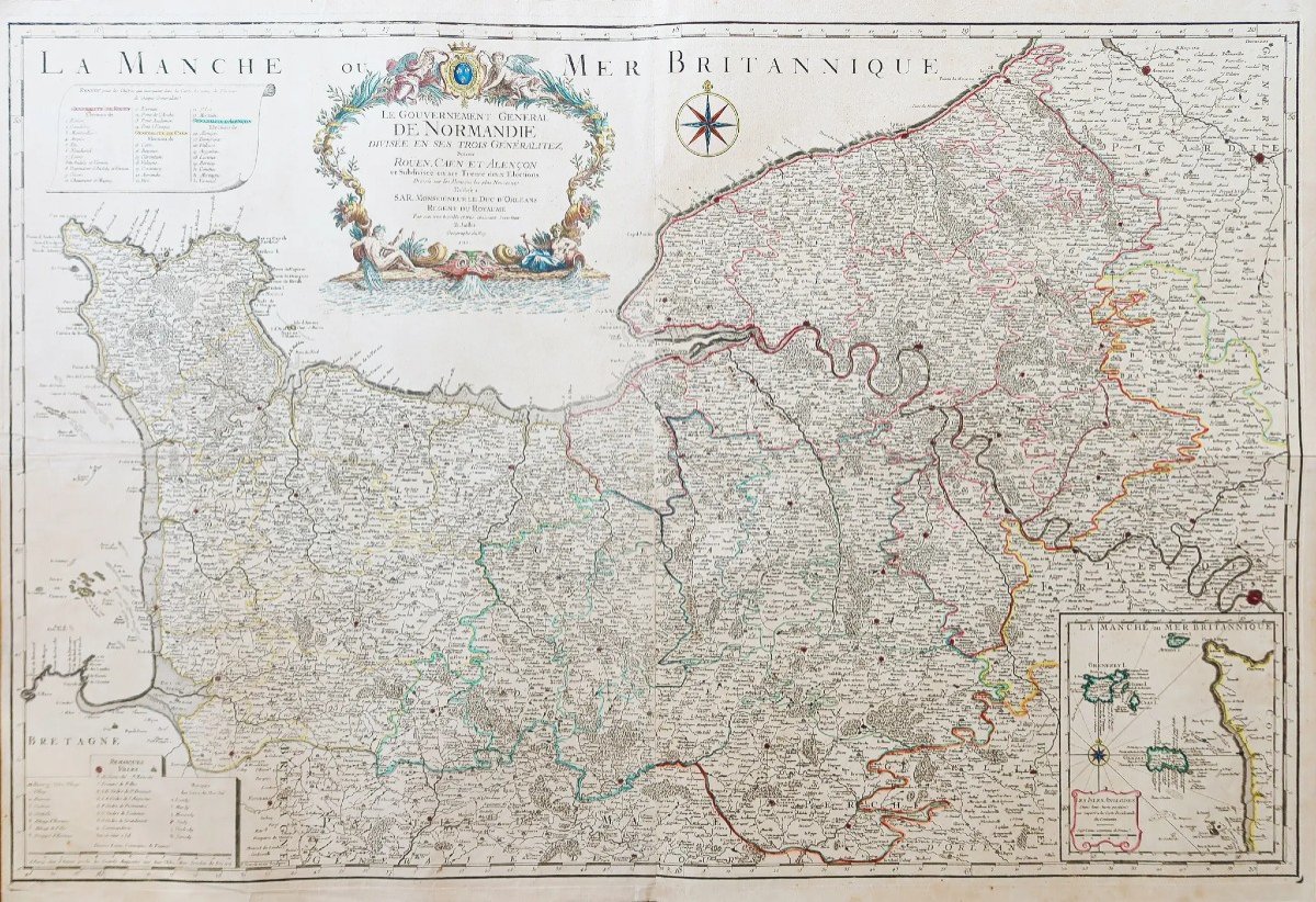
Grande épreuve originale réalisée en 1719. Jaillot cartographe.seconde édition.
Beaux coloris aquarelle.
Très bon état.
Format feuille: 106 x 72 cm.
Format gravure: 103,5 x 69 cm.
Original antique map of 1719.
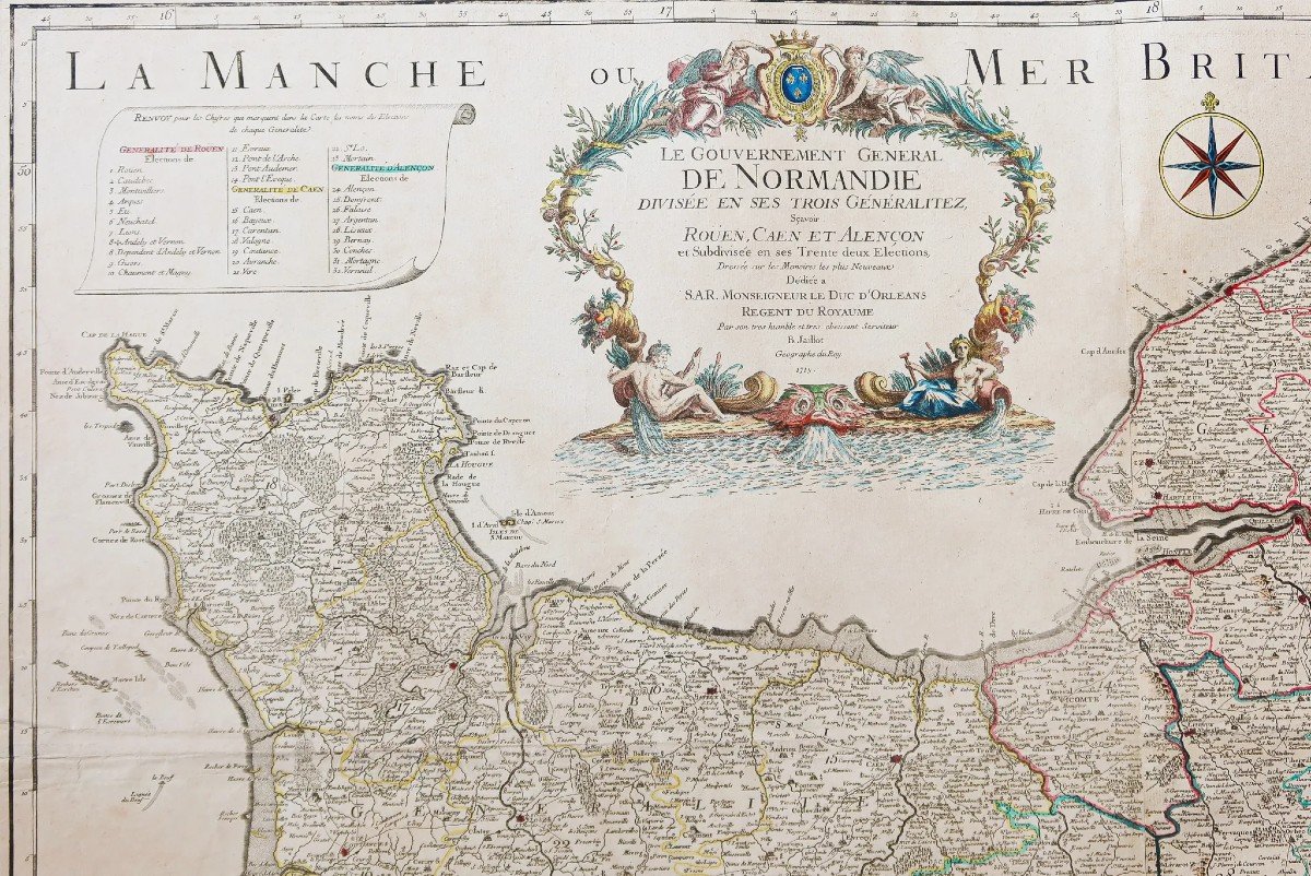
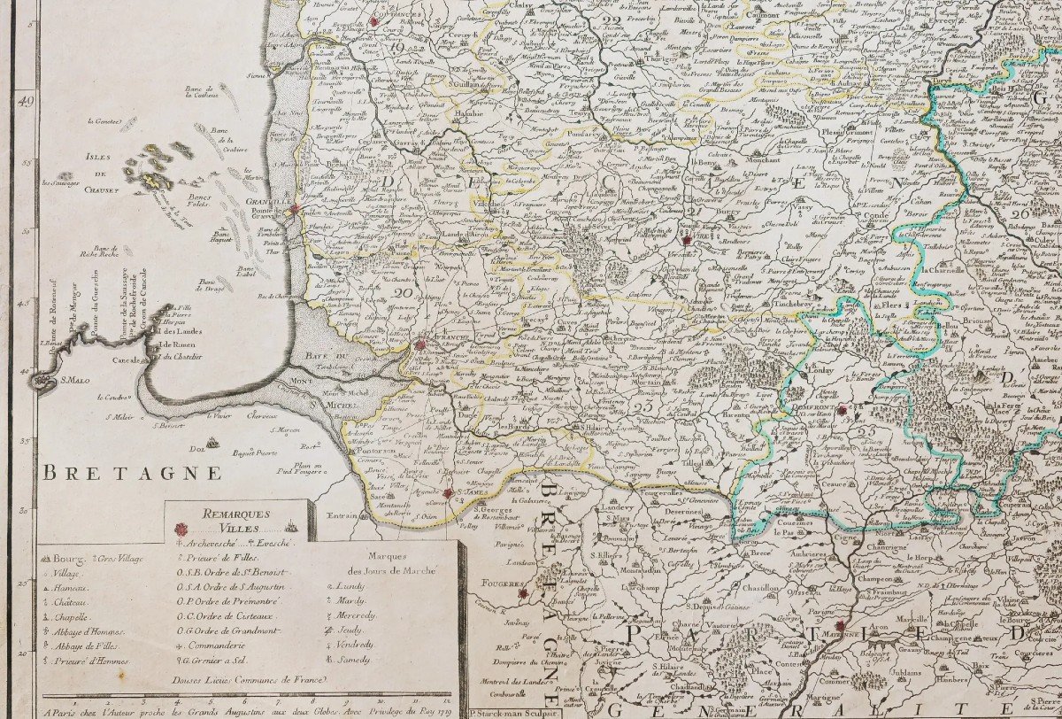
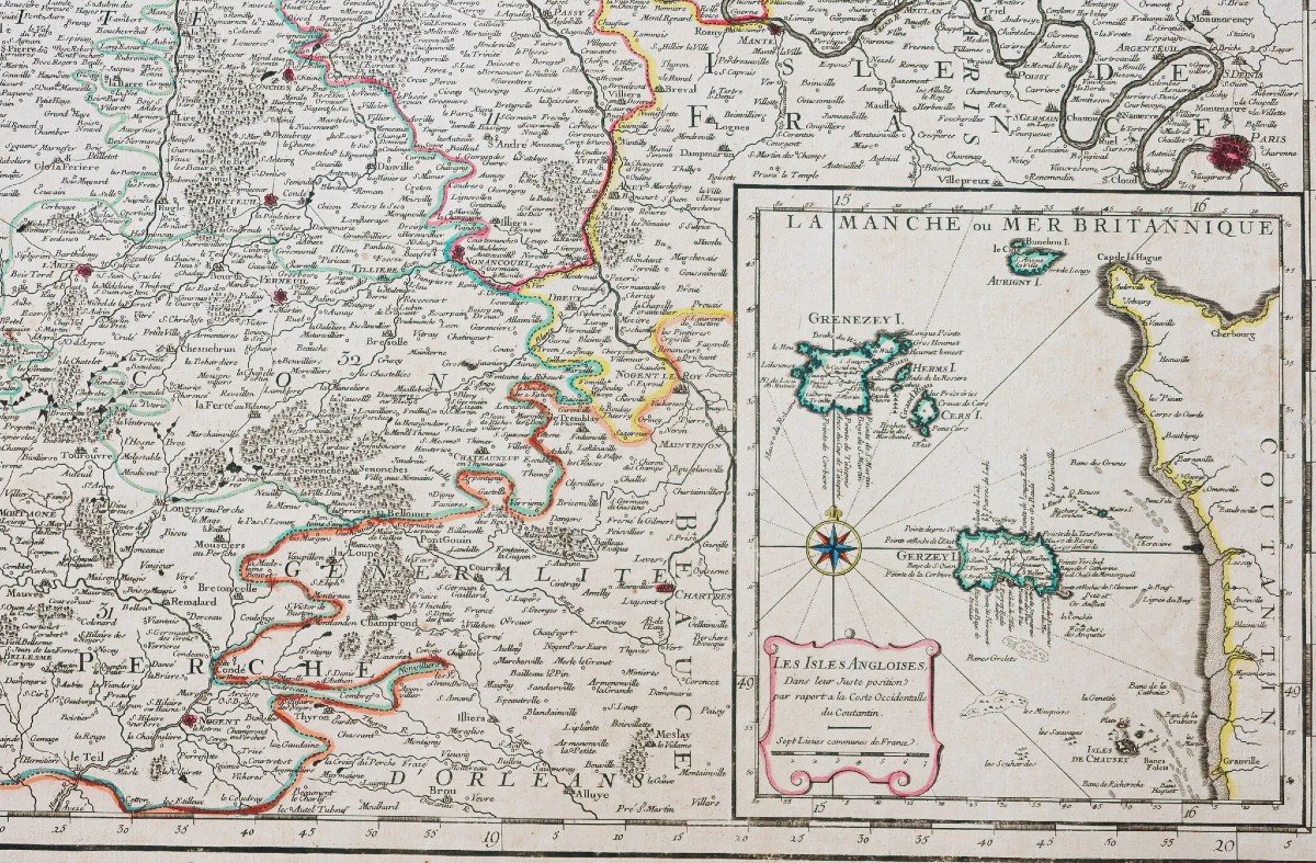
Carte gravée sur deux feuillets joints. Large cartouche de titre aux armes de France, renvois chiffrés de chaque généralités et cartouche dans la partie inférieure droite des îles Anglaises. Boussole.
L’une des plus grandes cartes gravées du 18èmesiècle sur la Normandie.
Vous pouvez consulter l’ensemble des cartes, livres et gravures disponibles sur votre région en cliquant sur le lien de notre site internet spécialisé en archives anciennes géographiques:
https://cartes-livres-anciens.com/categorie-produit/cartes-geographiques-anciennes-original-antique-maps/france/normandie/
Règlement sécurisé par carte bancaire sur notre site internet en cliquant sur le lien ci-dessous:
https://cartes-livres-anciens.com/produit/cartes-geographiques-anciennes-original-antique-maps/france/normandie/carte-geographique-ancienne-de-la-normandie-6/
Toutes nos cartes et gravures sont accompagnées d’un certificat d’authenticité.
Alexis-Hubert Jaillot(1632-1712) est un ingénieur géographe et cartographe français, imprimeur à Paris, de la fin du XVIIesiècle et du début du XVIIIesiècle, au service du roi Louis XIV.
«Les plus grandes cartes du 17èmesiècle »
Il publie de nombreux travaux de géographes contemporains ainsi que ses propres œuvres.
«L’Atlas François», Jaillot, 1692-1695, compilation des cartes de Nicolas Sanson (cartographe), Édité à Paris et à Amsterdam chez R. et J. Ottens.
Son travail sera continué par son fils, Bernard Jean Hyacinthe Jaillot (1673-1739), son petit-fils, Bernard Antoine Jaillot, ainsi que le beau-frère de celui-ci, Jean Baptiste-Michel Renou de Chauvigné dit Jaillot (1710-1780).
Large original proof made in 1719. Jaillot cartographer. second edition. Beautiful watercolor colors. Very good state. Sheet size: 106 x 72 cm. Engraving format: 103.5 x 69 cm. Original antique map of 1719. Map engraved on two attached sheets. Large title cartouche with the arms of France, cipher references of each generality and cartouche in the lower right part of the English islands. Compass. One of the largest 18th century engraved maps of Normandy. You can consult all the maps, books and engravings available in your region by clicking on the link of our website specializing in ancient geographical archives: https://cartes-livres-anciens.com/categorie-produit/cartes-geographiques -anciens-original-antique-maps/france/normandie/ Secure payment by credit card on our website by clicking on the link below: https://cartes-livres-anciens.com/produit/cartes-geographiques-anciennes -original-antique-maps/france/normandie/carte-geographique-ancienne-de-la-normandie-6/ All our maps and engravings are accompanied by a certificate of authenticity. Alexis-Hubert Jaillot (1632-1712) was a French geographer and cartographer, printer in Paris, at the end of the 17th century and the beginning of the 18th century, in the service of King Louis XIV. “The greatest maps of the 17th century” He publishes numerous works by contemporary geographers as well as his own works. "L'Atlas François", Jaillot, 1692-1695, compilation of maps by Nicolas Sanson (cartographer), Published in Paris and Amsterdam by R. and J. Ottens. His work will be continued by his son, Bernard Jean Hyacinthe Jaillot (1673-1739), his grandson, Bernard Antoine Jaillot, as well as his brother-in-law, Jean Baptiste-Michel Renou de Chauvigné dit Jaillot (1710- 1780).


 Le Magazine de PROANTIC
 TRÉSORS Magazine
 Rivista Artiquariato