


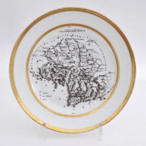
"Old Porcelain Plate Decorated With Geographical Map Of The Haute Garonne XIXth Century"
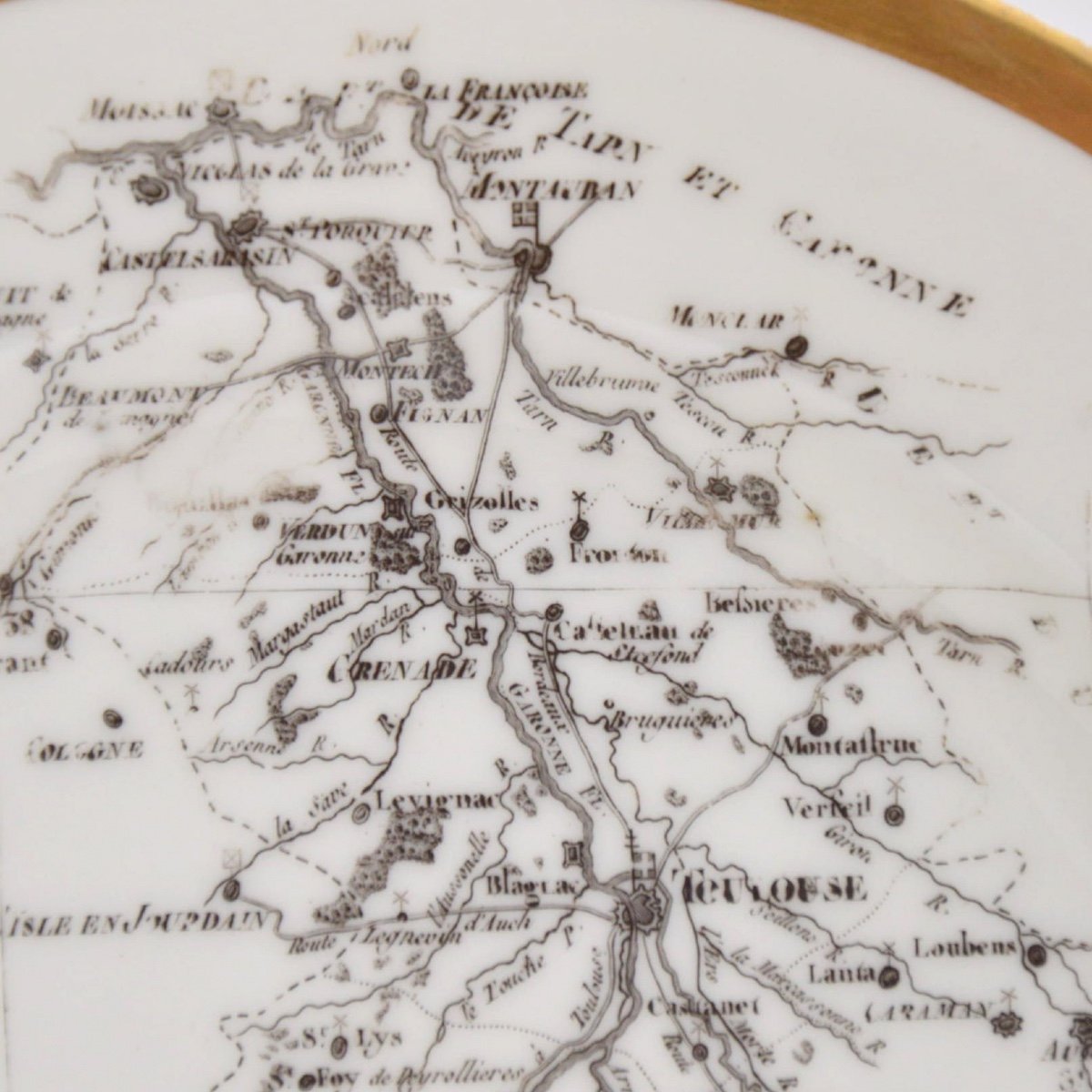
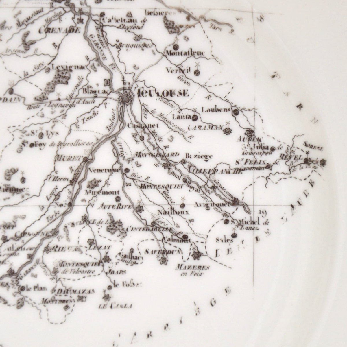
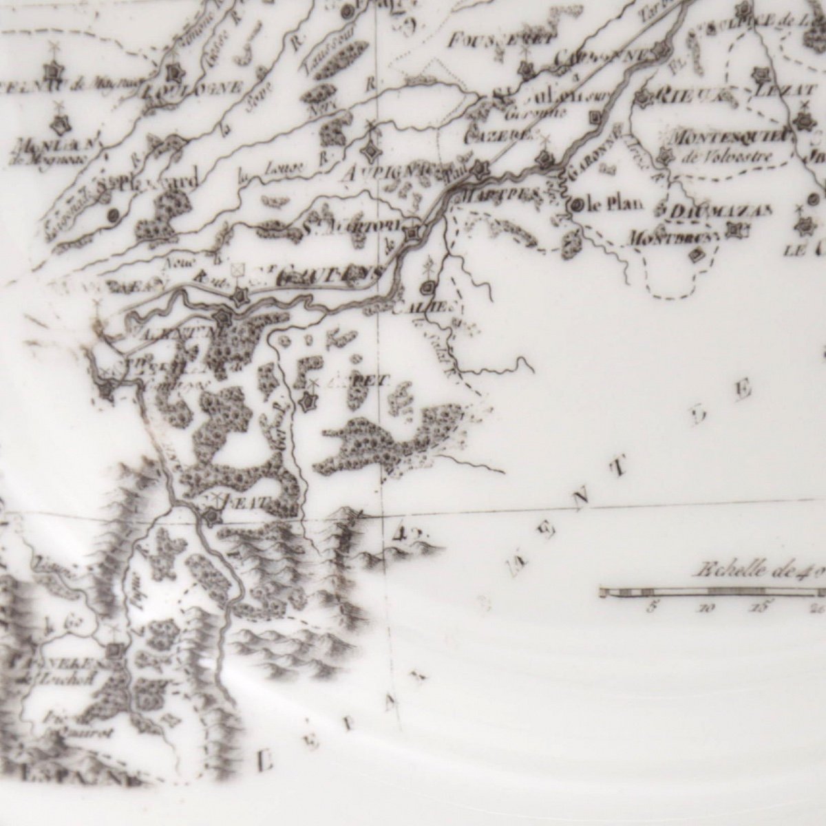
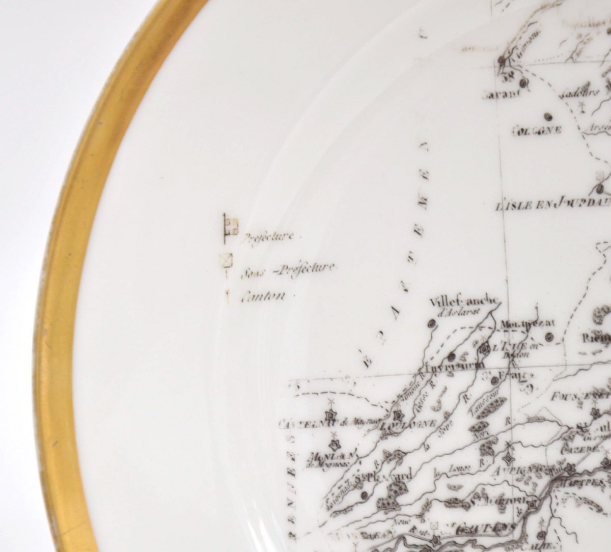
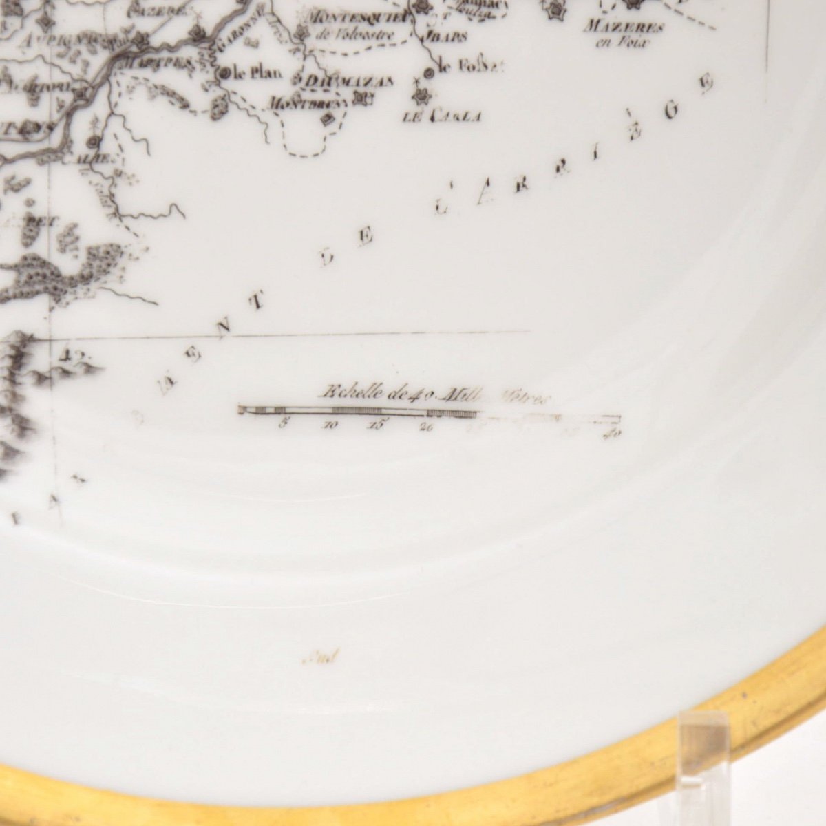
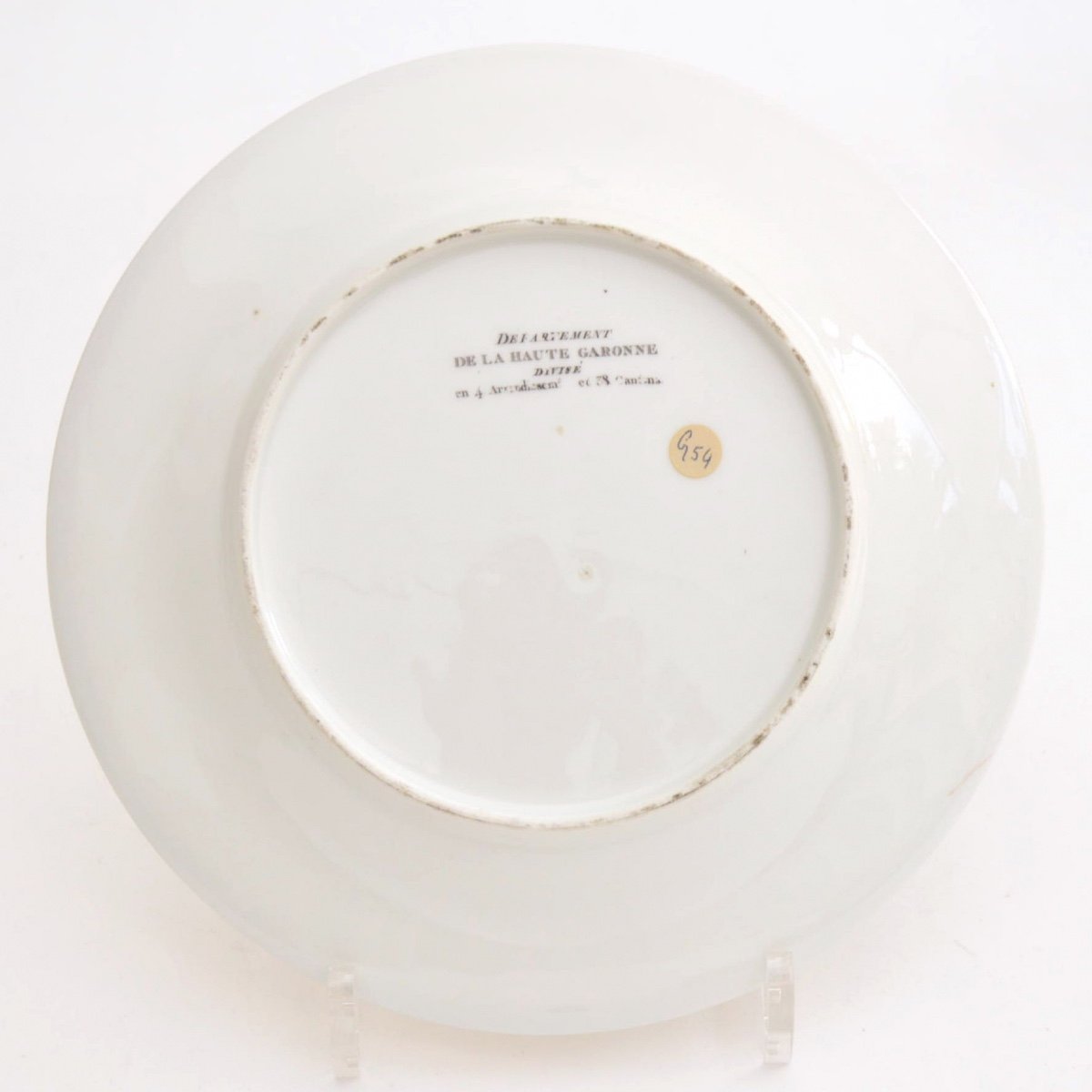
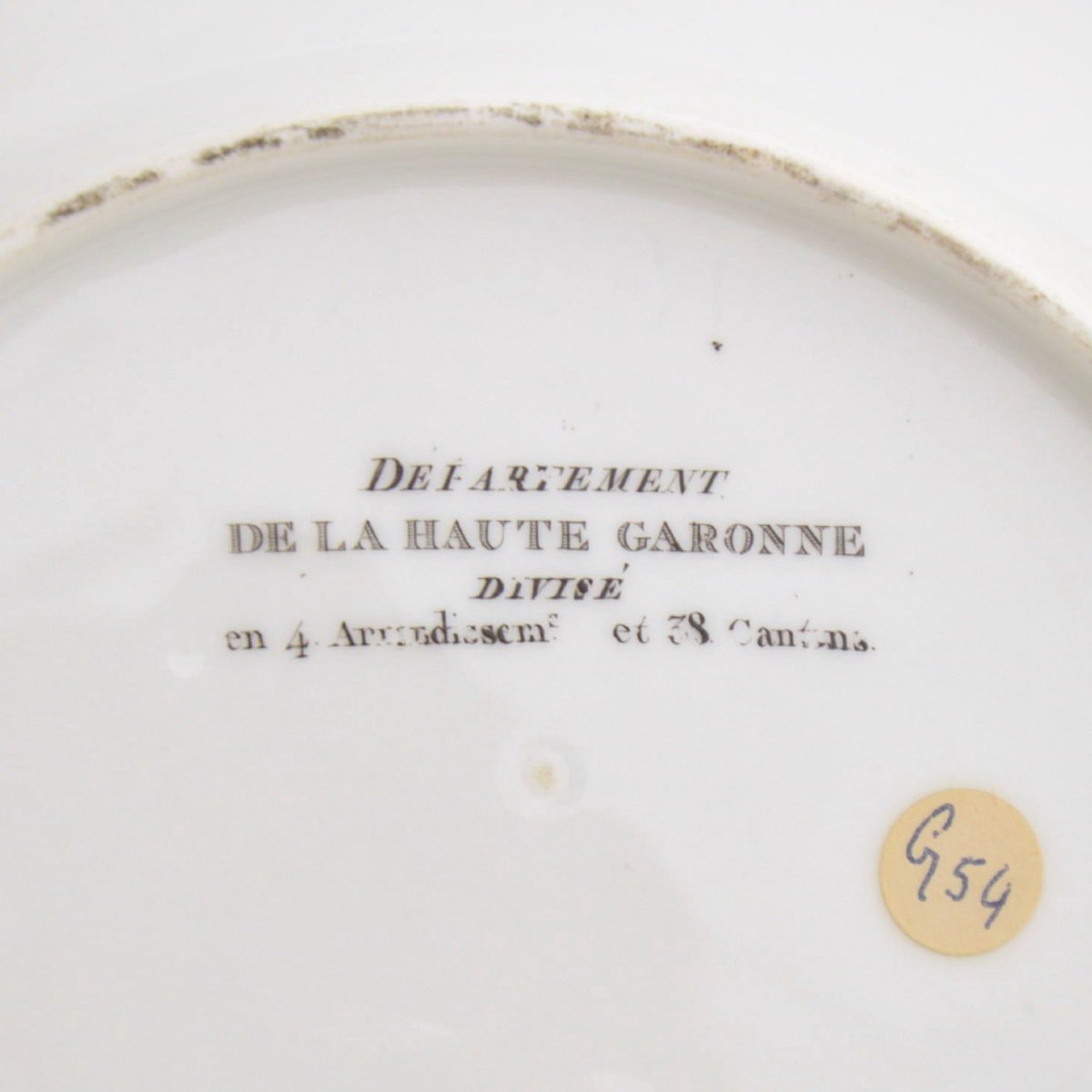
Map of La Haute Garonne Departement divided into 4 Arrondissements and 38 Cantons. Period 19th century, around 1810.François Gonord (1756–1822), a miniature painter on porcelain and ivory, and the son of an engraver, came to Paris, rue de Courty, in 1800 after working in Geneva. On January 4, 1805, he presented to the cabinet of the Council of Ministers a cup adorned with a parrot "life-size" and a saucer with the same bird, but in a reduced size. Brongniart, who was consulted, gave a favorable opinion and offered him a workshop in Sèvres. Gonord missed the gold medal in 1806 due to his modest production and only received the silver medal. After requesting support, Gonord received official commissions. In 1807, the Bureau of Arts and Manufactures ordered 120 plates from him, depicting the maps of the departments, colored and decorated with gold.
Literature: Régine de Plinval de Guillebon. Faïence et porcelaine de Paris XVIIIe-XIXe siècles. Éditions Faston. 1995


 Le Magazine de PROANTIC
 TRÉSORS Magazine
 Rivista Artiquariato