
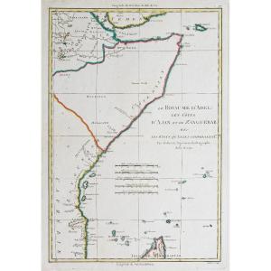


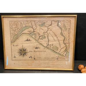
"Old Map Of Somalia – Zanzibar"
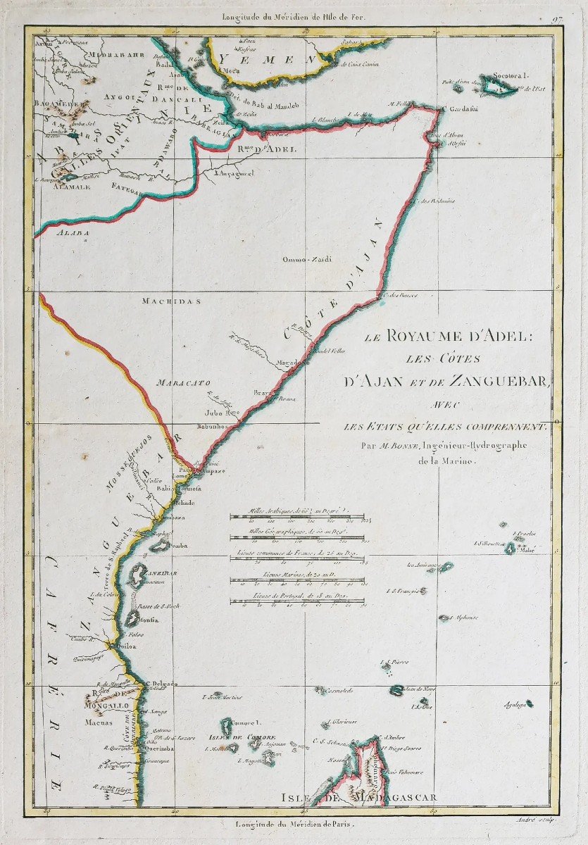
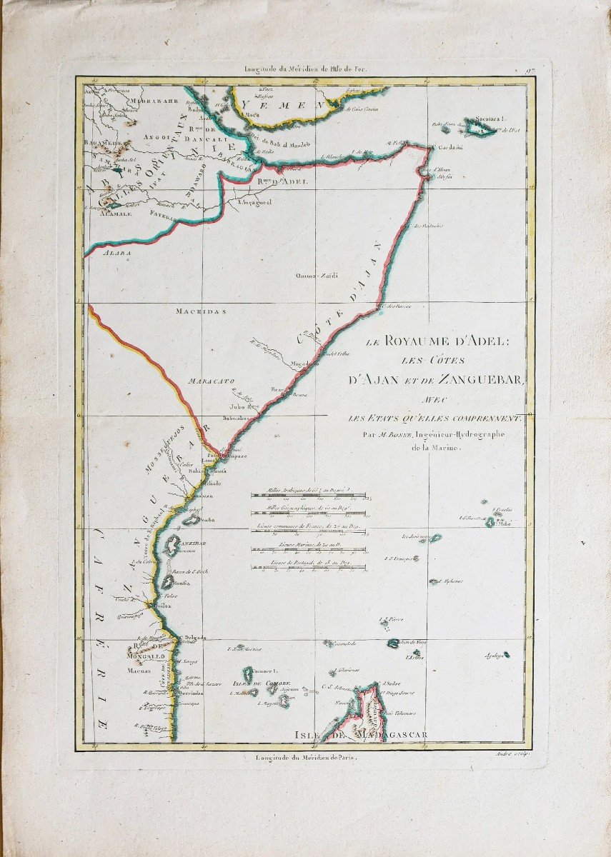
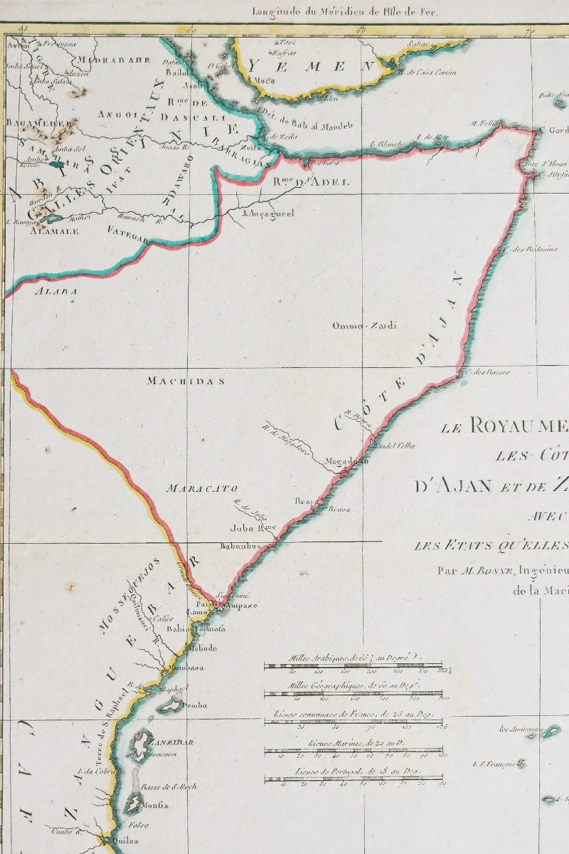
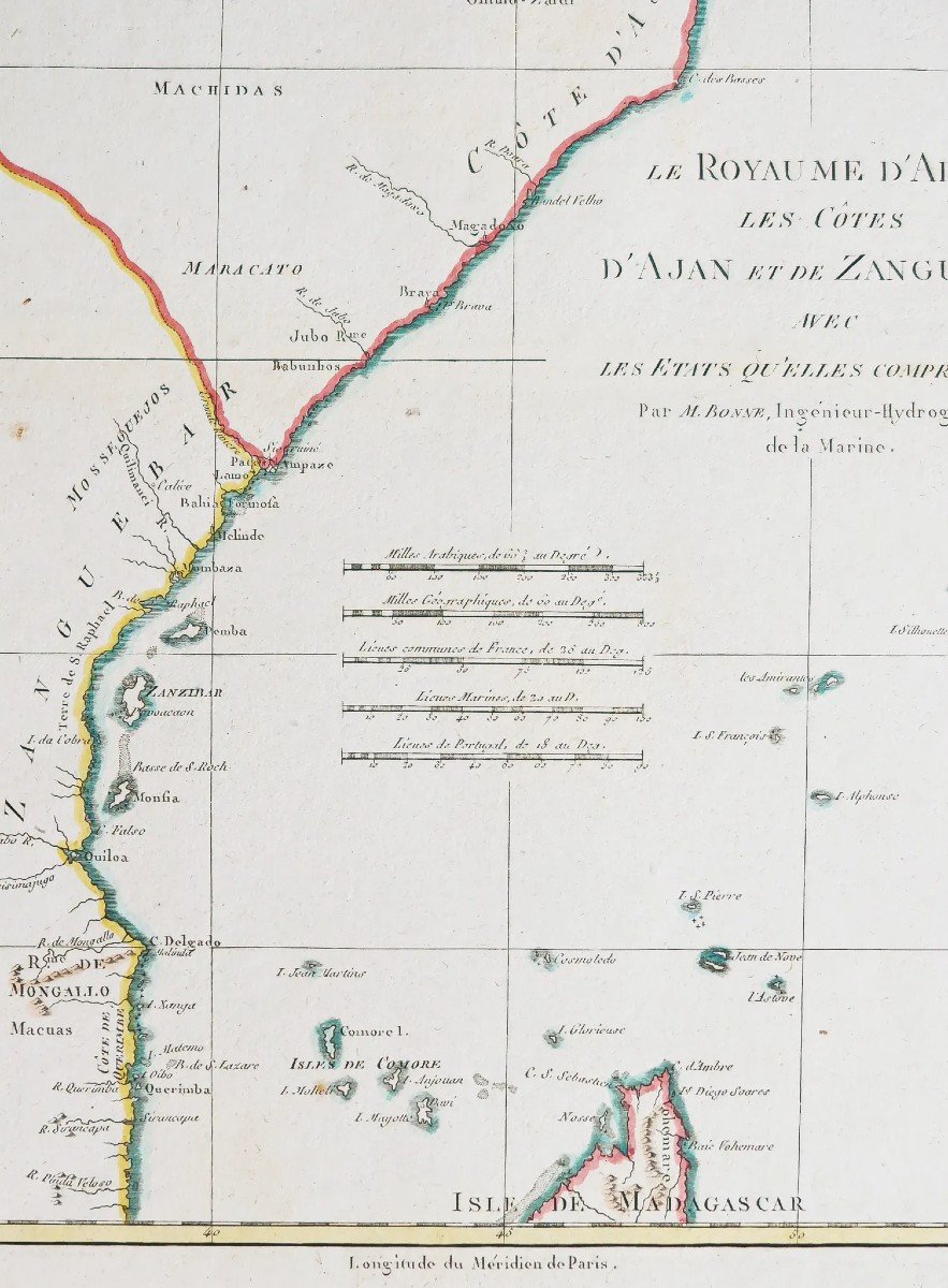
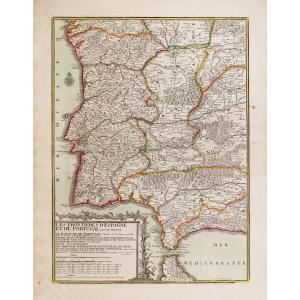
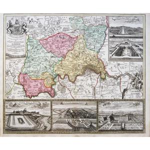
Le Royaume d’Adel : les côtes d’Ajan et de Zanguebar avec les Etats qu’elles comprennent.Epreuve originale réalisée vers 1780. Bonne cartographe.
Limites colorées de l’époque.
Très bon état.
Format feuille : 44,5 x 31,5 cm.
Format cuivre : 36 x 25 cm.
Original antique map around 1780
Vous pouvez consulter l’ensemble des cartes, livres et gravures disponibles sur votre région en cliquant sur le lien de notre site internet spécialisé en archives anciennes géographiques :
https://cartes-livres-anciens.com/categorie-produit/cartes-geographiques-anciennes-original-antique-maps/afrique/ethiopie-somalie/
Règlement sécurisé par carte bancaire sur notre site internet en cliquant sur le lien ci-dessous :
https://cartes-livres-anciens.com/produit/cartes-geographiques-anciennes-original-antique-maps/afrique/ethiopie-somalie/carte-ancienne-de-la-somalie-zanzibar/
Toutes nos cartes et gravures sont accompagnées d’un certificat d’authenticité.
Rigobert Bonne (1727-1795) est un ingénieur hydrographe et cartographe français du 18ème siècle.
Né dans les Ardennes à Raucourt en 1727, il succède en 1775 à Giovanni Rizzi-Zannoni comme cartographe du Roi de France au Service Hydrographique de la Marine (le Dépôt des cartes et plans de la Marine est créé sur ordre du Roi Louis XV en 1720).
Vers 1780, il définit précisément la projection qui portera alors son nom : la Projection de Bonne. Il meurt à Paris en 1795, son fils Charles-Marie Rigobert dit le Chevalier Bonne (25 juin 1771 – 23 novembre 1839), poursuivra son œuvre.
The Kingdom of Adel: the coasts of Ajan and Zanguebar with the states they comprise. Original proof made around 1780. Good cartographer. Colored boundaries of the time. Very good state. Sheet size: 44.5 x 31.5 cm. Copper format: 36 x 25 cm. Original antique map around 1780 You can consult all the maps, books and engravings available in your region by clicking on the link of our website specializing in ancient geographical archives: https://cartes-livres-anciens.com/categorie- produit/cartes-geographiques-anciennes-original-antique-maps/afrique/ethiopia-somalia/ Secure payment by credit card on our website by clicking on the link below: https://cartes-livres-anciens.com/ product/old-geographical-maps-original-antique-maps/africa/ethiopia-somalia/old-map-of-somalia-zanzibar/ All our maps and engravings are accompanied by a certificate of authenticity. Rigobert Bonne (1727-1795) was an 18th century French hydrographer and cartographer. Born in the Ardennes in Raucourt in 1727, he succeeded Giovanni Rizzi-Zannoni in 1775 as cartographer to the King of France in the Hydrographic Service of the Navy (the Depot of Navy maps and plans was created by order of King Louis XV in 1720 ). Around 1780, he precisely defined the projection that would then bear his name: the Bonne Projection. He died in Paris in 1795, his son Charles-Marie Rigobert dit le Chevalier Bonne (June 25, 1771 – November 23, 1839), continued his work.


 Le Magazine de PROANTIC
 TRÉSORS Magazine
 Rivista Artiquariato