Map of the Diocese of Castres, dedicated to Messire Augustin de Maupéou, Advisor to the King in his councils, Bishop of Castres, by his very humble and very obedient servant HUBERT JAILLOT, Geographer[...]
Page 67 of a work from the beginning of the 18th century "Genesis"
Sheet 54 X 39 cm plate 19 X 30 cm
Very good condition
Date: 1704 or 1724
"Adjoining the Historical Table of the First Age of th[...]
-Ornamental cartridge with coat of arms. - List of battalions and squadrons at the headquarters of Lille. Plan of the city of Lille, France invested by the Haut-Allies under the command of HH Prince E[...]
État : Excellent, la feuille a été doublée, ce qui la rendu solide. Les couleurs d’époque sont fraîches.
(Pour le texte suivant, je me suis largement inspiré d’une traduction d’un texte de Curtis Wri[...]
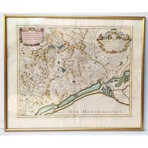
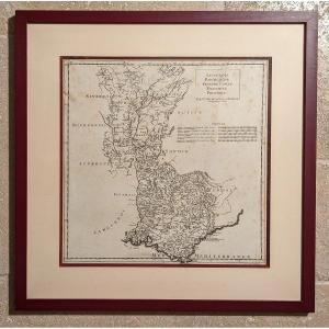
The diocese of Montpellier divided into nine archpriests, Hubert Jaillot, 53x43cm. Engraving dedicated “Monseigneur Charles Joachim Colbert, bishop of Montpellier (nephew of the great Colbert...) and [...]
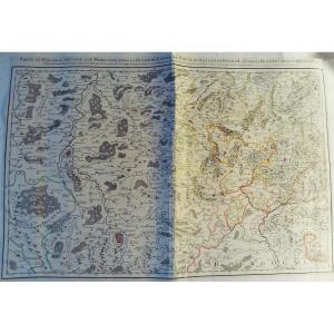
[MAP] - JAILLOT - Part of the bailiwick of Vosge or Mirecourt, in the duchy of Lorraine, part of the bailiwick of Bassigny or Barrois mouvant in the duchy of Bar divided by provost, offices, seneschal[...]
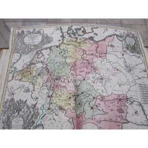
Historical map of the Holy Roman Empire. by Matthew Setter. XVIII century. 57 X 50 cm and is accompanied by a large sheet lined with long historical and scholarly explanations. The two colorful of the[...]
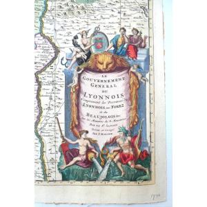
Map "Lyonnois, Burgundy, Franche Comté, Dauphiné, Provence" by JB Bourguignon d'Anville (1697-1782) geographer of the King Engraved by Jean-Baptiste Delahaye. Year of publication: 1719
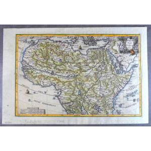
Beautiful map of the North of the African continent, due to the famous Jesuit cartographer Scherer, printed and nicely hand colored in Munich, who edited the Atlas Novus.
Nice cartridge with emblemat[...]
Jean Baptiste NOLIN (1686-1762) Cartographer.
GALLIAE CHRISTIANAE. PROVINCIA ECCLESIASTICA ARELATENSIS.
18th century map of the Camargue including the dioceses of Arles, Marseille, Toulon and the Pr[...]
Map from : Traité de la Police
In 1667, Lamoignon, first president of the Parliament of Paris, suggested to Nicolas de La Mare to write a book exposing the police methods applicable in a big city. L[...]
Proantic uses a cookie to analyze traffic and improve its service by using Google Analytics. Data sent to Google Analytics (frequency of visits to the site and pages visited) are anonymous. No other cookie tracks your activity, your personal data is not collected. Thank you for helping us to have better understanding how Proantic is used.


 Le Magazine de PROANTIC
 TRÉSORS Magazine
 Rivista Artiquariato