ESNAULT, Jacques (1739-1812) § RAPILLY, Michel (1740-1797), Engravers-publishers, Booksellers and Print Dealers in Paris - "New Road Map of the City and Suburbs of Paris (..) from the year 1786". Pres[...]
Map of Switzerland in 1783, double-page engraving, map by Jaillot, ordinary cartographer of the King (Louis XVI), good condition, period coloring, a small reinforcement (photo), traces of folding.
Map of the northern part of the United States, map by Pierre François Tardieu from 1792, published in Paris in the Atlas of Mentelle & Chanlaire in 1806. Double-page engraving, original coloring, all [...]
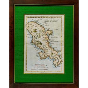
Original engraving on steel with a chisel and watermarked laid paper. Engraved by ROUX Antoine or Joseph Ange Antoine, (French -1765-1835). Marine painter. Hand watercolored. Dimensions: High. 29.5 cm[...]
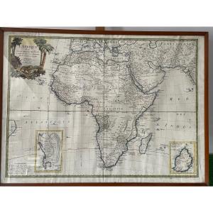
VERY BEAUTIFUL MAP OF AFRICA FROM THE 18TH PERIOD, 1753, AT THE BOTTOM RIGHT THE SPECIAL MAP OF ISLE DE FRANCE DRAWED UP BY THE ABBÉ DE LA CAILLE IN 1753, VERY FRESH, THE PHOTOS WITH THE GLASS ARE SLI[...]
Original proof made in 1780 by Rigober BONNE cartographer, engraved on copper by André. From the Atlas of all the known parts of the terrestrial globe, drawn up for the Philosophical and Political His[...]
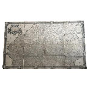
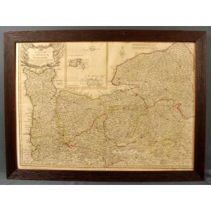
Huge 18th Century Map (1730) Of The Pyrenees Mountains And Part Of The Kingdoms Of France & Spain By Antoine Coquart (16..-17..) and Roussel (king's engineer, 16..-1733) Canvased at the Bel period con[...]
plan of the city and suburb of Paris 1788 with all its additions and the new enclosure map mounted on canvas in 24 sections allegory of MONCEAU with street references. In Paris at Mondhare and Jean ru[...]
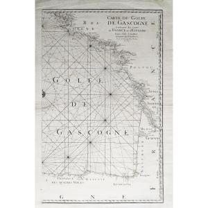
Maritime chart of the Bay of Biscay containing the Costes of France and Spain from the Ile d'Ouessant to the Cap de Finistère, surveyed and engraved by order of the Roy (King)
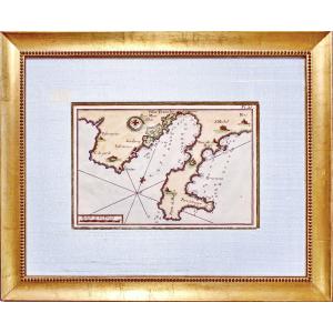
18th century maritime c[...]
Map of Normandy dated 1780 executed by Duperrier engineer Geographer in Rouen. In a posterior frame (20th) view format 68cm X 49cm, with frame 77.5cm X 58cm.
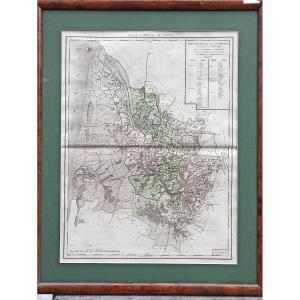
Beautiful map of the Gironde department from the National Atlas decreed on February 6, 1790. Original edition in period colors engraved on rag paper with watermark. Beautiful copy, untrimmed engraving[...]
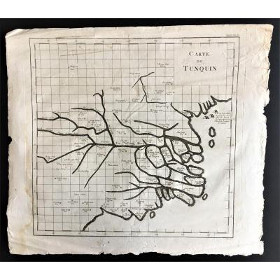
Extremely rare map of Tonkin (written Tunquin) executed at the end of the 18th century by Canu, on laid paper. These are the very first maps of this region of the globe. Good general condition, paper [...]
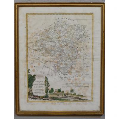
Beautiful colored map dating from 1776 by Antonio Zatta describing the lower Limousin, Quercy and Périgord. Freckles on paper. Modern frame in gilded wood baguette. XVIIIth century period. Delivery 14[...]
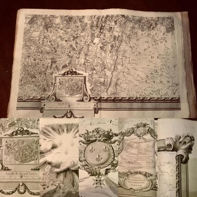
very large period map 18 Eme particular map of the duchy of Burgundy in 15 sheets by Seguin jean Dominique engineer and geographer of the Roy about 300 x 235 cm The map consists of 15 double sheets co[...]
Map: "The Swiss, their subjects and their allies" corrected and increased according to new observations gentlemen of the Royal Academy of Sciences in Paris in Desnos geographer and engineer for Globes[...]
Proantic uses a cookie to analyze traffic and improve its service by using Google Analytics. Data sent to Google Analytics (frequency of visits to the site and pages visited) are anonymous. No other cookie tracks your activity, your personal data is not collected. Thank you for helping us to have better understanding how Proantic is used.


 Le Magazine de PROANTIC
 TRÉSORS Magazine
 Rivista Artiquariato