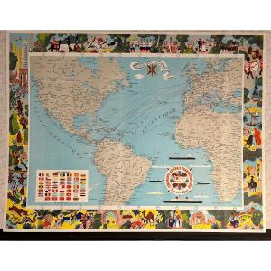
Epreuve originale réalisée vers 1960 – 1970.
Belle impression en couleurs.
Format feuille : 52,5 x 44 cm.
Carte publiée par le Ministère des travaux publics des transports et du tourisme.
1 carte [...]
Lithographie originale en couleurs réalisée en 1943.
Très bon état.
Format feuille : 38 x 28 cm.
Original antique map of 1943
Vous pouvez consulter l’ensemble des cartes, livres et gravures disp[...]
Lithographie originale en couleurs réalisée en 1943.
Très bon état.
Format feuille : 38 x 28 cm.
Original antique map of 1943
Vous pouvez consulter l’ensemble des cartes, livres et gravures disp[...]
LA GUYENNE.
Large black and white lithographic map. Representation of this region of Gironde (Aquitaine), close to Bordeaux.
Period at the very end of the 19th century / beginning of the 20th centur[...]
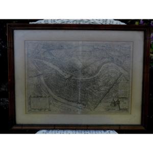
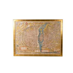
Paris in 1630, “The plan of the city, City, University, Faubourgs of Paris with the description of its antiquity” Color engraving after a model by Melchior Tavernier (Antwerp 1594 – Paris 1665) and pu[...]
Engraving, plan of the city of Lyon, in the 16th century after Braun and Hogemberg Engraving from the end of the 19th century, beginning of the 20th, framed and under glass. Slight trace of fold in th[...]
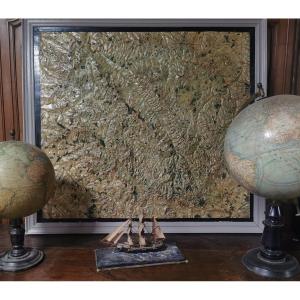
educational map in painted stucco drawn up by Eugéne CABRISY, geographical engineer, from the Creuse department. Signed and dated 1905
contact me for delivery
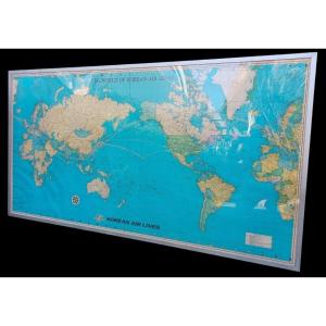
Important vintage planisphere 1970/1980 from the aviation company "Korean air lines" neat frame all in aluminum beautiful colors very well preserved no tears rear protective panel with original hooks [...]
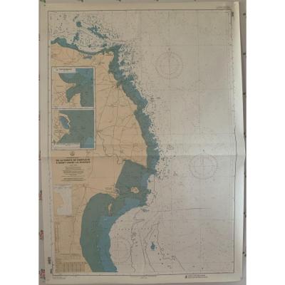
Marine chart. From Pointe de Barfleur to Saint Vaast la Hougue. Hydrographic and Oceanographic Service of the Navy publication 1988 Excellent condition, no tears or stains, just a few wrinkles of the [...]
Proantic uses a cookie to analyze traffic and improve its service by using Google Analytics. Data sent to Google Analytics (frequency of visits to the site and pages visited) are anonymous. No other cookie tracks your activity, your personal data is not collected. Thank you for helping us to have better understanding how Proantic is used.


 Le Magazine de PROANTIC
 TRÉSORS Magazine
 Rivista Artiquariato