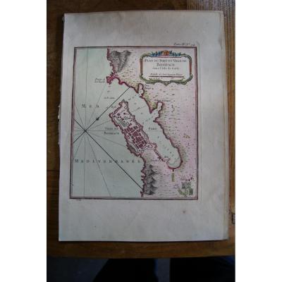
Epreuve originale réalisée en 1650. Mariette éditeur.
Quelques rousseurs claires dans les marges n’atteignant pas la carte.
Bon état.
Format feuille : 52,5 x 37 cm.
Format gravure : 40,5 x 32,5 cm[...]
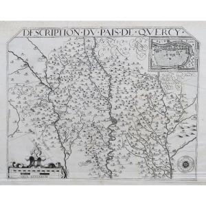
Original antique map engraved in 1581.
Beautiful impression of this rare map in French edition.
Very good state.
Explanation of the map in French on the back.
Sheet format: 61.5 x 43.5 cm.
Copper[...]
View Optics late 18th / early 19th century: "View of the Grand Place in Munich" unlocated Publisher size of the stage 40 X 25cm, Marie-Louise of view 43 x 28,5cm, modern style magnifying glass 53 x 43[...]
View Optics late 18th / early 19th century: "Perspective view of Mount of the Holy Virgin said Frauen Berg in Frankfurt am Mein where we see the Metropolitan Church dedicated in his honor" in Paris, a[...]
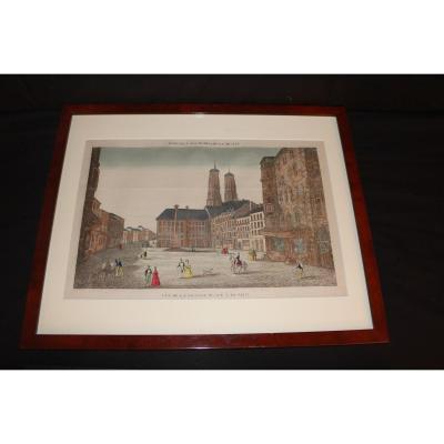
View Optics late 18th / early 19th century: "Head Bergopzoom Commissioned by Mr Marshal Lowendal" in Paris, the scene size 40 X 20cm, Marie-Louise of view 42 x 23cm, modern style magnifying glass fram[...]
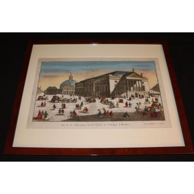
View Optics late 18th / early 19th century: "View of the Opera Hall and the Church of Saint Hedurg in Berlin" in Paris, at Mondhare, rue St Jacques size 40 X 23cm engraving, Marie-Louise view 43 x 27c[...]
Proantic uses a cookie to analyze traffic and improve its service by using Google Analytics. Data sent to Google Analytics (frequency of visits to the site and pages visited) are anonymous. No other cookie tracks your activity, your personal data is not collected. Thank you for helping us to have better understanding how Proantic is used.


 Le Magazine de PROANTIC
 TRÉSORS Magazine
 Rivista Artiquariato