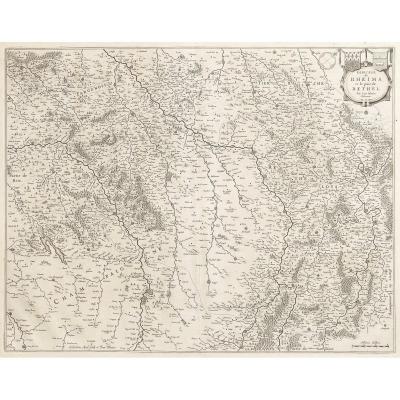
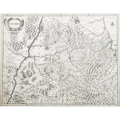
Epreuve originale gravée en 1664. Pierre Duval cartographe.
Limites colorées de l’époque.
Angles de la marge supérieure érasés. Petite tache dans la marge inférieure loin de la carte.
Très bon état[...]
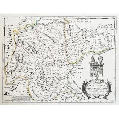
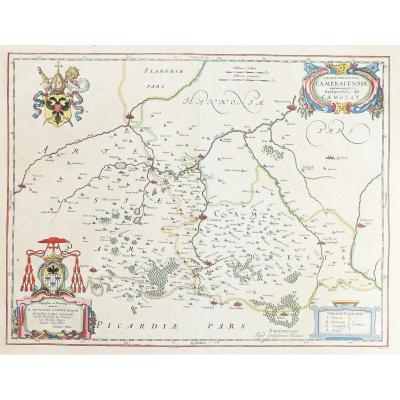
Carte originale gravée en 1650. J. Blaeu cartographe.
Texte explicatif en latin au verso.
Quelques rousseurs dans les marges loin de la gravure.
Très bon état.
Format feuille : 59 x 52 cm.
Format[...]
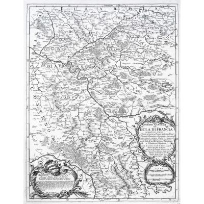
Carte originale gravée en 1690. Anonyme.
Belle épreuve sur grand papier.
Très bon état.
Format feuille : 64 x 54 cm.
Format gravure : 55 x 40 cm.
Original antique map of 1690.
Belle édition réal[...]
Original proof made in 1648. Guilhem Blaeu cartographer.
Beautiful watercolor colors.
xplanatory text in Latin on the back.
Excellent condition.
Sheet size: 56 x 48 cm.
Engraving format: 50.5 x 3[...]
Carte originale gravée en 1692. Rossi Domenico et Giacomo Cantelli auteurs.
Très belle épreuve sur papier fort.
Très bon état.
Format feuille : 62,5 x 47 cm.
Format gravure : 59 x 45,5 cm.
Origin[...]
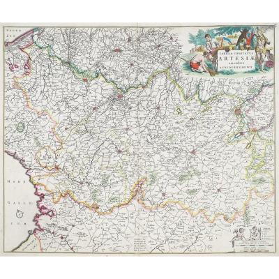
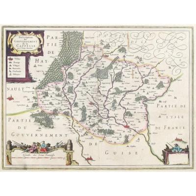
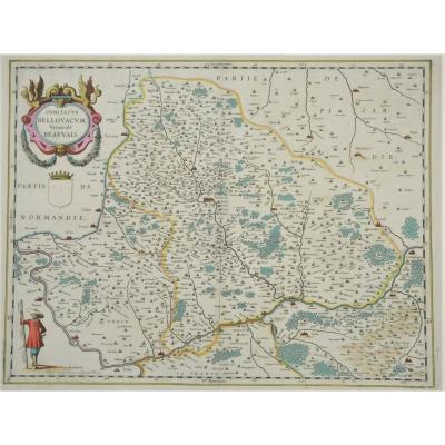
Carte originale gravée en 1634. Guilhem Blaeu cartographe.
Beaux coloris aquarelle de l’époque.
Rousseur dans la marge de gauche avec léger débord sur la carte.
Bon état.
Texte explicatif au verso[...]
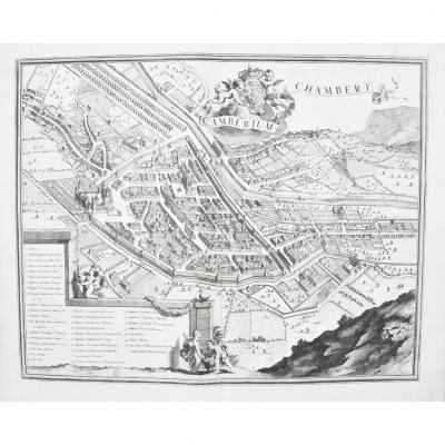
Carte originale gravée en 1650. merian éditeur.
Très bon état.
Format feuille : 38 x 32 cm.
Format gravure : 36 x 27 cm.
Original antique map of 1650.
Vous pouvez consulter l’ensemble des carte[...]
Epreuve originale gravée en 1680 – 90. De Witt Frederick cartographe.
Beaux coloris anciens.
Infime petit pincement de papier dans le bas du pli central d’origine.
Très bon état.
Format feuille : [...]
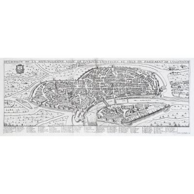
Epreuve originale gravée en 1654. Pierre Duval cartographe.
Format feuille : 55 x 44 cm.
Format gravure : 53 x 42 cm.
Original antique map of 1654.
Carte peu courante en édition française du début[...]
Original proof engraved around 1640.
Henri Hondius cartographer.
small foxing in the margins with an erased lower left angle. Good condition.
Sheet size: 54 x 42 cm.
Engraving format: 49 x 38.5 cm[...]
Original proof engraved around 1660. Pierre Duval cartographer. Colored boundaries of the time. Tiny freckle in the left side margin away from the map. Very good state. Sheet size: 54.5 x 43 cm. Engra[...]
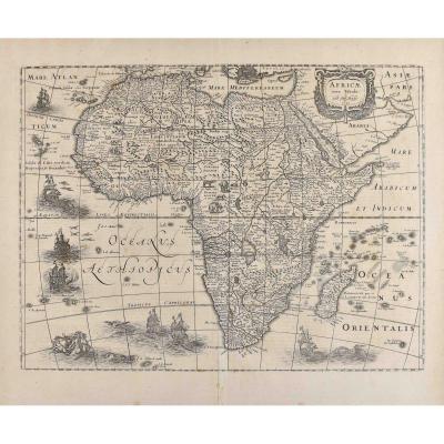
Henricus Hondius II said the Younger (1597-1651) Atlas Mercator-Hondius: map of Africa 1631 47.7 x 57 cm woodcut Signed and dated upper right in a cartouche "Africae nova Tabula.Auct.Hen. Hondio.1631 [...]
Original proof engraved in 1638. Johannes Jansson cartographer.
Very beautiful old colors.
Thin trace of friction and 2 traces of oxidation in the center of the card.
Explanatory text in Latin on t[...]
Epreuve originale gravée en 1661. Guilhem Blaeu cartographe.
Beaux coloris anciens.
Rare texte explicatif en vieux français au dos de la carte.
Très bon état.
Format feuille : 59,5 x 51 cm.
Forma[...]
Original proof engraved in 1627. Chatillon engraver of Roy.
Beautiful old colors.
Small hole and brown mark of 5 mm following the oxidation of the ink in the upper left corner. flattened corners.
G[...]
Original proof engraved in 1663.
Pierre Duval cartographer.
Colored boundaries of the time. Light redness in the margins not reaching the engraving with the absence of the 2 upper margin angles.
Go[...]
Johannes Janssonius
Johannes Janssonius, plus connu sous le nom de Jan Jansson, est né à Arnhem, où son père était libraire et éditeur (Jan Janszoon the Elder).
En 1612, il épousa la fille du cartog[...]
Carte originale gravée sur cuivre en 1640. Johanne Blaeu cartographe.
Double in -folio.
Format : 51 x 39 cm au cuivre.
Beaux coloris anciens.
explication de la carte en français au dos.
Excellent[...]
Gravure sur cuivre originale de 1693.
Parfait état.
grand in-folio.
Format feuille : 64 x 53 cm.
Format gravure : 58 x 48 cm.
Original antique map of 1693.
Vous pouvez consulter l’ensemble des [...]
Original map engraved on copper around 1610.
Beautiful old colors.
Explanatory text in French on the back.
very good state.
Sheet format: 48 x 36 cm
Original antique map of 1610.
You can consult[...]
Epreuve originale gravée en 1645 sur 2 feuillets joints. Jean Boisseau éditeur.
Renfort de papier japon au dos des grandes marges bien conservées, fines traces de plis.
Bon état.
Format feuille : [...]
The surroundings of the long pond.
Original map engraved in 1635.
Ian Van Damme, Sr. of Amendale & Leclerc cartographers.
2 small rednesses in the cartridge.
Very good state.
Sheet size: 54.5 x 4[...]
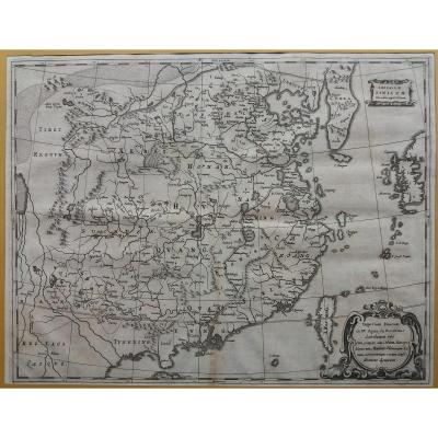
The +: very good state of conservation. Usage: historical and decorative map. Imperium Sinicum. Detailed map of China with cities, lakes, rivers, mountains, neighboring countries and Great Wall. Imper[...]
Epreuve originale gravée en 1628.
Mouillure claire dans la marge latérale gauche n’atteignant pas le sujet.
Bon état.
Format feuille : 53,5 x 41 cm.
Format gravure : 46,5 x 35,5 cm.
Original anti[...]
map geography vintage 17 Eme circa 1653 titled: map of the Duchy of Lorraine and bar edited by: Pierre Mariette (1603-1657) to where in 1653 from the book "theater geography of France" reference atlas[...]
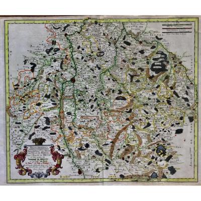
serious geographical map and dating from 1656 by Nicolas SANSON (1600-1667) titled: mediomatrici Archidiac of METZ of VIC and MARSAL in the eveche of METZ at the author 1656 in paris card named mediom[...]
Here is the beautiful celestial planisphere of Eimmart, one of the most sought after engravings in astronomy. Our engraving is identical to that of the National Library, same colors and dimensions, or[...]
Proantic uses a cookie to analyze traffic and improve its service by using Google Analytics. Data sent to Google Analytics (frequency of visits to the site and pages visited) are anonymous. No other cookie tracks your activity, your personal data is not collected. Thank you for helping us to have better understanding how Proantic is used.


 Le Magazine de PROANTIC
 TRÉSORS Magazine
 Rivista Artiquariato